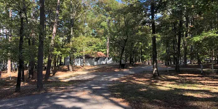
Within DeGray Lake's protected waters, this US Army Corps of Engineers campground operates year-round with sites accommodating RVs up to 65 feet. The forested setting provides natural shade, though Cultivating Fire L. notes campers shouldn't "expect good satellite due to the trees." Sites spread across the peninsula offer water views on three sides when lake levels cooperate.
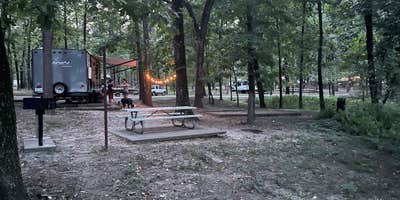
The bathhouse receives daily maintenance attention, with campers consistently reporting strong water pressure and hot showers. A beach area provides swimming access during higher water periods, though lake levels fluctuate seasonally. Sites include electric and water hookups, with some locations requiring advance reservations. The campground tends to stay relatively uncrowded, particularly in shoulder seasons.
Camp hosts assist with after-hours arrivals, and the $24 nightly rate covers hookup access and use of the dump station. Pet owners find the campground welcoming, with standard leash requirements in effect. For those exploring the broader region, camping near DeGray Lake includes several other Corps-managed areas along the shoreline.
The combination of lakefront positioning and tree cover creates a setting where RV campers can enjoy water access without sacrificing shade or basic amenities.
Description
Overview
Alpine Ridge Campground sits on the banks of DeGray Lake in the foothills of the Quachita Mountains. The lake attracts visitors far and wide for fishing tournaments, triathlons, water sports and more.
Recreation
Boating, water skiing, kayaking and other water sports are the biggest draw to the lake, and a boat ramp and sandy swimming beach are provided. The lake is also stocked with a variety of game fish, including plenty of hybrid striped bass, making it an ideal area for both boat and bank fishing.
Facilities
Alpine Ridge offers the most modern facilities in the area, with a convenient boat ramp, flush toilets, hot showers and electric hookups at every site. A swimming beach and playground are also available. To see USACE DeGray Lake Virtual Tour, click here.
Natural Features
Degray Lake is one of the region's five Diamond Lakes, known for their crystal clear waters. The lake flows from the Caddo River in western Arkansas and spans 13,500 surface acres. The first settlers around the lake were the Caddo Indians, whose remains have been traced back to 700 A.D. The early inhabitants were skilled in agriculture, and grew crops like beans, squash, maize and sunflowers.
Nearby Attractions
The DeGray Lake Resort State Park offers golf courses, tennis courts, horseback riding trails and more along the 207 miles of lake shoreline. The Ouachita National Forest and Hot Springs National Park are both located nearby.
RV Road Trip Guides


Location
Public CampgroundAlpine Ridge - De Gray Lake is located in Arkansas
Directions
From Interstate 30, take exit 73 and merge onto State Highway 8 west for 19 miles. Turn right on Fendley Road and continue 8.5 miles to the campground.
Address
729 CHANNEL RD.
Arkadelphia, AR 71923-9364
Coordinates
34.2586111 N
93.2283333 W
Connectivity
 T-MobileLTESome Coverage
- VerizonLTESome Coverage
- AT&TLTESome Coverage
Connectivity
- T-MobileLTESome Coverage
- VerizonLTESome Coverage
- AT&TLTESome Coverage
Access
- Drive-InPark next to your site
- Boat-InSites accessible by watercraft.
Site Types
- Tent Sites
- RV Sites
- Standard (Tent/RV)
- Dispersed
- Group
- Tent Cabin
Features
For Campers
- Trash
- Picnic Table
- Phone Service
- Reservable
- Drinking Water
- Electric Hookups
- Toilets
- Pets
- Fires
For Vehicles
- Sanitary Dump
- Water Hookups
- 50 Amp Hookups
- Big Rig Friendly
Drive Time
- 1 hr 5 min from Hot Springs, AR
- 1 hr 25 min from Little Rock, AR
- 1 hr 31 min from Texarkana, TX
- 2 hrs 39 min from Fort Smith, AR


