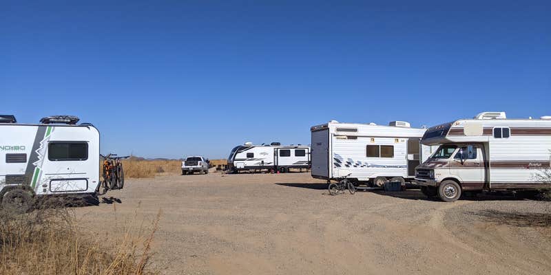
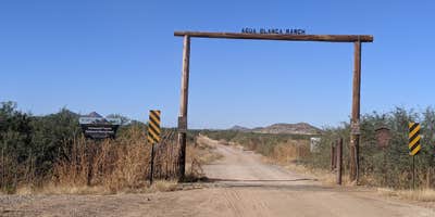
Within Ironwood Forest National Monument, this dispersed camping area sits at the western terminus of Manville Road, where the final half-mile transitions to graded dirt. The Bureau of Land Management maintains this free camping spot as a large parking area bordered by barrier rocks, with informational signs marking the boundary. Desert vegetation shows signs of livestock grazing impact, and privacy becomes limited when multiple camps occupy the space.
Cell service reaches the area reliably, though campers should prepare for the standard 14-day limit without water, restrooms, or trash services. A rough two-track road continues west from the camping area, likely requiring four-wheel drive vehicles for access. For different terrain options, BLM Ironwood Forest National Monument - Reservation Road Dispersed Camping provides another free alternative southeast of this location.
Description
This Ironwood Forest National Monument is made up of 129,000 acres and contains a significant system of cultural and historical sites covering a 5,000-year period. Possessing one of the richest stands of ironwood in the Sonoran Desert, the monument also encompasses several desert mountain ranges including the Silver Bell, Waterman, and Sawtooth, with desert valleys in between. Elevation ranges from 1,800 to 4,261 feet. Three areas within the monument, the Los Robles Archeological District, the Mission of Santa Ana del Chiquiburitac and the Cocoraque Butte Archeological District are listed on the National Register of Historic Places. The monument is a travel corridor for illegal immigrants traveling from Mexico. All suspected illegal activities should be reported to BLM or local law enforcement authorities. Stay safe by avoiding contact with persons exhibiting suspicious behavior or engaged in dangerous activities. Drive with caution and look for fast-moving vehicles and pedestrians on back roads. Some roads are rugged: high clearance or four-wheel-drive vehicles are recommended in those areas.
Fee Info
Free
Reservation Info
None
RV Road Trip Guides


Map & DirectionsIronwood Forest BLM Aqua Blanca dispersed camp is located in Arizona near Marana
Coordinates
32.29160966 N
111.347507 W
Connectivity
 T-Mobile5GGood CoverageVerified by 4 usersLast on 7/15/26
- Verizon5GGood CoverageVerified by 4 usersLast on 7/15/26
- AT&T5GGood Coverage
Connectivity
- T-Mobile5GGood CoverageVerified by 4 usersLast on 7/15/26
- Verizon5GGood CoverageVerified by 4 usersLast on 7/15/26
- AT&T5GGood Coverage
Access
- Drive-InPark next to your site
- Walk-InPark in a lot, walk to your site.
Site Types
- Tent Sites
- RV Sites
- Dispersed
Features
For Campers
- Phone Service
- Alcohol
- Pets
- Fires
For Vehicles
- Big Rig Friendly
DISPERSED CAMPING
Enjoy dispersed camping on government land and leave no trace. Pack in and pack out. No (or limited) services at this camping area. Permit may be required.
PERMIT might be REQUIRED
We curate permit requirements across the US for our PRO members. Try PRO to see if Ironwood Forest BLM Aqua Blanca dispersed camp needs a permit.
Drive Time
- 39 min from Tucson, AZ
- 1 hr 36 min from Sierra Vista, AZ
- 1 hr 48 min from Phoenix, AZ
- 2 hrs 52 min from Prescott Valley, AZ


