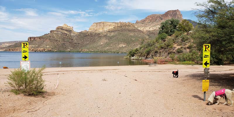
Apache Lake's shoreline camping comes with two route options: a rough dirt road for 4x4 vehicles or the paved service road 79 that leads to the adjacent marina resort. This small, first-come-first-served campground sits next to Apache Lake Marina and Resort, creating an unusual setup where desert camping meets convenience store amenities. The resort sells firewood, ice, and food just steps from campsites.
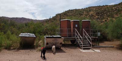
Campers need a Tonto Pass rather than paying campground fees, and the site provides basic facilities including toilets and trash pickup. RVs are limited to 22 feet maximum due to access constraints. The lakeside location offers water access for kayaking with minimal boat traffic, though desert conditions mean hot nights well into September. For additional options, campers can explore campgrounds near Tonto National Forest.
Description
Crabtree Wash This site offers shoreline parking and boat access. Access is by the Apache Trail National Forest Scenic Byway, a scenic mountain road. Nearby are views of mountains with abundant wildlife.
RV Road Trip Guides


Map & DirectionsCrabtree Wash is located in Arizona near Tonto National Forest
Directions
This site is 12 miles south of Roosevelt Dam on the south shoreline of Apache Lake. From Apache Junction: Drive north on State Hwy. 88 for 32 miles (the last 20 miles of State Hwy. 88 are unpaved) to FR 79. Turn left and continue to site approximately 1 mile. From Mesa: Take State Hwy. 87/Beeline Highway north for approximately 60 miles to itsjunction with State Hwy. 188. Turn right onto State Hwy. 188 for 33 miles to its junction with State Hwy. 88. Turn right onto State Hwy. 88, and drive past historic Roosevelt Dam (unpaved) for 12 miles to FR 79. Turn right and continue to the site approximately 1 mile. From the Globe area: Take State Hwy. 188 west for 30 miles to its junction with State Hwy. 188. Turn left onto State Hwy. 88, and continue past historic Roosevelt Dam (unpaved) for 12 miles to FR 79. Turn right and continue to the site approximately 1 mile. Click Here For Map.
Coordinates
33.57684362 N
111.25365297 W
Connectivity
 T-MobileNo Coverage
 VerizonLTESome CoverageVerified by 2 usersLast on 7/26/26
- AT&TLTESome Coverage
Connectivity
- T-MobileNo Coverage
- VerizonLTESome CoverageVerified by 2 usersLast on 7/26/26
- AT&TLTESome Coverage
Access
- Drive-InPark next to your site
- Boat-InSites accessible by watercraft.
Site Types
- Tent Sites
- RV Sites
- Group
Features
For Campers
- Market
- Trash
- Picnic Table
- Firewood Available
- Phone Service
- Drinking Water
- Toilets
- Alcohol
- Pets
- Fires
For Vehicles
- Sanitary Dump
Drive Time
- 3 hrs 58 min from Phoenix, AZ
- 4 hrs 31 min from Prescott Valley, AZ
- 4 hrs 41 min from Flagstaff, AZ
- 4 hrs 46 min from Tucson, AZ


