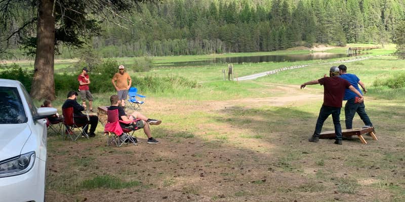
Within the Little Pend Oreille National Wildlife Refuge, this dispersed camping area operates under U.S. Fish and Wildlife Service management with no fees required. Campers access sites via narrow gravel roads that present challenges for larger rigs, according to multiple visitor accounts. Each dispersed site includes a fire ring with cooking grate, though no tables or water sources exist beyond the nearby creek.
The campground provides pit toilets and allows both drive-in and walk-in access, with some sites positioned near Potters Pond for fishing access. Cell phone reception remains unavailable throughout the area. Visitors report spacious, well-separated sites in open terrain, though road conditions require careful navigation and GPS skills for exploring the surrounding trail network.
Description
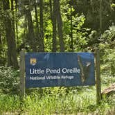
Bear Creek @ Little Pend Orielle Wildlife Refuge, east of Colville WA
Camping is allowed on a first come-first serve basis from April 14 through December 31. Established campgrounds have a vault toilet and metal fire rings.
No drinking water is available. Do not leave campfires unattended. High fire danger will cause campfire restrictions. Information will be posted in all campgrounds and at the Headquarters kiosk.
**Dispersed hunting camp sites are open from October 1 through December 31. These are primitive campsites with no amenities. Campsites must be within 50 feet of a dispersed campsite carsonite marker. Bury all human waste in a hole 6 to 8 inches deep and at least 200 feet from water, camp or trails.
RV Road Trip Guides

Map & DirectionsLittle Pend Orielle Campground is located in Washington near Colville
Directions
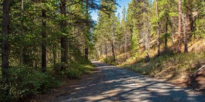
Little Pend Oreille National Wildlife Refuge is federal land so a state issued Discover Pass is not required. The easiest way to get to the Refuge is to start from downtown Colville, Washington. From Main Street (Highway 395), follow Third Avenue (Highway 20) for 6 miles – you will be traveling east toward Tiger, Washington. There is a brown and white sign at the intersection of Main and Third labeled “Little Pend Oreille National Wildlife Refuge 13 miles.” Just after passing White Mud Lake, make a right turn onto Artman-Gibson Road. The sign states the Refuge is 7 miles away. Travel 1.7 miles until reaching a 4-way intersection. Turn left onto Kitt-Narcisse Road and follow it for 2.2 miles where the road forks. Take the right fork onto Bear Creek Road (a dirt road), and follow it for 3.3 miles. The Refuge headquarters is a brown log building with a flag pole in the yard.
Coordinates
48.46634027 N
117.7491844 W
Connectivity
 T-MobileNo Coverage
- VerizonNo Coverage
- AT&TNo CoverageVerified by 2 usersLast on 6/23/26
Connectivity
- T-MobileNo Coverage
- VerizonNo Coverage
- AT&TNo CoverageVerified by 2 usersLast on 6/23/26
Access
- Drive-InPark next to your site
- Walk-InPark in a lot, walk to your site.
Site Types
- Dispersed
Features
For Campers
- Toilets
- Pets
- Fires
DISPERSED CAMPING
Enjoy dispersed camping on government land and leave no trace. Pack in and pack out. No (or limited) services at this camping area. Permit may be required.
Drive Time
- 1 hr 36 min from Spokane, WA
- 1 hr 59 min from Coeur d'Alene, ID
- 3 hrs 19 min from Lewiston, ID
- 4 hrs 2 min from Wenatchee, WA