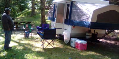
Comers Rock Campground near Elk Creek, VA, is situated in a region characterized by rolling hills and dense forests. Temperatures range from 30°F in winter to 85°F in summer, offering varied seasonal experiences. Nearby, Mount Rogers National Recreation Area provides hiking opportunities and scenic views.
Description
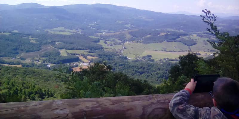
Located on top of Iron Mountain at 3800 feet, a small primitive campground and historic picnic area await the true outdoor enthusiast. The log picnic shelter with large stone fireplace was built by the Civilian Conservation Corp. Within walking distance of the campground are long distance hikes in Dry Run Wilderness, 360 degree views from Comers Rock Overlook and former fire tower, and the Unaka Nature Trail. Less than 2 miles away is Hale Lake for fishing, hiking, and canoeing.
Map & DirectionsComers Rock Campground is located in Kentucky near Elk Creek
Directions
From I-81: Take Wytheville exit 67, 70 or 73 onto US 11 (Main Street). On the west end of town US 11 turns off, and Main Street becomes VA 21 south. Follow VA 21 south for 17 miles, then turn right onto gravel Forest Service Road 57 and follow it west for 4 miles to the campground.
Coordinates
36.76305 N
81.22491 W
Connectivity
 T-MobileNo Coverage
- VerizonNo Coverage
- AT&TNo Coverage
Connectivity
- T-MobileNo Coverage
- VerizonNo Coverage
- AT&TNo Coverage
Access
Site Types
- Tent Sites
- RV Sites
- Standard (Tent/RV)
Features
For Campers
- Trash
- Drinking Water
- Toilets
Drive Time
- 1 hr 19 min from Blacksburg, VA
- 1 hr 33 min from Winston-Salem, NC
- 1 hr 35 min from Beckley, WV
- 1 hr 49 min from Johnson City, TN


