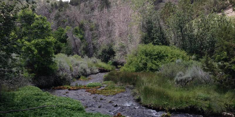
Clover Springs Campground, near Stockton, Utah, is a peaceful spot that offers a refreshing escape from the hustle and bustle of city life. With its charming natural spring creek running through the area, it’s a great place to unwind and enjoy the outdoors.
This campground is perfect for tent and RV camping, though you won’t find any electric hookups or showers here. Visitors have raved about the clean facilities and the beautiful scenery, with one camper noting, “Beautiful campground and nice small natural spring creek to play or fish in.” If you’re up for a little adventure, there’s a rope swing over the creek that adds a fun touch to your stay.
Clover Springs is conveniently located between Stockton and Dugway, making it an ideal base for exploring the surrounding area. It’s a self-serve site with a modest fee, so you can enjoy a weekend getaway without breaking the bank. Many campers appreciate the tranquility, with one reviewer mentioning, “It’s a nice little campground if you have a water filter.”
Whether you’re looking to fish, picnic, or simply soak in the starry skies at night, Clover Springs Campground has a laid-back vibe that makes it a great choice for your next outdoor adventure.
Description
Overview
- Camping is allowed in designated campground sites only.- Maximum of 2 vehicles per single site (passenger, RV, or trailers), except at Site # 7-9. Refer below for details.- For each day paid, your permit is good until 2:00 PM the next day.- Individual sites are occupied on a first-come, first-served basis, except Group Site #7 which requires a reservation.- There is no trash collection. Pack out what you bring in. Do not dispose of trash in fire rings or vault toilets.- Quiet hours are between 10 PM and 6 AM.- Do not leave unattended personal property within the campground for a period of more than 24 hours.- The campground is adjacent to private lands. Please respect private property and posted signs. Keep all gates closed.- Group Site #7 is limited to 50 people and the daily fee is $45. You must pay for day-use of this site._Parking is limited to 10 vehicles total (including RVs, passenger vehicles, and trailers) in the two parking areas at the group site. Please do not park in the campground road or other campsites.
RV Road Trip Guides

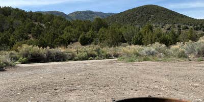
Map & DirectionsClover Springs Campground is located in Utah near Rush Valley
Directions
The campground is located in Tooele County, west of the town of Rush Valley. From Salt Lake City, drive west on I-80 to exit 99. Drive south on SR 36 through Tooele and Stockton. Continue driving south until the junction of State Route 199. Turn west at the junction of 199. The campground is on the south side of the road in the foothills of the Oniqui Mountains.
Coordinates
40.347171 N
112.550251 W
Connectivity
 T-MobileNo Coverage
 Verizon5GExcellent CoverageVerified by 15 usersLast on 6/21/26
- AT&TNo CoverageVerified by 5 usersLast on 6/21/26
Connectivity
- T-MobileNo Coverage
- Verizon5GExcellent CoverageVerified by 15 usersLast on 6/21/26
- AT&TNo CoverageVerified by 5 usersLast on 6/21/26
Access
- Drive-InPark next to your site
- Walk-InPark in a lot, walk to your site.
Site Types
- Tent Sites
- RV Sites
- Standard (Tent/RV)
- Group
- Equestrian
Features
For Campers
- Trash
- Phone Service
- Reservable
- Toilets
- Alcohol
For Vehicles
- Big Rig Friendly
Drive Time
- 55 min from Salt Lake City, UT
- 1 hr 9 min from Provo, UT
- 1 hr 22 min from Ogden, UT
- 2 hrs 6 min from Logan, UT


