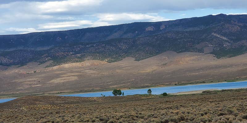
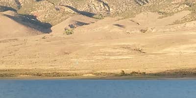
Within BLM Land managed by the Richfield Field Office, Otter Creek, Tamerisk Point Rec Site provides dispersed camping along the shoreline of Otter Creek Reservoir. The site sits less than six yards from the water on level ground with large trees offering shade and includes picnic tables and vault toilets at multiple locations nearby.
Access comes via decent gravel roads suitable for both drive-in and walk-in camping. Campers report minimal cell phone coverage in the area. The lake supports kayaking and fishing, with wildlife sightings including deer, waterfowl, and various bird species. Muddy conditions exist at the water's edge where some campers launch watercraft. For those wanting developed facilities, Otter Creek Lake rd offers a different camping experience nearby.
Description
Otter Creek has an activity for almost everyone. The cold, clear water of this large reservoir offers year-round fishing for rainbow trout. For wildlife watchers, numerous waterfowl, raptors, deer, antelope, and elk abound. If you re an ATV rider, you ll want to try the Paiute ATV trail, which can be accessed from here. The primary activities are fishing and boating although it also serves as a regional staging site for extended and day trips into the surrounding National Forest, Utah State Lands and BLM managed lands by horse, foot, and vehicle. The Richfield Field Office manages day use facilities, dispersed and primitive camping facilities, and fishing access to the Reservoir at Fisherman's Beach, Tamarisk Point, and South Point along the west side of the reservoir. There is no potable water but picnic tables and pit toilets are available. Otter Creek Reservoir is located at the southeastern corner of Paiute County near the town of Antimony. A Utah State Park is located at the south end and provides well developed facilities, while the Richfield BLM maintains several semi-primitive sites along the west side of the lake and dispersed use is available on the east side of the reservoir. The main attraction is fishing and camping. The lands are sagebrush steppe. The Parker Mountains are located to the east, Monroe Mountain and Kingston canyon to the west of the lake, and the Sevier Plateau is to the southwest.
RV Road Trip Guides


Map & DirectionsOtter Creek, Tamerisk Point Rec Site is located in Utah near Kingston
Directions
Located West of Antimony and North of Otter Creek State Park. Once you reach the West side of the reservoir turn East onto a dirt road. This road will parallel the reservoir until you find Tamarisk Point.
Coordinates
38.25428068 N
111.99058067 W
Connectivity
 T-MobileNo CoverageVerified by 1 userLast on 6/23/26
- VerizonNo Coverage
- AT&TNo Coverage
Connectivity
- T-MobileNo CoverageVerified by 1 userLast on 6/23/26
- VerizonNo Coverage
- AT&TNo Coverage
Access
- Drive-InPark next to your site
- Walk-InPark in a lot, walk to your site.
Site Types
- Dispersed
Features
For Campers
- Picnic Table
- Phone Service
- Toilets
- Alcohol
- Pets
- Fires
DISPERSED CAMPING
Enjoy dispersed camping on government land and leave no trace. Pack in and pack out. No (or limited) services at this camping area. Permit may be required.
PERMIT might be REQUIRED
We curate permit requirements across the US for our PRO members. Try PRO to see if Otter Creek, Tamerisk Point Rec Site needs a permit.
Drive Time
- 2 hrs 3 min from St. George, UT
- 2 hrs 23 min from Provo, UT
- 2 hrs 54 min from Salt Lake City, UT
- 3 hrs 41 min from Grand Junction, CO


