Cave Falls Campground is located in the Bridger-Teton National Forest, surrounded by forested terrain and river landscapes. Temperatures in the area can range from lows in the 30s Fahrenheit in spring and fall to highs in the 80s during summer. Nearby attractions include the scenic Cave Falls and the expansive Yellowstone National Park, offering opportunities for hiking and wildlife viewing.
Description
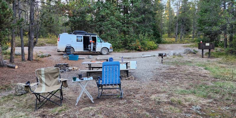
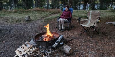
This campgrond is situated on the banks of Fall River in Wyoming along the south border of Yellowstone National Park. Cave Falls Campground has 23 single site units and a terrific area for fishing. Each campsite has fire rings, grills and picnic tables. Located throughout the campground are vault toilets, water faucets, bear proof storage boxes, and a dumpster. The campground is located in grizzly bear habitat that requires special precautions be taken with food storage.
RV Road Trip Guides

Map & DirectionsCave Falls Campground is located in Wyoming near Felt
Directions
From Highway 20 at Ashton, ID, go through the town heading east on State Highway 47 for 5.7 miles. Turn right onto E 1400 N/Cave Falls Rd and drive for 17.6 miles. Approximately 12 miles of this road is dirt.
Coordinates
44.12922313 N
111.0150756 W
Connectivity
 T-MobileNo Coverage
- VerizonNo Coverage
- AT&TNo Coverage
Connectivity
- T-MobileNo Coverage
- VerizonNo Coverage
- AT&TNo Coverage
Access
- Drive-InPark next to your site
- Walk-InPark in a lot, walk to your site.
Site Types
- Tent Sites
- RV Sites
- Standard (Tent/RV)
Features
For Campers
- Trash
- Firewood Available
- Drinking Water
- Toilets
- Alcohol
Drive Time
- 1 hr 56 min from Idaho Falls, ID
- 2 hrs 39 min from Pocatello, ID
- 3 hrs 40 min from Bozeman, MT
- 5 hrs 43 min from Billings, MT


