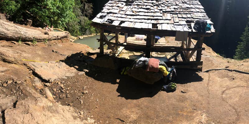
Umpqua Hot Springs Trailhead, near Umpqua National Forest, is a unique spot that draws visitors looking for a natural soak in hot springs. This area is known for its stunning scenery and the chance to unwind in warm waters surrounded by nature.
The hot springs themselves are a highlight, offering a chance to relax, though visitors should be prepared for a rustic experience. Some have mentioned the need for a sense of humor and an appreciation for the outdoors, as the area can get a bit crowded and is not always the cleanest. As one camper noted, “Go with a sense of humor and appreciation for the nature and you'll enjoy it.”
While there are no designated campsites or amenities like picnic tables or electric hookups, the location allows for a true back-to-nature experience. The hike to the springs is short but steep, making it accessible for most. Just keep in mind that this is a day-use area, so you might encounter some long-term campers who enjoy the springs as part of their routine.
For those who love the outdoors, Umpqua Hot Springs Trailhead offers a chance to connect with nature and enjoy the beauty of the surrounding forest. Just be ready for a bit of adventure and the unexpected, as this spot is as much about the experience as it is about the destination.
Description
The trailhead and surrounding area is a Day-Use only site, open from sunrise to sunset. Toketee Lake Campground is the closest overnight campground. Provides access to: Umpqua Hot Springs Trail #1444 North Umpqua Trail Amenities No drinking water Vault toilet Limited garbage disposal - Please pack it out
RV Road Trip Guides


Location
Public CampgroundUmpqua Hot Springs Trailhead is located in Oregon
Directions
From Roseburg, OR, take OR-138 east / northeast Diamond Lake Boulevard. Continue east on Highway 138 and then turn left at milepost 59 onto Forest Road 34. At the bottom of the hill, turn left across the concrete bridge. Go 2.2 miles and turn right onto Forest Road 3401. Proceed 0.7 mile to a parking area on the left.
Coordinates
43.29561316 N
122.361333 W
Connectivity
 T-MobileNo Coverage
 VerizonLTESome CoverageVerified by 3 usersLast on 3/21/26
- AT&TNo Coverage
Connectivity
- T-MobileNo Coverage
- VerizonLTESome CoverageVerified by 3 usersLast on 3/21/26
- AT&TNo Coverage
Access
- Walk-InPark in a lot, walk to your site.
- Hike-InBackcountry sites.
Site Types
- Tent Sites
Features
For Campers
- Trash
- Toilets
- Pets
- Fires
Drive Time
- 2 hrs 13 min from Medford, OR
- 2 hrs 19 min from Bend, OR
- 2 hrs 33 min from Grants Pass, OR
- 2 hrs 36 min from Eugene, OR


