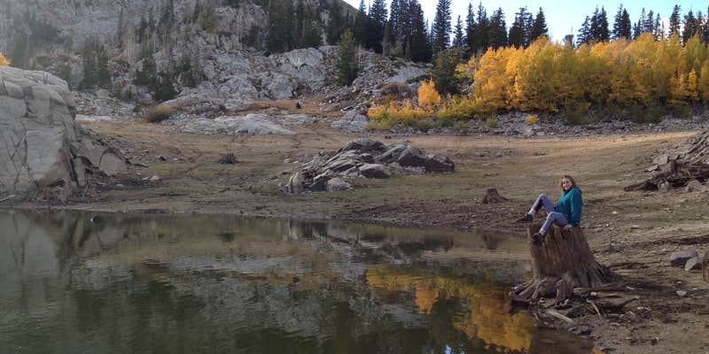
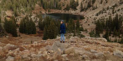
Camper submitted image from Albion Basin - Dispersed - 1
View All
Camper submitted image from Albion Basin - Dispersed - 2
Nature
Camper submitted image from Albion Basin - Dispersed - 3
People

Free Camping Collection

Dispersed Camping

Albion Basin - Dispersed

2 Reviews

About

National Forest

Suggest an Edit

The Dyrt Alerts

Get reservations at sold-out campgrounds.

Learn More

Access

  • Walk-In
    Park in a lot, walk to your site.
  • Hike-In
    Backcountry sites.

Stay Connected

  • WiFi
    Unknown
  • Verizon
    Unknown
  • AT&T
    Unknown
  • T-Mobile
    Unknown

Site Types

  • Dispersed

Features

For Campers

  • Picnic Table
  • Phone Service
  • Reservable
  • Toilets

Rent an RV near Alta, Utah

Find RVs Nearby

Reviews

Add Review

5 Stars

4 Stars

3 Stars

2 Stars

1 Star

100%
0%
0%
0%
0%

5.0

out of 5

2 Reviews

Sloan C.
Reviewed Aug. 12, 2021

Quiet views, walking distance to Cecret Lake

Parked at Cecret Trail parking lot. I arrived at 10:30 PM so parking was not an issue. Was towing a small trailer, which had some difficulty handling terrain en route to parking lot. Area is not illuminated, as is expected, so I prepared a headlamp and a backup lantern for the hike. I packed some potables in a bear can because I was unfamiliar with the area’s ecology, but this is not necessary as bears do not have a presence in this area.

I embarked on Cecret Lake Trail and after a mile or so of mild hiking, arrived at the lake. I encountered a few innocuous nocturnal animals along the trail.

After assessing the topography at the lake, I continued towards the left most side of lake around the concrete bridge, and hiked upwards along trail for about 500 feet, until I found a clearing away from the trail, nestled between boulders.

I set up a two person tent on flat soft ground, padded by pine needles. Visibility was excellent and at some points I turned off my headlamp, to operate by moon and star light.

The night was quiet and peaceful, the silence periodically broken by a gentle breeze. If weather permits, leaving off the rain fly provides an exquisite view of the milky way as you drift off to sleep.

10/10 Sick af

SiteDispersed near Lake
Month of VisitSeptember
Alan B.
Reviewed Nov. 1, 2018

Beautiful area with access to many lakes

Another beautiful dispersed campground site that sits in a beautiful meadow at the top of one of the busiest canyons in the country! This site along with many others in the Grizzly Gulch area of the terminus of Little Cottonwood Canyon can be reached from either the Cecret Lake Trailhead or the Lake Mary via Catherine Pass trailhead. The place we like to set up is in a cozy secluded meadow that sits directly below Mt Wolverine and Tuscarora. The hike to this site is around a mile but you can camp anywhere in the area as long as it is a half mile from any road.

In addition to having breathtaking views of Devils Castle to the south there are numerous recreational activities all within close hiking distance. Hiking up to Catherine Pass gives you access to 3 lakes with fishing in the terminus of Big Cottonwood Canyon. From the pass you can also hike the ridge to the south to reach Sunset Peak and reach Mt Wolverine and Tuscarora on the ridge to the North. Going back to the trailhead for Cecret Lake you can reach the namesake lake within a half mile which is loaded with hundreds of cute little salamanders! For the more adventurous there is climbing abound from 5 single pitch crags that surround Cecret Lake and adventurous (read: chossy) mixed multi-pitch routes that will take you to the top of Devils Castle. Would recommend you being confident at at least 11a. for even the easiest 10b route as these routes are not heavily trafficked and you WILL tear some pieces off.

Month of VisitMay
  • Review photo of Albion Basin - Dispersed by Alan B., November 1, 2018
  • Review photo of Albion Basin - Dispersed by Alan B., November 1, 2018
  • Review photo of Albion Basin - Dispersed by Alan B., November 1, 2018
  • (10) View All

Location

Albion Basin - Dispersed is located in Utah

Detail location of campground

Coordinates

40.581606028700804 N
111.6049844160512 W

Open in Google Maps