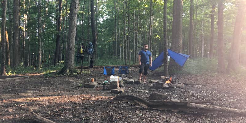
Camper submitted image from Turnhole Backcountry Campsite — Mammoth Cave National Park - 1
View All
Camper submitted image from Turnhole Backcountry Campsite — Mammoth Cave National Park - 2
Nature
Camper submitted image from Turnhole Backcountry Campsite — Mammoth Cave National Park - 3
Roads
Camper submitted image from Turnhole Backcountry Campsite — Mammoth Cave National Park - 4
People
Camper submitted image from Turnhole Backcountry Campsite — Mammoth Cave National Park - 5
Activities

Established Camping

Turnhole Backcountry Campsite — Mammoth Cave National Park

2 Reviews
Review Campground Win Gear

Do you own or manage this property?

Claim Your Listing

About

National Park Service

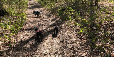
The park offers thirteen designated backcountry campsites that are accessible only by hiking or horseback.

Backcounty sites are primitive, with only a fire ring and horse hitching posts available.

All sites except McCoy Hollow have a nearby water source, but campers should boil and treat water before drinking, or plan to carry in drinking water.

Campsites are limited to one party up to eight people in size. Pickup a Backcountry map at the Mammoth Cave Campground information kiosk, or the Visitor Information desk. Permit Required - $10 per trip. Reservations through Recreation.gov.

Overnight camping is permitted along floodplains and on islands along the Green and Nolin Rivers. Camping in these areas is only accessible by boat.

When camping on floodplains, campers must camp at least ½ mile away from Green River Ferry, Houchin Ferry and Dennison Ferry Day Use Area.

Know where you are. Riverside camping on private lands outside the park may not be permitted.

Sudden rainstorms can cause rapid flooding along riverways and river levels and currents fluctuate dramatically, particularly during winter months. Always check the river level and weather forecast before launching or camping along the rivers. Pickup a Backcountry map at the Mammoth Cave Campground information kiosk, or the Visitor Information desk. Permit Required - $10 per trip. Permits available online, up to a week in advance. Permits are subject to cancelation due to river levels. River levels must remain below 20 feet.

Suggest an Edit

The Dyrt Alerts

Get reservations at sold-out campgrounds.

Learn More

Access

  • Walk-In
    Park in a lot, walk to your site.
  • Hike-In
    Backcountry sites.

Stay Connected

  • WiFi
    Unknown
  • Verizon
    Poor
  • AT&T
    Unknown
  • T-Mobile
    Unknown

Site Types

  • Tent Sites
  • Dispersed
  • Equestrian

Features

For Campers

  • Phone Service
  • Reservable
  • Pets
  • Fires

Rent an RV near Mammoth Cave National Park, Kentucky

Find RVs Nearby

Reviews

Add Review

5 Stars

4 Stars

3 Stars

2 Stars

1 Star

50%
50%
0%
0%
0%

4.5

out of 5

2 Reviews

Mandy C.
Reviewed Aug. 8, 2020

Secluded Site, Easy Hike

Despite this campsite being surrounded by the Green River on 3 sides, water is hard to come by here, and hiking it in may be your best bet. The river is at least 1/2 mile away, through extremely dense brush, and the banks are not easy to access, if accessible at all. We were lucky that a creek just north of the intersection of Buffalo Creek, Sal Hollow, and Turnhole trail had some water to filter from.

This is a nice, secluded spot. You are on the end of a ridge. Clear nights with a bright moon were magical here. It is probably a beautiful spot when there is no foliage, as well. We camped in August.

There is a tent pad, hooks for lanterns or packs, horse hitches, and a fire ring with a grate attached. Hike in is a little over 3 miles, a pleasant hike, but not a whole lot to see in the summer besides a lot of chantrelles.

The Green River Ferry seems to be non-operational a lot. Call the hotline the day of your drive in to see which route you should take: 270-758-2166

We decided to do a day hike on the Sal Hollow Trail. It ended up being pretty exhausting: we believe it is a lot longer than the markers suggest, and a lot of the trail seems pretty unused/not kept up.

  • Review photo of Turnhole Backcountry Campsite — Mammoth Cave National Park by Mandy C., August 8, 2020
  • Review photo of Turnhole Backcountry Campsite — Mammoth Cave National Park by Mandy C., August 8, 2020
  • Review photo of Turnhole Backcountry Campsite — Mammoth Cave National Park by Mandy C., August 8, 2020
  • (6) View All
Shelly S.The Dyrt PRO User
Reviewed Apr. 28, 2020

Easy or Hard

Another backside primitive campsite at Mammoth Cave National Forest, Ky.

A lot of people don’t realize the extensive trail system of Mammoth Cave. They come for the Cave and never take the time to enjoy the natural beauty of the area.

Before using this campsite you are supposed to check in at the visitors center. Unfortunately the ferry is closed so it’s a long drive around to the backside.

Turnhole Campsite is a short or long hike from the Maple Springs parking area. Sal Hollow Trail would be the long trail, twisty , turny and moderately challenging. Buffalo Trail is a straight hike in , take a left at the intersection and straight on to the campsite. Difference of about 3 miles-ish.

The trails are used by hikers and horseback riders, are well marked and lotsa fauna to see. No major vistas here, just woods.

The campsite has poles to tie your horses, a fire ring, tent pad and lantern hooks. Pretty easy to find seasoned wood to burn. DARK at night, lots of animal noises ;) not much of a night sky except in the winter months.

The cool thing about this campsite is your sorta on a peninsula of the river. Very private and it’s not on a loop trail so no foot traffic passing by.

  • Review photo of Turnhole Backcountry Campsite — Mammoth Cave National Park by Shelly S., April 28, 2020
  • Review photo of Turnhole Backcountry Campsite — Mammoth Cave National Park by Shelly S., April 28, 2020
  • Review photo of Turnhole Backcountry Campsite — Mammoth Cave National Park by Shelly S., April 28, 2020
  • (13) View All

Location

Turnhole Backcountry Campsite — Mammoth Cave National Park is located in Kentucky

Detail location of campground

Coordinates

37.171801828807766 N
86.15493097645562 W

Open in Google Maps