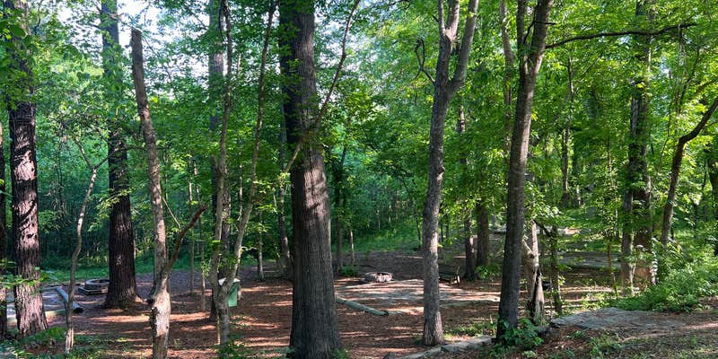
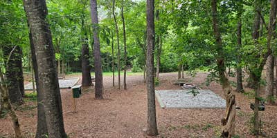
Where the Broad River curves through central South Carolina, Alston Trailhead sits alongside active railroad tracks just outside Chapin. This county-managed site serves as both a Palmetto Trail access point and an overnight camping spot, with a large gravel parking area that accommodates vans and smaller RVs alongside designated tent pads tucked into the treeline.
The campground's proximity to freight rail means trains pass every few hours, with most campers reporting 2-4 nighttime crossings that briefly interrupt sleep. "Right next to a river, with porta-potties available and designated tent pads," notes Logan S., who found the level sites suitable for van camping despite the steep access road. Two portable restrooms serve the area, and picnic tables with fire rings dot the camping zones behind the main parking lot.
Cell coverage varies across the site, with some visitors finding reliable service while others report limited connectivity. The river provides a backdrop for morning walks along the trail system, and evening hours often bring the sounds of local wildlife, including coyotes calling from the surrounding woods. Security towers with blue flashing lights monitor the area, though campers generally report feeling secure during overnight stays.
For those wanting more developed amenities, Dogwood Ridge offers full hookups a short drive south.
Description
The Alston trailhead park provides parking, picnicking, camping, and canoe access on the Broad River. 3 night maximum for camping.
RV Road Trip Guides


Map & DirectionsAlston Trailhead is located in South Carolina near Chapin
Directions
Alston Trailhead: From Columbia: I-26, exit 97, take US 176 west 11 miles; turn east on SC 213; drive 3.1 miles, turn right onto Alston Road (1st road after the bridge); road changes to unpaved, take right fork, cross RR track and go under the trestle; parking is on the left at the top. From Spartanburg: I-26, exit 82, take 773 to Pomaria, east on US 176 to SC 213; turn east on 213; follow directions above.
Coordinates
34.24355474 N
81.31786099 W
Connectivity
 T-Mobile5GExcellent CoverageVerified by 17 usersLast on 6/20/26
 Verizon5GGood CoverageVerified by 6 usersLast on 6/20/26
- AT&T5GGood CoverageVerified by 2 usersLast on 6/20/26
Connectivity
- T-Mobile5GExcellent CoverageVerified by 17 usersLast on 6/20/26
- Verizon5GGood CoverageVerified by 6 usersLast on 6/20/26
- AT&T5GGood CoverageVerified by 2 usersLast on 6/20/26
Access
- Drive-InPark next to your site
- Walk-InPark in a lot, walk to your site.
Site Types
- Tent Sites
- RV Sites
- Standard (Tent/RV)
- Dispersed
- Group
Features
For Campers
- Picnic Table
- Phone Service
- Pets
- Fires
FREE established camping
Enjoy camping on government land. Limited or no services at this camping area.
PERMIT might be REQUIRED
We curate permit requirements across the US for our PRO members. Try PRO to see if Alston Trailhead needs a permit.
Drive Time
- 34 min from Columbia, SC
- 1 hr 5 min from Spartanburg, SC
- 1 hr 15 min from Sumter, SC
- 1 hr 25 min from Charlotte, NC


