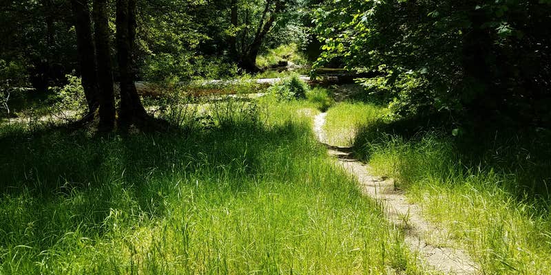
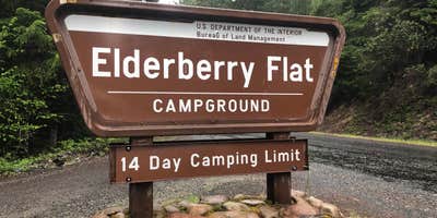
Elderberry Flats Campground, near Medford, Oregon, is a laid-back spot perfect for those who want to escape the hustle and bustle. With 11 sites, many right next to Evans Creek, you’ll find small swimming holes and a chance to catch some crayfish while soaking up the serene surroundings.
This place is all about simplicity—there are no electric hookups or showers, but you’ll find a pit toilet and plenty of space for your setup. Campers have mentioned that the sites are spacious enough for tents and gear, making it easy to spread out and enjoy your time outdoors. One visitor noted, “The site was clean of debris, very spacious; more than enough space for our two tents, two easy-ups, corn hole game, and four vehicles.”
If you’re into off-roading, this area is a hit for dirt bikes and quads, with trails that are accessible for OHVs. The peaceful forest setting is a great backdrop for hiking, and you might even spot some wildlife as the days go by. Just be prepared for a bit of a drive to get here, as some routes can be tricky.
Elderberry Flats is a solid choice for those looking to unwind in nature without the frills. Whether you’re swimming in the creek or just kicking back by the fire, it’s a great spot to recharge and enjoy the great outdoors.
Description
Elderberry Flat Campground provides 11 campsites along the tranquil and beautiful West Fork of Evans Creek, a tributary to the famous Rogue River. There is a paved road that provides easy access to the campground which is typically open from late May to September. The area offers a variety of recreation activities including camping, biking, hiking, hunting, OHV riding, picnicking, swimming, and wildlife viewing. The campground provides multiple access points to the creek to enjoy the cool water on hot summer days. Granite sand bars, calm water, and gentle sloping access provide family friendly access to the water. Campsites are equipped with picnic tables and grills and there is one pit toilet. There is no fee to use the campground but a 14 day limit is enforced.
Fee Info
No fees at this campground.
RV Road Trip Guides


Map & DirectionsElderberry Flats Campground is located in Oregon near Trail
Directions
Directions From I-5 Exit 48/Rogue River: Head northeast on Depot St ___ Turn left onto Pine St ___ Continue onto E Evans Creek Rd ___ in 6 miles take a slight right onto Covered Bridge Rd ___ Slight right onto E Evans Creek Rd ___ in 10.5 miles turn left onto W Fork Evans Creek Rd ___ travel approximately 9.1 miles and campground will be on the left.Directions From Medford I-5 Exit 30: Follow signs for Airport/Biddle Road ___ Turn right onto Biddle Rd ___ in 2.2 miles turn right on Table Rock Rd ___ in 9.7 miles turn right onto OR-234 E ___ Turn left onto Meadows Rd ___ in 8 miles turn left onto E Evans Creek Rd ___ in 3.6 miles turn right onto W Fork Evans Creek Rd ___ travel approximately 9.1 miles and the campground will be on the left.
Address
Butte Falls Field Office
3040 Biddle Rd.
Medford, OR 97504
Coordinates
42.6625 N
123.098888 W
Connectivity
 T-MobileNo Coverage
- VerizonNo Coverage
- AT&TNo Coverage
Connectivity
- T-MobileNo Coverage
- VerizonNo Coverage
- AT&TNo Coverage
Access
- Drive-InPark next to your site
Features
For Campers
- ADA Access
DISPERSED CAMPING
Enjoy dispersed camping on government land and leave no trace. Pack in and pack out. No (or limited) services at this camping area. Permit may be required.
PERMIT might be REQUIRED
We curate permit requirements across the US for our PRO members. Try PRO to see if Elderberry Flats Campground needs a permit.
Drive Time
- 56 min from Medford, OR
- 1 hr 1 min from Grants Pass, OR
- 2 hrs 37 min from Eugene, OR
- 3 hrs 12 min from Corvallis, OR


