Public Campground
Olallie Lake Guard Station Cabin
Olallie Lake Guard Station Cabin is located in the Mt. Hood National Forest, featuring forested terrain and a nearby lake. The area experiences temperature highs around 80°F in summer and lows near 20°F in winter. Visitors can explore Olallie Lake and nearby hiking trails, with Mt. Hood and Timothy Lake accessible for additional outdoor activities.
Description
Overview
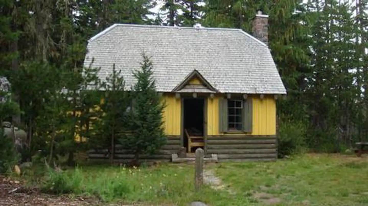
Olallie Lake Guard Station Cabin gives campers an old-fashioned cabin experience with its well-preserved features, including a massive rock chimney, interior wood and hand-wrought iron work. It provides access to a number of outdoor recreation opportunities as well as its namesake lake. The cabin is at nearly 5,000 feet so the season can be delayed by late snows which restricts cabin access.
Recreation
The Olallie Lake Guard Station Cabin is located in the heart of the Olallie Lake Scenic Area which has several lakes and miles of trails including the Pacific Crest Trail located adjacent to the cabin. Olallie Lake (240 arces in size) has non-motorized boating and excellent fishing. Rental row boats are available at the nearby Olallie Resort. The lake is stocked with rainbow trout. Swimming is allowed in all lakes except Olallie Lake. Some of the trails and most of the graveled roads are open for mountain biking.
Facilities
The four-room guard station has a kitchen, living room with two futon couches, a bunk bedroom and a loft with a queen bed. The cabin sleeps up to eight people. It has propane lights, a propane refrigerator, stove and oven, basic cooking pots, pans, dishes and eating utensils. A table and chairs is provided. A wood stove is available for heat. Firewood is provided. The cabin has a limited water supply to the kitchen sink with hot and cold water. A vault toilet is located about 75 feet from the cabin and is used by others. Cell phone coverage is not available at the cabin and very spotty in the entire Olallie Lake Scenic Area. Guests will need to bring sleeping bags or bedding, towels and wash cloths, paper towels, food and personal gear, as well as a flashlight or lantern for emergencies, a first aid kit, insect repellent (a must!), sunscreen and dish soap, among other necessities. Please bring garbage bags and clean the facility before leaving. Olallie Lake Resort is in charge of managing this cabin for the Forest Service. We are just next door and have personel onsite 24 hours a day. Guests can access the cabin by vehicle. Higher clearance or 4wd is preferable, but the cabin is accessible to 2wd passenger cars if they drive slow. Road conditions can be hampered by early or late snows. Guests are responsible for their own travel arrangements and safety..
Natural Features
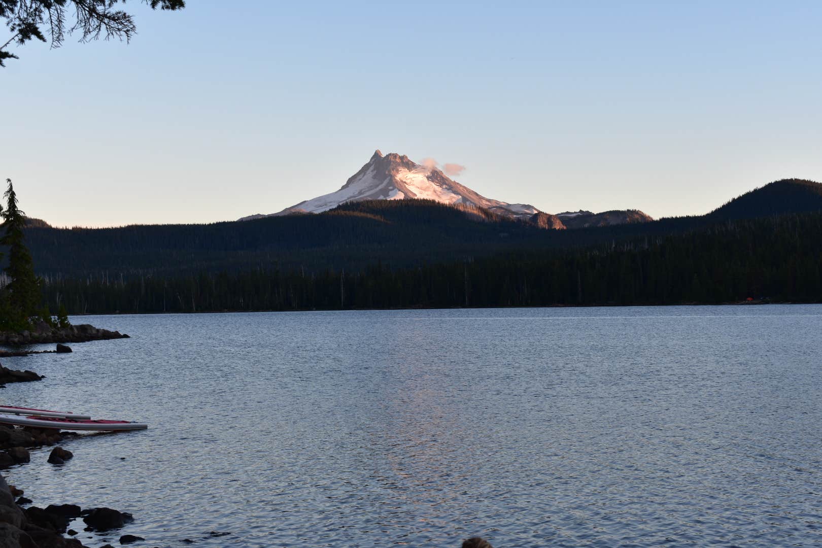
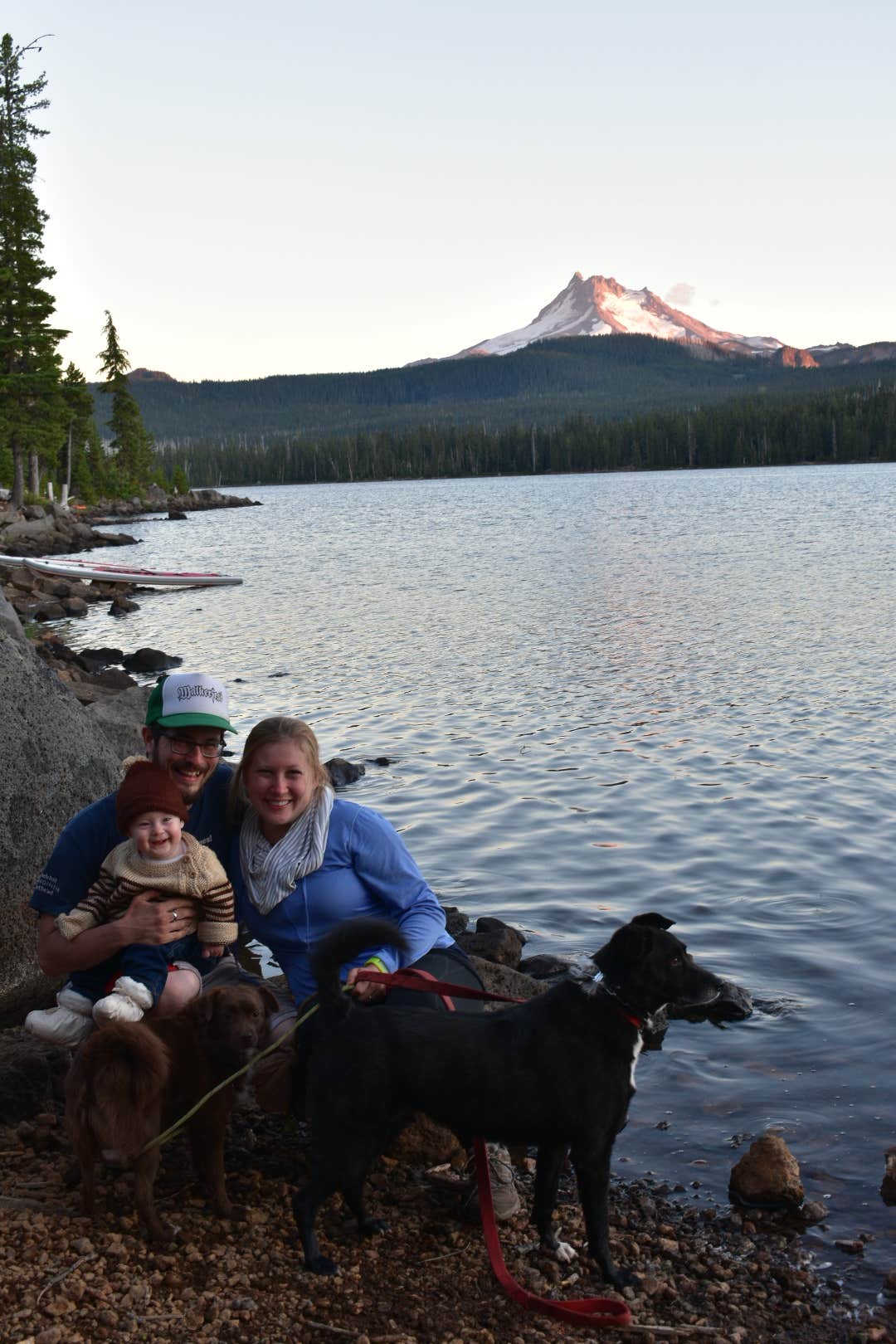
This historically significant, two-story cabin was built by the Civilian Conservation Corps in the 1930s for the Forest Ranger that patrolled the area. It is a classic example of the Forest Service rustic architectural style of Depression Era administration buildings. The cabin is located on the far south end of the Mt. Hood National Forest. Its location near the shore of Olallie Lake affords visitors views of the north face of 10,497-foot Mt. Jefferson and 7,215-foot Olallie Butte, in the Cascade Mountains. The facility was listed on the National Register of Historic Places in 1991. Olallie is Chinook jargon for "berry."
Nearby Attractions
The Olallie Lake Resort is near the cabin. There is a store there that sells some food, bait, etc. The nearest town is Detroit which is 36 miles south. CJs Chevron is the north 40 miles on Hwy 26.
Contact Info
For local information, please call (503) 853-3481 or call (503) 668-1700 for general information.
Reservation Info
Olallie Lake Scenic Area is remote; no phones, fuel or other services available Access to the cabin can be rough; four-wheel drive or high-clearance vehicles are recommended
RV Road Trip Guides
Location
Olallie Lake Guard Station Cabin is located in Oregon
Directions
The best route from the Portland area is east on HWY 224 from 1-205 through Estacada. Continue past Ripplebrook Ranger Station onto Forest Hwy 46. HWY 224 turns into HWY 46. Go approximately 25 miles;\_\_you will want to watch your odometer as the turn off to FSR (Forest Service Road) 4690 is\_\_easy to miss.\_Olallie is\_\_painted on the road at the junction of 46 and 4690. Turn left onto FSR 4690. Once on FSR 4690 the road is winding and travel is very slow. Stay straight on FSR 4690 and follow the signs 13 miles to Olallie Lake (first sign is at the gate about 8 miles in when the road becomes FSR 4220). -------------------------------------------------------------------------------------------------------- The best route from the Salem area is through Detroit to Forest Hwy 46. Turn left just as you pass over the bridge into Detroit. Follow Forest Hwy 46 for approximately 25 miles.\_\_It is best to watch your odometer. At approximately 25 miles\_\_turn right onto FSR 4690. \_ Olallie \_ is\_\_painted on the road at the junction of 46 and 4690. Once on FSR 4690 the road is winding and travel is very slow. Stay straight on FSR 4690 and follow the signs 13 miles to Olallie Lake (first sign is at the gate about 8 miles in when the road becomes FSR 4220). -------------------------------------------------------------------------------------------------------- From Mt Hood: From Highway 26 turn on to Skyline Road\_\_ FSR 42, which is approximately 12 miles south of Government Camp and follow the signs 35 miles to the Lake. You will have to watch closely for the left turn onto FSR 4220. Please note this is considered a primitive road. The roads are closed in the winter.
Address
FSR 4220 Mt Hood National Forest
Mt hood, OR
Coordinates
44.8138889 N
121.7902778 W
Connectivity
- T-MobileNo Coverage
- VerizonNo Coverage
- AT&TNo Coverage
Connectivity
- T-MobileNo Coverage
- VerizonNo Coverage
- AT&TNo Coverage
Access
- Drive-InPark next to your site
- Walk-InPark in a lot, walk to your site.
- Hike-InBackcountry sites.
Site Types
- Cabins
Features
For Campers
- Trash
- Firewood Available
- Reservable
- Drinking Water
- Toilets
- Alcohol
Drive Time
- 2 hrs 8 min from Salem, OR
- 2 hrs 19 min from Albany, OR
- 2 hrs 39 min from Bend, OR
- 2 hrs 43 min from Portland, OR

