Where the Arkansas River curves through eastern Oklahoma, Brush Creek Public Use Area sits on Keystone Lake's shoreline under US Army Corps of Engineers management. The campground features two distinct sections: outer sites with water and electric hookups up to 50 amp, and an inner circle that adds sewer connections for full hookups. RVs up to 70 feet can access the drive-in sites, though signage from the main road requires attention to avoid missing the turn.
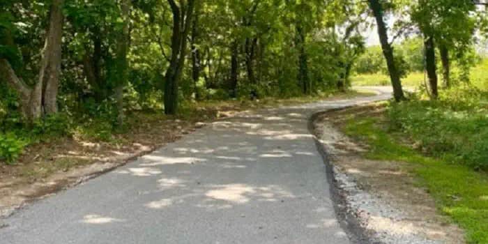
The facility locks its gates from 10 pm to 6 am, creating a controlled environment for overnight guests. A new one-mile asphalt trail connects camping areas to lake access points, where Terry L. notes fishing opportunities are "right there" along the river. The campground includes standard amenities like picnic tables and allows campfires and pets. Views extend toward Keystone Dam from certain sites.
Campers report the facility maintains clean conditions and benefits from an active host presence. The location provides access to both Sand Springs and Mannford within minutes for supplies. For those exploring the broader region, places to camp near Keystone Lake include additional Corps-managed areas and state park options. The combination of full hookups, lake access, and gated security appeals to RV travelers seeking established amenities along Oklahoma's waterways.
Description
Overview
Brush Creek is located downstream of Keystone Dam, just 10 minutes from Tulsa, Oklahoma. This park features campground provided activities such as horseshoes, cornhole, a basketball court, a sand volleyball court, a mile-long fitness trail, and quick access to nearby multi-purpose trails. This is a popular destination for fishermen as they have the ability to cross along the pedestrian bridge from the campground to the fishing berm below the dam. In additon to fishing, this area offers prime opportunities to observe multiple wildlife species._Please note when camping here, while typically quiet, water releases from the dam are preceded by several warning signals from a horn. This is a brief safety measure for anyone in or near the water below the dam, and there is no danger to the campground.
Recreation
This park features fishing opportunities with disabled access, a pedestrian bridge, playground, horseshoe, cornhole, basketball court, volleyball court, and a fitness trail. Recreation opportunities that are offered nearby include the Two Rivers Trail, Keystone Singletrack Trail, and White Water Off Road Vehicle Area.
Facilities
This popular, quaint campground features 50 amp electrical service, water hookups, picnic tables, fire rings, grills, and lantern hooks at all sites. Additionally, sewer hookups are included at sites 1-14. This park also offers a restroom/shower facility.
Natural Features
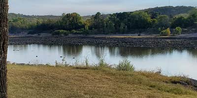
The park is nestled along the Arkansas River, downstream from Keystone Dam. This location is popular for striped bass, white bass, white crappie, and various catfish species.
Nearby Attractions
BOK Center The Gathering Place Tulsa Zoo Jenks Aquarium White Water and Appalachia Bay Off Road Vehicle Areas Multi-purpose trails OneOK Field Downtown Tulsa Turkey Mountain Urban Wilderness Area Various casinos, malls and shopping centers
Fee Info
Camping is $25 per night.
Warning 1 Alert is In Effect
There is 1 alert for this campground. Camp safely!
Warning 1 Alert is In Effect
There is 1 alert for this campground. Camp safely!
Beginning April 1, 2026 the check-in time for camping will be 3:00 PM, and check-out time will be 1:00 PM.
RV Road Trip Guides

Map & DirectionsBrush Creek Public Use Area is located in Oklahoma near Mannford
Directions
From Highway 412 take the Keystone Dam Exit on to Highway 151 and take the first left before you cross the Dam. At the stop sign you will travel straight and take the second right turn to the park entrance.
Coordinates
36.150868 N
96.246994 W
Access
- Drive-InPark next to your site
Site Types
- RV Sites
- Group
Features
For Campers
- Picnic Table
- Reservable
- Electric Hookups
- Pets
- Fires
For Vehicles
- Sewer Hookups
- Water Hookups
Drive Time
- 22 min from Tulsa, OK
- 1 hr 21 min from Enid, OK
- 1 hr 26 min from Oklahoma City, OK
- 1 hr 47 min from Joplin, MO


