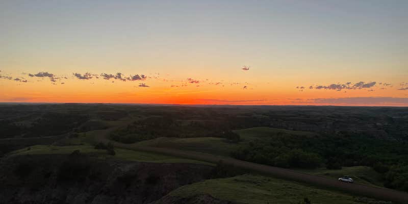
Within Little Missouri National Grassland, Magpie Campground provides access to over 100 miles of the renowned Maah Daah Hey Trail system. This US Forest Service facility sits 25 minutes off the highway via dirt roads, creating a buffer from traffic noise. The drive requires patience but rewards campers with direct trail connections for hiking, biking, and horseback riding.
Sites spread throughout the forested area with trees providing natural separation between camping spots. Even during busier periods, the layout ensures privacy. A hand-operated water pump supplies fresh drinking water, though it requires some effort to operate effectively. The facility includes clean pit toilets stocked with supplies and metal fire rings with attached grills at each site.
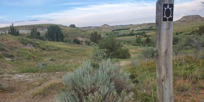
Trail access defines this location's appeal. The Magpie Trail begins nearby and follows a small creek, while connections to the main Maah Daah Hey system lead west toward Devil's Pass or east to ice caves. Jenny K. notes "Even if it was at capacity, you wouldn't hear or see much of others" due to the wooded site spacing.
Capacity rarely becomes an issue, with most visitors finding fewer than half the sites occupied even on weekends. The $6-10 cash fee system operates on an honor basis. For additional camping options in the region, explore campgrounds around Grassy Butte. This location suits campers prioritizing trail access over convenience.
Description
Turn west on Road #712 at the Magpie Camp sign, located 1.5 miles north of Fairfield on Highway 85; travel 15.5 miles on gravel road #712. The campground is located ¼ mile northeast off road # 712. A day use parking lot right adjacent to the MDH trail is located ½ mile south of the campground. This fenced camp features 11 camp spurs. A handicap accessible vault toilet and a potable water well are available during the summer months. A convenient meeting area for those traveling to Devil's Pass or the Ice Caves. A great shaded area in the summer!
RV Road Trip Guides

Map & DirectionsMagpie Campground is located in North Dakota near Grassy Butte
Directions
Turn west on Road #712 at the Magpie Camp sign, located 1.5 miles north of Fairfield on Highway 85; travel 15.5 miles on gravel road #712. The campground is located ¼ mile northeast off road # 712. A day use parking lot right adjacent to the MDH trail is located ½ mile south of the campground.
Coordinates
47.30937938 N
103.47419418 W
Connectivity
 T-MobileNo Coverage
- VerizonNo Coverage
- AT&TNo Coverage
Connectivity
- T-MobileNo Coverage
- VerizonNo Coverage
- AT&TNo Coverage
Access
- Drive-InPark next to your site
- Boat-InSites accessible by watercraft.
Site Types
- Tent Sites
- RV Sites
- Standard (Tent/RV)
- Group
- Tent Cabin
- Equestrian
Features
For Campers
- ADA Access
- Trash
- Picnic Table
- Firewood Available
- Drinking Water
- Toilets
- Alcohol
- Pets
- Fires
Drive Time
- 2 hrs 26 min from Bismarck, ND
- 3 hrs 11 min from Minot, ND
- 4 hrs 21 min from Rapid City, SD
- 4 hrs 57 min from Billings, MT


