Best Dispersed Camping near Blossvale, NY
Searching for the perfect place to dispersed camp near Blossvale? Dispersed camping is the perfect way to get off the grid. Find the perfect dispersed campsite for your next adventure.
Primitive camping is allowed. Campsites must be at least 150 feet away from the nearest road, trail, or body of water. Camping for more than three nights or in groups of ten or more requires a permit from a Forest Ranger.
This location is the parking area for the dispersed hike-in and backpacking camping; the established primitive campgrounds are elsewhere in the forest, at Spruce Pond and adjacent to the North Country Scenic Trail access for the trail to Tinkers Falls.
Two additional drive-up, accessible camping sites are available on a first come, first served basis. The sites are located off of Morgan Hill Road, in close proximity to the forest's accessible trail. See map above and directions below.
The Spruce Pond camping area and the two drive-up accessible camping sites are located on seasonal roads with no winter maintenance or available parking nearby. Accessing these sites from November through March is not recommended.
Primitive camping is welcomed year-round throughout the forest, where safe and authorized access and parking allows. Campsites must be at least 150 feet away from the nearest road, trail, or body of water. Camping for more than three nights or in groups of ten or more requires a permit from a Forest Ranger.
Bucks Brook State Forest consists of 2,178 acres located between State highway 26 and County Highway 13 in the northwest corner of Chenango County. Popular recreational uses of this forest are hiking, nature observation and hunting.
Camping At-large primitive camping is allowed. Campsites must be at least 150 feet away from the nearest road, trail, or body of water. Camping for more than three nights or in groups of ten or more requires a permit from a Forest Ranger.
Hiking General information on hiking includes how-to and safety tips and links to rules & regulations.
A portion of the Finger Lakes Trail (leaves DEC website) traverses the forest. The trail enters the forest on the northwest side along Ratville Road and traverses east and then south to where it exits the forest on Bucks Brook Road near its junction with Rt. 26
Fishing General information on fishing includes how-to and safety tips and links to seasons, rules & regulations.
The Otselic River, which runs along Rt. 26, offers nearby trout fishing opportunities and is easily accessible due to the numerous DEC parking areas.
Fishing Access information is available. Fishing Easement information is available.
Hunting & Trapping General Information on hunting and general information on trapping includes how-to and safety tips with links to seasons, rules & regulations.
Cross-country Skiing & Snowshoeing General information on cross-country skiing and snowshoeing includes how-to and safety tips and links to rules & regulations.
Cross-country skiing and snowshoeing are permitted on all hiking trails.
Wildlife General information on animals includes links to information about birds, mammals, fish, reptiles, amphibians and insects that inhabit or migrate through the state.
Primitive camping is allowed. Campsites must be at least 150 feet away from the nearest road, trail, or body of water. Camping for more than three nights or in groups of ten or more requires a permit from a Forest Ranger. More details here: https://www.dec.ny.gov/outdoor/41282.html
Primitive camping is allowed on many DEC lands, including Forest Preserve lands in the Catskills and Adirondacks, as well as on State Forest lands outside the Preserve. Primitive camping is prohibited on Unique Areas, Wildlife Management Areas, and a few other categories of state land.
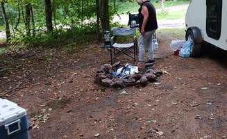
Where to Set Up Camp The best place to camp is at designated primitive tent sites. These sites are typically flatter than other areas and have deeper, harder soils more resistant to heavy use and erosion, minimizing the impacts of camping. Many sites have nearby pit privies and rock fire rings.
Yellow and black camp here marker attached to a tree "Camp Here" marker Campers are encouraged to use designated tent sites. They are often close to trails and provide views of ponds, lakes, streams or rivers. These can be a source of water when properly treated.
All designated primitive tent sites have yellow and black "Camp Here" markers. Many sites on lakes and ponds are identified by a yellow number against a dark brown wooden plaque typically attached to a tree near the water's edge.
The coordinates lead you to a small parking area at the end of Grover Brown Rd, which is accessed by going north from Rt 23. The road itself is in pretty rough shape, and is marked with a sign that says it is a low maintanence road. But if you follow the road north to the end, you will come to a dead end and a parking circle that gives you the option of hiking north past a gate into the state forest on a hunting trail, or west onto the Finger Lakes Trail where dispersed camping is allowed within the state forest. However, the whole road in is a tough ride, it is posted extensively en route that you are passing private property with no trespassing allowed until you see the DEC sign announcing the border of the state forest. The parking area is overgrown, the neighbors aling the road en route seem frustrated with hikers coming into the forest via this route, and the Trailhead here for the Finger Lakes Trail is blocked by downed trees that seem to have been there for a while. While you might try to hike the trail for day use, I wonder if this may not be a great place to leave your car during a foray into the woods for dispersed camping. Although the Pharsalia Forest is beautiful throughout, and dispersed camping is allowed throughout, there are better places to access it. There are also designated primitive campsites in several locations in other areas of this state forest which are worthy of your camping adventures! You
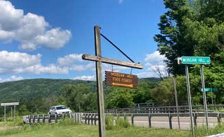
This is a small state forest campground in the Morgan Hill forest from which you can directly access the Onondaga Trail branch of the National North Country scenic trail. Although the campsites here are primitive and free, they are official developed campsites and not really “dispersed” campsites. There are several basic tent spots, which are just cleared grassy areas adjacent to the trailhead parking circle; BUT in addition, there are two lovely developed campsites with parking spot right next to a cement pad with picnic tables and fire pits. These are very nice roomy wooded campsites, and the developed sites are supposedly ADA accessible —but while I agree that the picnic tables and cement pad around the fireplace can certainly accomodate wheelchairs, and the tenting area is roomy, note that there are NO OTHER ADA amenities at these sites, eg no water source and NO toilet or outhouse right at the campground. While you can drive right up to your campsite location, which is accessible, you would actually have to hike quite a long ways west on the OnondagaTrail to access a pit toilet, or to have stream access for obtaining water to boil, so you DO need to come prepared to use the bushes by your campsite and leave no trace, plus bring your own water. (See attached map where I circled the campground area in orange) That being said, this location is peaceful and quiet with mature trees and plenty of distance between neighboring campers, and would be an ideal setting for a group campout. Hiking the trail west on a day trip will bring you to the beautiful Tinker Falls, which may not be flowing during dry seasons but is still a gorge worth exploring! You can best access this campground from the south side of the forest; the entrance is from state route 13 on Morgan Hill Rd south, adjacent to a very nice farm stand that is a good stop for supplies, and there is a DEC forest sign to mark the turn off from Rt 13. After that, you are on your own and should bring a map to navigate as the hiking trails are marked with signs where they cross the roads, but the road to turn off from Morgan Hill Rd to the campground is not marked. You can set your driving directions on Google Maps beforehad, to this endpoint: https://www.google.com/maps/dir//42.767846,-75.997552/@42.7799792,-76.08097,12z?entry=ttu
You might also want to download the free Avenza map of the forest which will allow you to navigate real time even if you don't have cell service, that link is here: https://store.avenza.com/products/morgan-hill-state-forest-nysdec-map?queryID=eb824498ff4125babc1c06655b111da4&objectID=42626406056092
general info for this state forest is here:
This location has a set of 2 large trailhead parking lots for hikers and backpackers accessing the vast trail network of the Morgan Hill State Forest. (See area circled in image on map) You do not camp here at these parking lots, but from here can backpack in to the woods on the Onondaga Trail or connecting trails, and from there you can do LNT dispersed camping as long as you follow the state forest camping rules(see this link for more details: https://dec.ny.gov/things-to-do/camping/state-land-rules) such as not setting up camp within 150 of a stream or other body or water, and not near an official campground (There are 2 official drive-in primitive camp grounds in the vicinty, for which you need permits from the local ranger; otherwise, elsewhere in the forest you can backpack the various trails and camp at your own site if you leave no trace). You need to bring your own water, there is none provided here, and be prepared to pack out your own garbage. Be sure to download a copy of the forest map with the trails network marked, as the various trails are blazed and have occasional signs, but they crisscross in a confusing network and you can get easily turned around without a map. The woods are beautiful and the trails are well developed, but also be prepared for ticks and the need for repellent as they are thick in spring and early summer. Note: the trails going west from here enter the Labrador Hollow Unique area, which is part of the state forest but is a special preserve where camping is NOT allowed, so be aware of your lication
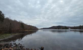
This is a primitive undeveloped campsite, there is a clearing for tenting but no potable water or amenities of any kind. The site is adjacent to a small parking area and fishing access on a really beautiful pond, which is unnamed on the map but is an impoundment of Bear Wallow Creek so it can be considered Bear Wallow Pond. I have been there in both summer, when the shoreline wildflowers are riotous, and in fall when the changing leaves are breathtaking. If you camp here, you can kayak or fish on the pond, go mountain biking on the network of state forest roads that are all part of the Pharsalia Woods Game Refuge, or access the Finger Lakes Trail or Canasawacta Creek Trail (see website for this listing for map of the refuge and more info at https://cnyhiking.com/FLT-PharsaliaWMA.htm)
You can get to the site from state highway 23 via the Benedict Hill Rd, or from the hamlet of Beaver Meadow going south and west of Cole Hill via Mud Lane. A peaceful pretty wooded spot not far from either Norwich or South Otselic for an easy overnight or weekend. I give it 4 stars not for amenities but for being an idyllic example of a dispersed primitive site
Had a quiet and peaceful stay. Must camp at a numbered site. Most sites are right along the road, but I was lucky enough to snag one deeper in the woods. Some of the sites even have an outhouse. Stayed in October, so when I left early the next morning, I passed a lot of hunters that had camped along the road, too. The road is in good condition. No AT&T cell service in this area.
nice place to sleep. good for someone who doesn’t want something too off the road. when you get to the destination you have to go a little more up the road until you see a sign and a sand patch on the side of the road.
Primitive site on the beautiful south eastern end of Stillwater. A short hike in to a great beach for swimming or paddling.
We’ve stayed here many times in tents and hammock tents. The swimming is fantastic- water is clean and clear.
Because you can’t make a reservation here sometimes there’s competition for a spot. There is a good fire circle with space all around. The trail down to the beach is only about a hundred feet, but it is downhill.
This site is close to the trailhead for the Stillwater firetower, an original Adirondack firetower.
This is a small primitive site. No services, but a very beautiful spot. There’s a small fire ring, and access to the lake for swimming or fishing.
Sunday lake has always been lovely and quiet and a great place to take youth campers.
Take Stillwater rd. to McCarty road, the trail is 0.3 miles To Sunday lake. Space to park two cars or a small RV off the road.
You have to work a bit to find info on the Whaupaunaucau state forest as a camping destination, but for primitive campers that is part of the appeal! This is a relatively unknown oasis outside of the county, but this state forest has a network of miles of trails for both hiking and criss country skiing. There is an offifical lean-to shelter and developed campsite on trail 20 (see map) but there are several primitive sites with tent site and stine fireplace, plus dispersed leave-no-trace camping is allowed anywhere in the state forest, and the possibilities are endless. Lovely hilly vistas, pondside glens, and lots of clearings near clear streams deep in this old stately forest. A great place to get away from it all for hiking and camping but it is also a fantastic place to go if you enjoy botanizing or birding, lots of unusual species to see. Just beware of ticks, they are invading the region
Bucks Brook carves a beautiful gorge through Bucks Brook State Forest before it cascades into the Otselic River. There are both state forest roads and off road trails to hike on in the area; the Bucks Brook Forest Road follows a series of small waterfalls at the bottom of the gorge to the source of the creek near the top of the ridge above it, while the Finger Lakes trail follows the brook for a short while near its mouth before climbing offroad through the ridge high above the gorge, along steep cliffs above the Otselic and west along the crest of Bucks Brook Hill. There are several very primitive tent sites along the FTL, but dispersed camping is also allowed. Two sites on the ridge near the source of the Brook are accessible by the Finger Lakes trail either from Bucks Brook Rd or Ridge Rd.
The setting is scenic and picturesque, and the winding trail can be quite a challenge if hiking the long way uphill on the FTL. An easier hike-in access is at Ridge Rd, about a 1/4 hike to the brook where there are several nice flat tent sites. The brook is beautiful and unspoiled, but this truly is primitive camping, no picnic tables, no lean-to shelter like at somecother area FTL campsites, no water source other than the brook (you should filter it even though the source is a spring near by), no latrines, no fire grates though there is a stone fire ring and you could easily build a new one of your own with stones from the brook.
Although this is an idyllic and secluded spot for primitive camping, and the hike in (either via the long or short way) is well marked and enjoyable, the campsites are really nothing more than flat ground for basic tent-sites; this location could be improved with at least a fire grate, and preferably a lean-to. Also, the parking spot for access to the trail and tentsites really needs to be upgraded; it is just a muddy turnout off the forest road. Hence the four star rating d spite the five star brook and forest! However, it should be mentioned that the amenities at campsites along other segments if the FLT have been developed and maintained not by the DEC but by different volunteer chapters of the trail organization who have adopted certain local segments; this Bucks Brook section just hasnt been adopted yet! It has the potential for being a 5-star primitive camping experience if upgraded a bit; volunteers should feel free to step forth!
For more on the Bucks Brook section if the Finger Lakes Trail, go to this link: http://www.cnyhiking.com/FLT-BucksBrookSF.htm
Discover the beauty of dispersed camping near Blossvale, New York, where nature lovers can find serene spots to unwind and connect with the outdoors. With a variety of locations offering unique experiences, you'll find the perfect place to pitch your tent or park your RV.
Frequently Asked Questions
Which is the most popular dispersed campsite near Blossvale, NY?
According to TheDyrt.com, the most popular dispersed campground near Blossvale, NY is Towsley Road Dispersed Camping with a 4-star rating from 1 review.
What is the best site to find dispersed camping near Blossvale, NY?
TheDyrt.com has all 14 dispersed camping locations near Blossvale, NY, with real photos and reviews from campers.