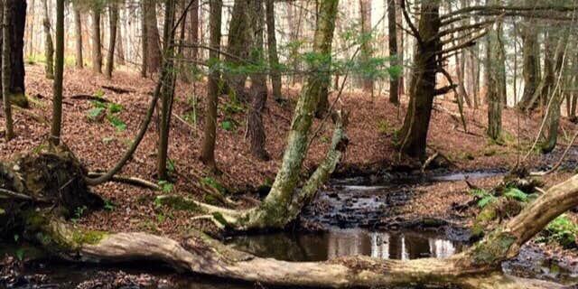
This free dispersed campground within Bucks Brook State Forest requires a hike-in approach, with the shortest access trail covering about a quarter-mile from Ridge Road. The primitive tent sites sit along Bucks Brook near its source, where the creek carves through forested terrain before flowing toward the Otselic River. Sites consist of flat ground suitable for tents, with a stone fire ring present and additional rings easily constructed from brook stones.
The location connects to both the Finger Lakes Trail system and state forest roads, providing hiking opportunities through the surrounding ridge terrain. Campers must pack in all supplies since no facilities exist beyond the basic fire ring—no picnic tables, latrines, or potable water sources. The brook provides water but requires filtration. Access parking consists of a basic turnout along the forest road that can become muddy in wet conditions.
Description
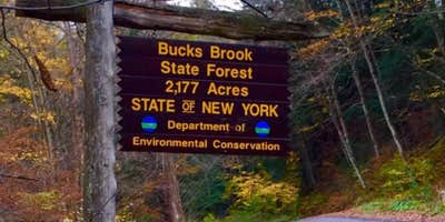
Bucks Brook State Forest consists of 2,178 acres located between State highway 26 and County Highway 13 in the northwest corner of Chenango County. Popular recreational uses of this forest are hiking, nature observation and hunting.
Camping At-large primitive camping is allowed. Campsites must be at least 150 feet away from the nearest road, trail, or body of water. Camping for more than three nights or in groups of ten or more requires a permit from a Forest Ranger.
Hiking General information on hiking includes how-to and safety tips and links to rules & regulations.
A portion of the Finger Lakes Trail (leaves DEC website) traverses the forest. The trail enters the forest on the northwest side along Ratville Road and traverses east and then south to where it exits the forest on Bucks Brook Road near its junction with Rt. 26
Fishing General information on fishing includes how-to and safety tips and links to seasons, rules & regulations.
The Otselic River, which runs along Rt. 26, offers nearby trout fishing opportunities and is easily accessible due to the numerous DEC parking areas.
Fishing Access information is available. Fishing Easement information is available.
Hunting & Trapping General Information on hunting and general information on trapping includes how-to and safety tips with links to seasons, rules & regulations.
Cross-country Skiing & Snowshoeing General information on cross-country skiing and snowshoeing includes how-to and safety tips and links to rules & regulations.
Cross-country skiing and snowshoeing are permitted on all hiking trails.
Wildlife General information on animals includes links to information about birds, mammals, fish, reptiles, amphibians and insects that inhabit or migrate through the state.
RV Road Trip Guides


Map & DirectionsBucks Brook State Forest Primitive Tent Site is located in New York near DeRuyter
Directions
Bucks Brook State Forest can be accessed by either the Bucks Brook Road from State highway 26 or the Ridge Road which traverses north from South Otselic to its junction with County highway 16. These are both dirt roads that are plowed in the winter. Ridge Road pull off, northern end near the Finger Lakes Trail (42.707672°N, 75.785836°W)
Coordinates
42.7068 N
75.7852 W
Connectivity
 T-MobileNo Coverage
- VerizonNo Coverage
 AT&T5GExcellent CoverageVerified by 4 usersLast on 7/11/26
Connectivity
- T-MobileNo Coverage
- VerizonNo Coverage
- AT&T5GExcellent CoverageVerified by 4 usersLast on 7/11/26
Access
- Hike-InBackcountry sites.
Site Types
- Dispersed
Features
For Campers
- Pets
- Fires
For Vehicles
- Sanitary Dump
DISPERSED CAMPING
Enjoy dispersed camping on government land and leave no trace. Pack in and pack out. No (or limited) services at this camping area. Permit may be required.
PERMIT might be REQUIRED
We curate permit requirements across the US for our PRO members. Try PRO to see if Bucks Brook State Forest Primitive Tent Site needs a permit.
Drive Time
- 48 min from Syracuse, NY
- 51 min from Binghamton, NY
- 59 min from Utica, NY
- 1 hr 5 min from Ithaca, NY


