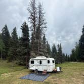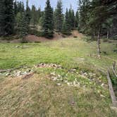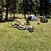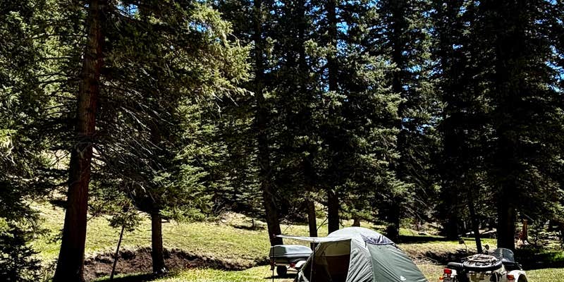
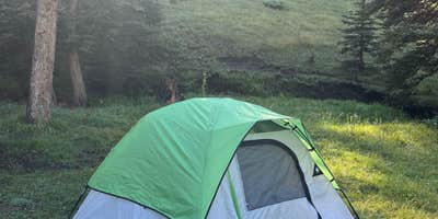
The sounds of rushing water and wildlife calls create a backdrop for camping along Forest Road 5, where dispersed sites spread out along a short dirt road in Carson National Forest. Multiple camping spots line the route, though road conditions vary significantly with weather and some sites require higher clearance vehicles to access safely.
Spring brings particular challenges and rewards to this area. Meghan B. noted the "sounds of rushing water, the birds and frogs chirping, and the elk walking through" during snowmelt season, though muddy conditions can make several sites inaccessible until the ground dries. Summer temperatures drop into the mid-40s even in July, making this a cool-weather retreat from lower elevations.
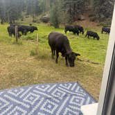
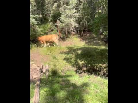
Most sites feature existing fire rings and access to deadfall for firewood. A creek runs behind several camping areas, and cattle occasionally wander through the vicinity. Verizon cell service reaches 5G strength after the first few sites along the road. The area maintains relatively low use compared to developed campgrounds, with sites spaced far enough apart that neighboring campers remain audible but not intrusive.
Plan for variable road conditions and bring appropriate gear for potentially muddy or steep site entrances, especially during spring runoff or after rain.
Description
**This road runs into Taos Pueblo land, please respect this and do not trespass on their land. **
The road is closed in the winter and is popular for cross country skiing and snowshoeing.
Summer and fall the road is open to hiking, mountain biking and horseback riding, but is also open to vehicles. Expect to see motorized traffic. When it is closed for the winter it is a quiet place to cross-country ski or snowshoe.
RV Road Trip Guides


Map & DirectionsForest Road 5 is located in New Mexico near Angel Fire
Directions
From Taos – Follow US Highway 64 about 16 miles to the horseshoe turn west of Palo Flechado Pass. La Jara Canyon is on the left. The trailhead is signed and parking is available.
Coordinates
36.42039671 N
105.34305767 W
Connectivity
 T-MobileNo CoverageVerified by 7 usersLast on 7/29/26
 VerizonLTESome CoverageVerified by 6 usersLast on 7/29/26
- AT&TNo CoverageVerified by 4 usersLast on 7/29/26
Connectivity
- T-MobileNo CoverageVerified by 7 usersLast on 7/29/26
- VerizonLTESome CoverageVerified by 6 usersLast on 7/29/26
- AT&TNo CoverageVerified by 4 usersLast on 7/29/26
Access
- Drive-InPark next to your site
- Walk-InPark in a lot, walk to your site.
Site Types
- Tent Sites
- RV Sites
- Dispersed
Features
For Campers
- Phone Service
- Alcohol
- Pets
- Fires
For Vehicles
- Pull-Through Sites
DISPERSED CAMPING
Enjoy dispersed camping on government land and leave no trace. Pack in and pack out. No (or limited) services at this camping area. Permit may be required.
PERMIT might be REQUIRED
We curate permit requirements across the US for our PRO members. Try PRO to see if Forest Road 5 - Dispersed campsite needs a permit.
Drive Time
- 1 hr 38 min from Santa Fe, NM
- 2 hrs 27 min from Albuquerque, NM
- 2 hrs 56 min from Pueblo, CO
- 3 hrs 53 min from Farmington, NM