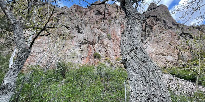
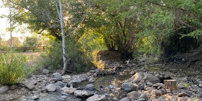
Accessible via a rocky forest road that requires slow driving for the final 2-3 miles, Pine Creek Campground sits at 7,510 feet elevation within an aspen and birch forest in Toiyabe National Forest. The US Forest Service manages this 21-site campground from May through November, with 14 sites positioned along the creek and 6 walk-in options. Most sites accommodate cars, vans, or trucks, though four pull-through spots can handle RVs up to 35 feet with careful navigation and leveling. The campground provides pit toilets, picnic tables, and fire rings, but campers should expect no cell service of any kind. Sites fill quickly during summer months on the first-come, first-served basis, making early arrival essential for securing a spot.
Description
Situated on the eastern side of the Toquima Mountain Range in the Monitor Valley. Fishing in Peavine Creek. Two trailheads with access to Arc Dome Wilderness at the end of Forest Road 020. The trail from Peavine trailhead leads up Peavine Canyon to connect with the Toiyabe Crest National Recreation Trail. The trail from Toms Canyon follows Toms Creek to the Toiyabe Crest National Recreation Trail. Hiking: trails lead to Mt. Jefferson in the Alta Toquima Wilderness Area and also to Arc Dome Wilderness. Places to visit are Arc Dome Wilderness, Alta Toquima Wilderness Area, Diana's Punch Bowl, the towns of Belmont and Manhattan. Pets should be kept on leash. 21 units and 1 group.
RV Road Trip Guides

Map & DirectionsPine Creek Campground is located in Nevada near Round Mountain
Directions
In Tonapah, NV, at intersection of US Rt. 6 and US Rt. 95, take Rt. 6 east 5.4 miles to State Rt. 376. Turn left onto Rt. 376 north and go 13.3 miles to Belmont sign. Turn right at sign and go 46.3 miles to Pine Creek sign. Turn left at sign and go 0.9 miles to a "Y" intersection. Bear right and go 2.5 miles on a rough, dirt road to campground.
Coordinates
38.79611932 N
116.84824197 W
Connectivity
 T-MobileNo Coverage
- VerizonNo Coverage
- AT&TNo Coverage
Connectivity
- T-MobileNo Coverage
- VerizonNo Coverage
- AT&TNo Coverage
Access
- Drive-InPark next to your site
- Boat-InSites accessible by watercraft.
Site Types
- Tent Sites
- RV Sites
- Standard (Tent/RV)
- Tent Cabin
- Equestrian
Features
For Campers
- Picnic Table
- Toilets
- Pets
- Fires
Drive Time
- 4 hrs 18 min from Reno, NV
- 4 hrs 22 min from Carson City, NV
- 4 hrs 45 min from Las Vegas, NV
- 7 hrs 45 min from Fresno, CA


