The peninsula setting of COE Table Rock Lake Old Highway 86 Park places campers on three sides of water, with waterfront sites wrapping around the shoreline. This Army Corps of Engineers facility operates seasonally from April through October, accommodating RVs up to 66 feet with full hookups. Natalie C. notes "the campground is on a peninsula with waterfront sites all the way around."
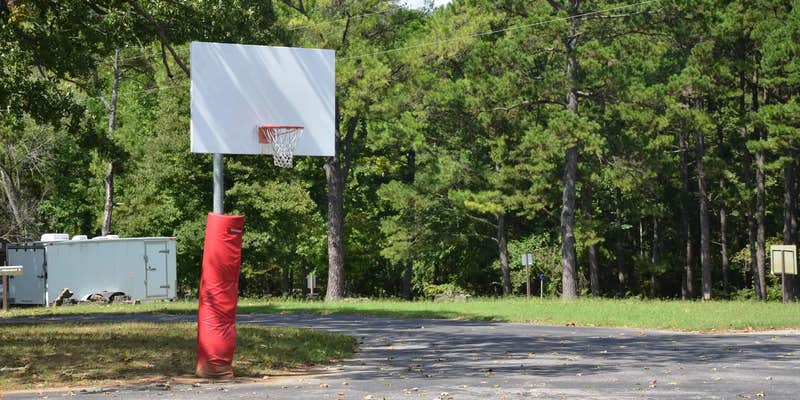
Campers consistently mention the maintained condition of facilities and the contrast between waterfront and interior sites. The bathhouses receive regular praise for cleanliness and spaciousness, while paved pads at each site simplify RV leveling. Interior sites sit closer together but many still provide lake views. A swim beach, sand volleyball court, and playground occupy common areas, with boat launching available directly from shore areas.
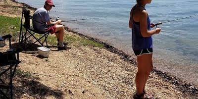
Fishing draws many visitors, with reviews mentioning professional tournament anglers using the facility. Kayaking works well from the protected waters around the peninsula. Each site includes electric and water hookups, fire rings, and picnic tables. Dogs are welcome throughout the campground, and reviews indicate good cell service for remote work needs.
Advance reservations prove essential for weekend stays, particularly during peak season. The campground fills quickly due to its waterfront location and proximity to Branson attractions. Access roads can become rough during wet conditions, though the drive remains manageable for large RVs. Crystal C. recommends coming "prepared as there are not really any services to pick up last minute need for several miles."
Campers seeking alternatives can explore Table Rock State Park Campground for different amenities and terrain options.
Description
Overview
Old Highway 86 is a spacious and sunny campground that sits along the White River Arm of Table Rock Lake in the rolling Missouri countryside.
Recreation
Whether on water or land, Old Highway 86 Campground offers visitors countless recreational activities. Picnicking, swimming, scuba diving, boating, fishing, hiking and wildlife viewing are all popular pastimes at the park. Many campsites are adjacent to the waters edge, and the remaining campsites are only a short walk away. Built on a peninsula, this park has water on three sides. Visitors can find plenty of room to fish from shore. While the lake boasts an abundance of crappie, catfish, and bluegill, Table Rock is most famous for bass, and is acclaimed as one of the best bass fishing lakes in this hemisphere. Table Rock Lakeshore Trail, about 2 miles long, runs from the Dewey Short Visitor Center to the Table Rock State Park Marina. During the spring hikers will see dogwood, serviceberry and redbud trees in bloom as well as many wildflower species. During the autumn months, visitors are treated to nature's colorful fall foliage. The trail also offers beautiful views of Table Rock Lake. Other hiking and mountain biking opportunities are available at the Mark Twain National Forest, parts of which are easily accessible from the campground. Click here for more information.
Facilities
Old Highway 86 Campground offers 71 reservable campsites, along with one large reservable group picnic shelter. Amenities like hot showers, drinking water, a dump station and electric hookups create a comfortable camping experience. One swimming area, a boat ramp, playground and volleyball court make the campground perfect for family trips.
Natural Features
Table Rock Lake is a beautiful body of water surrounded by a forest of oak and hickory trees. Its waters wind down through the valleys and hollows of the Ozark Mountains, from Branson, Missouri to Eureka Springs, Arkansas. More than five million visitors per year take advantage of this recreational oasis. Originally built for flood control, the Table Rock Dam has created a lake that boasts 779 miles of shoreline for the public to enjoy.
Nearby Attractions
The Dewey Short Visitors Center is located at the south end of Table Rock Dam. It offers three educational films focused on the history of the dam, the story of Lewis and Clark and the history of eagles and their endangerment in the state of Missouri. The visitor center also contains exhibits about the natural history of the area. Old Highway 86 Campground is about 17 miles from Branson, Missouri, which offers grocery stores, gas and additional tourist attractions.
Fee Info
Gate attendants are happy to help you with your inquiries, but cannot make reservations over the phone. Please call (877) 444-6777 for reservations.
RV Road Trip Guides

Map & DirectionsCOE Table Rock Lake Old Highway 86 Park is located in Missouri near Blue Eye
Directions
From Branson, Missouri, take Highway 65 and turn west onto Highway 86. After 6 miles turn north on Highway UU and follow signs to the campground.
Address
1791 State Hwy UU
Blue eye, MO 65611-7268
Coordinates
36.5594444 N
93.3194444 W
Connectivity
 T-Mobile5GExcellent Coverage
 VerizonLTESome CoverageVerified by 8 usersLast on 6/27/26
 AT&T5GGood CoverageVerified by 4 usersLast on 6/27/26
Connectivity
- T-Mobile5GExcellent Coverage
- VerizonLTESome CoverageVerified by 8 usersLast on 6/27/26
- AT&T5GGood CoverageVerified by 4 usersLast on 6/27/26
Access
- Drive-InPark next to your site
- Walk-InPark in a lot, walk to your site.
- Boat-InSites accessible by watercraft.
Site Types
- Tent Sites
- RV Sites
- Standard (Tent/RV)
- Group
Features
For Campers
- Trash
- Picnic Table
- Firewood Available
- Phone Service
- Reservable
- Drinking Water
- Electric Hookups
- Toilets
- Alcohol
- Pets
- Fires
For Vehicles
- Sanitary Dump
- Water Hookups
- 50 Amp Hookups
Drive Time
- 55 min from Springfield, MO
- 1 hr 37 min from Fayetteville, AR
- 1 hr 53 min from Joplin, MO
- 2 hrs 22 min from Fort Smith, AR