Public Campground
Council Lake Campground
Council Lake Campground is located in the Hiawatha National Forest, featuring forested terrain and a nearby lake. The area experiences temperature highs around 80°F in summer and lows near 10°F in winter. Visitors can explore Pictured Rocks National Lakeshore and Munising Falls, both accessible within a short distance.
Description
Overview
The Munising and Rapid River/Manistique Ranger Districts of the Hiawatha National Forest offer a variety of camping experiences. Many are located on inland lakes in a rustic forest environment with no drinking water. The rustic environment offers a wonderfully serene and peaceful setting for your next camping experience.
Recreation
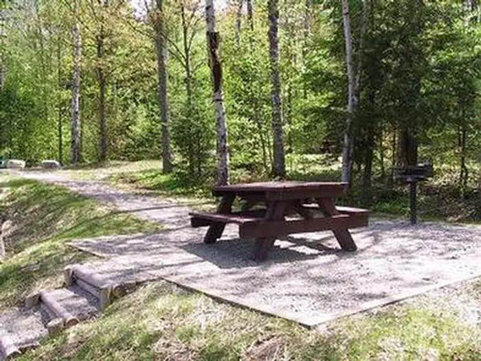
Council Lake is a 12-acre lake with yellow perch, rock and largemouth bass, bluegill, black crappie, bullhead and northern pike. Licenses are required to fish in Michigan waters. Council Lake is part of a small chain of lakes and offers excellent canoeing and kayaking opportunities. There is a short portage that links Council Lake to Bar Lake and the Indian Wild and Scenic River.Non-motorized boats can be used on the lake, however access at the campground is by land only. A boat ramp can be found at adjoining Red Jack Lake. The day-use area is equipped with tables and a pedestal grill. The area is near a beach that is perfect for lounging and swimming. No drinking water is provided at the campsite; water must be brought in and garbage must be carried out.
Facilities
There are four campsites at Council Lake for tent and small RV camping. Each campsite is equipped with a table and a campfire ring. A pit toilet is located near site 1, but toilet paper is not provided. There is NO drinking water. Lake Name: Council Lake Number of Sites: 4 Maximum Number of People: 8 (for each site) Toilets: 1 (by site 1) Boat Access: Carry-In Lake Size (acres): 14
Natural Features
These four campsites are situated on the quaint 12 - acre Council Lake, nestled in a mixed stand of hardwood and pine trees. They are on the southern shores of Council Lake, close to adjoining Red Jack and Scout lakes.
Contact Info
For local information, please call (906) 387-2512 or call (906) 474-6442 for general information.
Location
Council Lake Campground is located in Michigan
Directions
From Munising, Michigan, take Highway M-28 east towards Shingleton. Turn right (south) on Forest Highway 13 at Wetmore and drive 9.9 miles south to Forest Road 2261. Turn right (west) onto Forest Road 226 and drive 1.7 miles. Continue until the road ends at Council Lake.
Address
MUNISING RANGER DISTRICT
400 E. MUNISING AVE.
Munising, MI 49862
Coordinates
46.2416333 N
86.647175 W
Connectivity
- T-MobileNo Coverage
- VerizonNo Coverage
- AT&TNo Coverage
Connectivity
- T-MobileNo Coverage
- VerizonNo Coverage
- AT&TNo Coverage
Access
- Drive-InPark next to your site
Site Types
- Tent Sites
- RV Sites
- Standard (Tent/RV)
Features
For Campers
- Picnic Table
- Reservable
- Toilets
- Pets
- Fires
Drive Time
- 2 hrs 38 min from Green Bay, WI
- 2 hrs 58 min from Appleton, WI
- 3 hrs 50 min from Wausau, WI
- 4 hrs from Traverse City, MI


