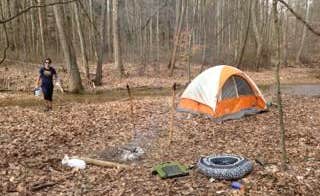
Dispersed camping options around Hoosier National Forest provide multiple opportunities for free camping near Leavenworth, Indiana. The terrain features limestone outcroppings and dense hardwood forests with elevations ranging from 400 to 900 feet. Seasonal creek beds can vary significantly between spring floods and summer dry spells, with summer temperatures typically reaching 85-90°F during peak camping months.
What to do
Fossil hunting along creek beds: Mitchell Creek Road area contains numerous fossils in exposed limestone outcroppings and creek beds. Hoosier National Forest offers "Deep woods" camping with access to geological features according to camper Nathanyal C.
Trail exploration: The primitive campsites near creek crossings provide access to hiking trails that connect to larger networks. Knobstone Trail features "lovely vistas and lots of fossils on the trail and creek beds" as noted by reviewer Maris H., who adds "You're never too far from water, although the quality may differ depending on the time of year."
Wildlife observation: Early mornings offer opportunities to spot wildlife including white-tailed deer, wild turkeys, and various bird species. Susan C. describes the area as "just beautiful. It's very family friendly and quiet. The sites are spacious, and there are a lot of nature things to do."
What campers like
Complete solitude: The remote nature of these dispersed sites means minimal encounters with other people. At Mitchell Creek Road Dispersed, camper Tommy S. reported, "We heard some loud mysterious crashing in some nearby trees, and what was possibly a large band of coyotes in the distance."
Primitive camping challenge: Experienced backcountry campers appreciate the self-reliance required. Dave E. notes that Knobstone Trail is "no walk in the park. There are continuous ups and downs that will challenge your leg strength and footing at times. There are plenty of great places to camp along the trail."
Historical elements: Several campsites feature historical remnants. Jaymi A. mentioned one Mitchell Creek Road Dispersed site "had a small graveyard behind it, so if you're superstitious, this may not be for you. There was also a big white building that was all locked up surrounded by open meadow."
What you should know
Navigation challenges: Paper maps are essential as digital navigation tools are unreliable in this region. Jaymi A. advises, "Have a paper map handy, as there is no cell signal and GPS was spotty."
Road conditions: Access roads deteriorate significantly after rain events. Sabrina C. notes about Mitchell Creek Road Dispersed: "Road south coming in was destroyed some time ago have to w yer from east or west road."
Site limitations: These are not designated campsites but rather clearings. Phil L. clarifies, "There are just a couple of sites along the road. One is at the trail crossing for horses, hikers, and bikers. Its basically a make your own campsite."
Water availability: Seasonal conditions impact water sources dramatically. Dave E. advises, "Water can become scarce in the summer/fall months, but if you walk far enough, you're likely to come by a stream of some sort."
Tips for camping with families
Safety considerations: The remote nature makes these sites better for experienced family campers. Sofia A. cautions solo travelers about Mitchell Creek Road: "If you are solo female traveler don't even waste your time. After 5 min of driving on the very skinny gravel road y saw what it look like spots but Iam not sure really."
Vehicle requirements: Small vehicles are recommended for accessing most sites. Jaymi A. explains, "I did not see any pull offs that would accommodate an RV of any size, and nothing large enough to turn a trailer around. One pull off was nearly too small to turn around my small pick up truck."
Tick prevention: Pack appropriate insect repellent, especially during spring and early summer. Maris H. warns, "Watch out for ticks. My dogs and I got loads of them in April 2020 from Leota to Spurgeon Hollow."
Tips from RVers
Size restrictions: Most dispersed camping areas cannot accommodate large vehicles. Jaymi A. notes that Jackson Trailhead has "parking after a decrepit gravel road and suitable for camping" but generally the area offers "roadside pull-offs" that are limited in size.
Alternative options: When forest roads prove too challenging, nearby towns offer backup options. Sofia A. relates her experience: "Y just keep driving till I got back to 64 and found a Cracker Barrel 17 miles away."
Boondocking preparation: Self-contained camping is essential as no facilities exist. Jaymi A. advises that for those "camping in a self-contained SMALL vehicle, this is quiet, secluded, and beautiful."


