Top Free Dispersed Camping near McCammon, ID
Planning a dispersed camping trip near McCammon? The Dyrt can help you find the best dispersed campsites for your next trip. You're sure to find the perfect dispersed campsite for your Idaho excursion.
Camping on public lands away from developed recreation facilities is referred to as dispersed camping. Most of the remainder of public lands are open to dispersed camping, as long as it does not conflict with other authorized uses or in areas posted "closed to camping," or in some way adversely affects wildlife species or natural resources. Dispersed camping is allowed on public land for a period not to exceed 14 days within a 28 consecutive day period. The 28 day period begins when a camper initially occupies a specific location on public lands. The 14 day limit may be reached either through a number of separate visits or through 14 days of continuous overnight occupation during the 28 day period. After the 14th day of occupation, the camper must move outside of a 25 mile radius of the previous location until the 29th day since the initial occupation. The purpose of this special rule is to prevent damage to sensitive resources caused by continual use of any particular areas. In addition, campers must not leave any personal property unattended for more than 10 days (12 months in Alaska).
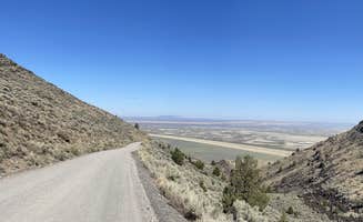
The Blackrock Canyon is associated with the Chinese Peak – Blackrock Rock Trail System, providing non-motorized and motorized users over 40 miles of trails to utilize for OHV, equestrian, mountain biking and hiking. This site is equipped with sheltered picnic tables, fire rings, vaulted restrooms and 2 trailhead parking lots. Additionally, there is an ATV loading/unloading ramp at the lower lot. Site and trail rules and regulations are posted at the trailheads. The site is closed to shooting year around.
Camping, fishing for trout and boating are the favorite activities along the Snake River from this semi-developed recreation site.
Good spot to stop for a night. Big gravel parking lot and some hiking trails nearby. Close to the highway.
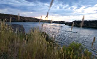
Great location just a few minutes off the highway with multiple sites. Offers great views of the river and several prebuilt fire rings around the area as well. 4 x 4 recommended to get down to some of the lower spots, but there’s sites up top as well that would be suitable for 2-Wheel drive vehicles. Bring bug spray if you visit in the hotter months
I don't know how people are finding the beautiful places they show here. I used the GPS coordinates from here and it led me to a maze of twisted little passages. Very deeply rutted roads challenging me and my 4wd led to a complex of turns and turnarounds. The only road that appeared to lead down to the river was dirt at about 45 degrees. There are many ways to go and I don't know how to could know which to take. Must be dumb luck to find a pretty place by the river.
So, I left and went to the location that the BLM website gives for this named place. It's not the same place. The official location of this place is farther west. That is poorly identified, too. There's a signed turnoff but down the road there's a "Y". I went right. That led to confusion and nasty flies going into my nose and eyes. I left.
Looking at the map later it appears that I should have gone LEFT at the "Y" instead of right. I have no idea what that's like.
Basically, this place has many roads that intersect and go to unknown places. I don't know why there are so many roads, circles, "Y"s, along the river, perpendicular to the river.
The BLM website isn't helpful. I called them and expected a call back but didn't get it.
I wouldn't go here without one of the people here who submitted great reviews with beautiful photos. It's not worth the confusing directions (both my Garmin RV GPS and Google Maps were wrong in different places) and ambiguity of destinations.
Such easy access off 86, so it’s the perfect pull out for a road trip. We were traveling from Colorado to Oregon and found this spot late in the evening of our 2nd day and couldn’t have been happier. We rolled in amongst the thunderstorms, which blew over just in time for a beautiful sunset. There was a little noise from the road, but once we crawled in the tent it was hard to distinguish the traffic noise from that of the river.
Very clean, lots of spots, 10 out of 10 would stay here again.
Nice stop, road is a little rough, but other than that it was great
Easy access from Lava with about 10 designated spots, most with room for two vehicles and one(?) pull through spot that fit my truck/30foot TT. Most had either a metal fire ring or picnic table or both. Pretty enough area, but right off the road and even closer to a train that passed through multiple times at night.
Pulled in at 10:30 pm Saturday night July Fourth weekend and was able to snag the last spot so very clutch!
NOTE - Google satellite photos are NOT accurate, the area is fenced off and sites are limited, no longer the free for all it appears to have been
Roads are rough but the area is pretty. Next to the river and multiple spots available.
May 2024 - This is a good stopping point for those who are passing through. There is a Flying J truck stop on the opposite side of I-15. They have fuel, propane, dump station ($10) and water. The road into dispersed camping is full of pot holes so go slow with a Class A RV or if you have low clearance. The noise from the freeway is minimal. I would stay here again.
Close to highway, easy driven dirt road with plenty of flat spots to park. Good for one night while passing through.
Nice spot in a gravel parking lot surrounded by small mountains with toilets nearby. Park on the right as camping is prohibited on the left.
As others have mentioned, dirt bikes and four wheelers are driving by at night & you can just barely hear the cars from the highway. I’m sure I’ll sleep juuuuust fine 😌
This site is at an abandoned state park. The coordinates navigate just past the entrance and we got a bit confused at first. Mapping to Indian Rocks State Park will provide more accurate directions.
The site is very accessible - the road is washboard with lots of potholes, slow going for us with a 24' travel trailer, but totally doable. Plenty of sites - we snagged a mostly level pull through and stayed hitched. Great views. Traffic noise isn't ideal, but fine for a quick stop.
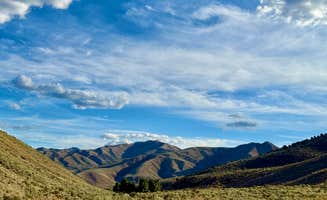
This is a safe spot for overnight. Nice views of mountains. There is highway noise. Camper trailers can manueuver without difficulty. TMobile works here.
Camped here on Sunday, we were the only ones there. Beautiful and scenic room for multiple sites, no amenities.
The road down to it was silt. We were afraid we wouldn't make it back out. It was like an old goat trail. The camp spots were not near the water and people burned garbage on them. I really don't recommend this spot. There were wood pallets and an old headboard people were trying to burn.
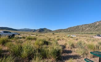
Fairly well maintained and freeway close. 10-12 campsites that are pretty level. Beautiful view on both sides. A great place for a night on the road.
After a long drive this place was perfect. This location is very close the freeway exit. We got lucky to find a pretty leveled pull through site. It looked liked there were only about 10 sites in total. The road in was unpaved but not too rough. Some cars drove past during our stay faster than that we thought was correct. The views to the mountain were awesome. We had some cows come and visit our site early the morning we were leaving. Not sure about why they are free roaming but we liked having them visit.
Found a perfect spot here and this particular one was quite level! A tree for some shade, quiet, but above all, spectacular views. Road is slightly washboard along with occasional pot holes but accessible for my 24 ft. RV.
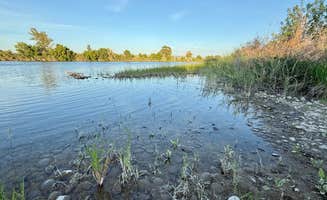
What an amazing find! This camp site had 4-5 sites, some on the hill others near the water. There was even a little beach that could be see from the road near the river. We found the perfect shady spot with fire pits built and the sound of the river in the background. Only 1 other person was there overnight. It was quiet and relaxing!
Close to the interstate so some traffic noise but we had a good nights sleep. 8+ spots. We stoped here on our way to Yellowstone. This is an abandoned state park so some sites are over grown.
This site is right above the snake River so you can hear the water, wonderful way to fall asleep! You are in the High Desert of Idaho so this site is amongst sagebrush but has good shade trees also. When I was there I could start a tent but this ground does tend to get pretty hard during dry season so staking may be a bit more difficult.
There are actually 2 sites you can pitch a tent or park a vehicle. There is also a firepit. I got really good cell reception. There are fun trails to explore with beautiful scenery. This would also be a great spot if you like to pole fish. You can walk to the river and cast in! This spot os about 8 miles to the American Falls Dam where you can kayak, SUP, fish, and picnic
The directions were spot on. I recommend a vehicle with relatively high clearance. It os closer to the interstate than you would expect so you can hear vehicles but was super quiet at night
This was a very amazing experience. The hot springs were absolutely amazing.
There were a few visitors but only us and one other stayed. Our stay was a couple of nights.
It’s worth the drive if you have 4WD or very good shocks and suspension
Great for a one-nighter. At least ten campsites that were no sweat to get to in my Forester. Highway noise, sage brush, and not much else.
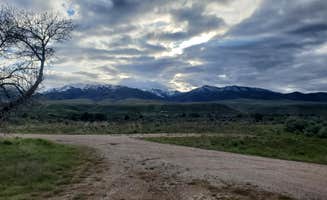
Blackrock Canyon BLM Pocatello, ID 8/4/22 DO NOT trust APP coordinates 42.8145, -112.3307 : Campendium 6/20/22 42.8146,-112.3307 : The Dyrt 6/30/22, 42.8142, -112.3306 : FREE Roam / 2019 These coordinates all lead to a reasonably level, fenced dirt parking lot on the left with a vault toilet and concrete walkway going across the road to a covered picnic/stream area. We were very excited. This is NOT the BLM camping area.... or rather more likely, 'no longer' is? There are 3 new looking signs stating Day Use Only, No Overnight Camping. However there is still a signboard by the toilet with the typical BLM rules/regs & 14 day limit? What's a gal to do? So I called the BLM office listed on the sign to clear up the conflicting sign info. Yep, the aforementioned parking lot is NOT FOR OVERNIGHTCAMPING - again, signs are shiney, no weathering, so this may be a new development? We were told there are 2 BLM camping areas. #1 is ACROSS from the aforementioned parking lot... big DEEPLY graveled area on the right as you come in that steeply slopes down to the picnic table area (our autolevel just laughed at us no matter what we did or where we positioned). #2 is about 1/4m further up where the road loops back on itself, and also has a vault toilet (no concrete walkway). This is a medium parking area inside the loop. Looked doable until we noticed the berm hiding under the grass. At 34' backed in, we'd have either lost the under carriage spare tire, or had our big butt sitting on the ground. So this too was a big nope for us. There is a pullout on the way to the 2nd area, but currently has a 'road closed' sign on it, and another pull out just before the 1st parking area. We could have squeezed into this one, but by this point we were wore out & the thought of all the dust ... just nope. We moved on. This is a GORGEOUS area, if you're a smaller footprint, and can get level. Verizon & ATT both usable but not very strong. Road in is a little washboard and hilly, but doable. I15 underpass ... we're 13'8" on truck & cleared both with no issues. Definitely recommend dropping your rig in the parking lot and scouting out this area 1st.
Roads get narrow with up & down that was too much for my off-road trailer (16in clearance) so stayed on side of road. Quiet, clear unobstructed view of sky for my Starlink.
Beautiful views. Very dark at night and quiet. Road coming in is not bad at all.
GPS correct, no signage and just off highway West. Small 60x40 yard gravel/dirt lot a quarter mile up improved road with some potholes. Was traveling late from Idaho to SLC and was a good stopping point. Can hear the highway still but quiet enough and secluded. No amenities whatsoever but there are some weathered petroglyphs to see. As an option there is a formal rest area off the highway a few miles south.
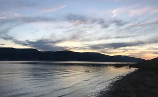
I camped here during a Snake River float trip. Easy to get to launch quickly and close proximity to Alpine WY where you can pick up supplies. There are no amenities at the campground. It is just across the Idaho/Wyoming boarder and on the banks of the Palisades Reservoir. There are trees along the banks. Only fire pits available. No tables, bathrooms, nothing. So please practice good camping etiquette and pack out everything. Gets pretty
Camping near McCammon, Idaho, offers a mix of beautiful landscapes and unique experiences. Whether you're looking for a family-friendly spot or a quiet place to unwind, there are plenty of campgrounds to choose from.
Camping around McCammon, Idaho, has something for everyone, from families to solo travelers. Just be sure to check the specifics of each campground to find the best fit for your needs!
Frequently Asked Questions
Which is the most popular dispersed campsite near McCammon, ID?
According to TheDyrt.com, the most popular dispersed campground near McCammon, ID is Indian Rocks - Dispersed Camping with a 4.1-star rating from 13 reviews.
What is the best site to find dispersed camping near McCammon, ID?
TheDyrt.com has all 10 dispersed camping locations near McCammon, ID, with real photos and reviews from campers.