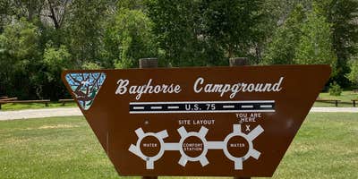
Accessible via Highway 93 just ten minutes from Challis, Bayhorse Recreation Site provides a convenient overnight stop for travelers along Idaho's salmon country corridor. This Bureau of Land Management campground operates year-round with fewer than 20 first-come, first-served sites at $10 per night, cash only. Sites include picnic tables, fire pits, and grills, with drinking water and toilets available on-site.
The campground sits directly alongside the Salmon River, with several sites offering direct water access for fishing or launching small watercraft. A boat ramp serves river users, and informational displays detail local salmon populations. Teri S. calls it an "exceptionally clean and well kept BLM campground" with well-spaced sites. Highway noise occurs regularly throughout the night as vehicles pass, though most reviewers find it manageable.
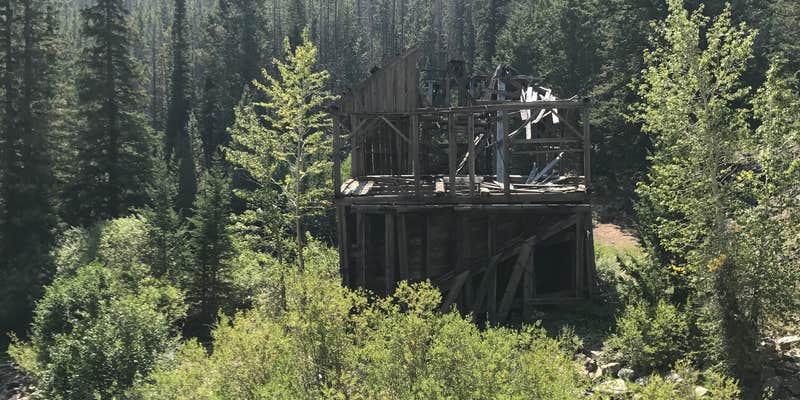
The location serves as a staging area for exploring nearby attractions including Bayhorse Ghost Town, Malm Canyon's petrified sequoias, and the Custer Motorway. An automated sprinkler system operates throughout the campground at unpredictable times, potentially soaking tents placed in irrigation zones. Cell service is nonexistent, though satellite internet functions normally.
This roadside campground works well for RV travelers and tent campers who need basic amenities near camping near Challis without hookups. Pets are not permitted at this location.
Description
Bayhorse Campground is at 5400-foot elevation and is ten miles south of Challis on Highway 75. Named for a historic mining district, Bayhorse Campground has 11 campsites along the Salmon River offering plentiful fishing. Anglers come for the resident cutthroat and rainbow trout, steelhead and whitefish. Visitors can take the road west to Bayhorse Lake, which is near a number of historic mines. The entire area is rich in mining history, and this is a comfortable base camp for exploring the Land of the Yankee Fork. Amenities Include: 11 first come, first served campsites with picnic tables and fire rings, seasonal campground hosts, potable water, vault toilets, boat ramp and day use parking area, and plenty of hiking trails and interpretive sites to explore. There is limited cell service at this site. Electric and water hook-ups are not available.
Fee Info
Camping fee: $10/night. Campsites are first come, first served. Stay limit: 14 Days.
RV Road Trip Guides

Map & DirectionsBayhorse Recreation Site is located in Idaho near Challis
Directions
Approximately 10 miles southwest of Challis, Idaho: travel south from Challis on Highway 93 for 2 miles, turn right onto Highway 75 and drive southwest for approximately 8 miles. The recreation site is on your right between the highway and the Salmon River.
Address
Challis Field Office
721 East Main Avenue, Suite 8
Challis, ID 83226
Coordinates
44.385555 N
114.260278 W
Connectivity
 T-MobileNo Coverage
- VerizonNo CoverageVerified by 1 userLast on 6/18/26
- AT&TNo Coverage
Connectivity
- T-MobileNo Coverage
- VerizonNo CoverageVerified by 1 userLast on 6/18/26
- AT&TNo Coverage
Access
- Drive-InPark next to your site
Site Types
- Tent Sites
- RV Sites
- Standard (Tent/RV)
- Group
Features
For Campers
- Trash
- Drinking Water
- Toilets
- Alcohol
Drive Time
- 2 hrs 18 min from Idaho Falls, ID
- 2 hrs 34 min from Pocatello, ID
- 3 hrs 6 min from Twin Falls, ID
- 3 hrs 51 min from Boise, ID


