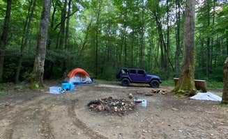
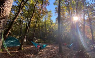
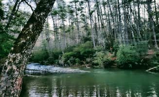
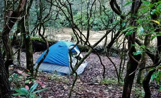
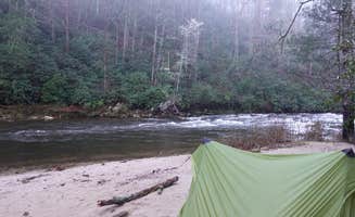
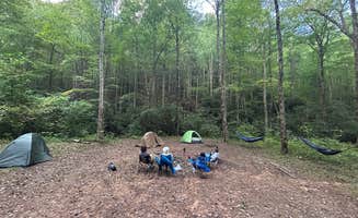
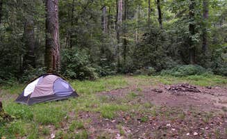
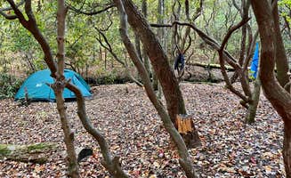
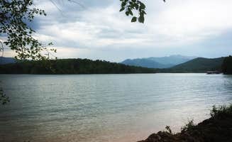
Primitive camping near Rabun Gap, Georgia spans parts of the Chattahoochee and Nantahala National Forests, with elevations ranging from 1,800 to 5,000 feet creating varied microclimates. The region includes several watersheds including the Chattooga and Tallulah Rivers, providing water access at many dispersed camping areas. Summer temperatures typically reach 75-85°F during day and 55-65°F at night, while spring and fall camping offers cooler temperatures and fewer crowds.
What to do
Waterfall exploration: 1-2 miles from campsites at Glen Falls Backcountry Campground, with the trail passing multiple cascade sections. One camper mentions there are "many (many) stairs but is well worth it for the views of Glen Falls," noting that "most people do not make it all the way down to this site so you will most likely find a significant amount of privacy."
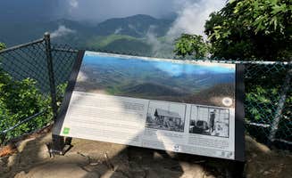
Hiking the Bartram Trail: 4+ mile sections near Whiterock Mountain Backcountry Campsite offer panoramic views and trail connections. A hiker notes, "This section of trail is part of the Bartram trail which is a wonderful through hike starting at the border with Georgia and traveling all the way up through Franklin and ending at Cheoah Bald and Stecoah Gap."
Swimming in mountain streams: 0.5-1 mile access from multiple camping areas with natural pools. At Soggy Boot Campground, campers report that "you can also hike up or down the stream to get to other beautiful small falls that are perfect for swimming in during the hot summers."
What campers like
Site privacy and seclusion: Many Blue Valley Dispersed Camping users appreciate the distance between sites. According to one camper, "Beautiful, large, private sites. You couldn't see our site from the road, huge site, lots of woods surrounding for kids to play and explore, right beside a gorgeous large creek."
Water proximity: Nearly all dispersed sites have creek or river access within walking distance. One camper at Glen Falls noted that the site "is located on the inside of a curve in the river so the creek surrounds almost the entire site giving easy access to water and a relaxing sound to help you sleep at night."
Group camping options: Several areas can accommodate larger groups of 6-40 people. A Mooney Gap Backcountry Group Campsite visitor mentioned, "This is a really great group backpacking site near the Mooney gap trailhead and near the AT that is perfect for heading up to the nearby Albert Firetower."
Cool mountain temperatures: Even in summer, higher elevation sites maintain comfortable sleeping conditions. One camper at Blue Valley noted, "I went in July and it was cool in day and cold at night nice, secluded."
What you should know
Navigation challenges: Forest roads are often unmarked and GPS signals unreliable. A Soggy Boot Campground visitor warns: "We came looking for this campsite past dark and after a half hour of driving on a gravel road we gave up searching and just parked on the side of the road for the night."
Road conditions: Many access roads require high-clearance vehicles. At Falls Creek, a reviewer notes: "Moderate clearance vehicle required, (or hike it)."
Water sources: Natural water requires treatment. One Bly Gap camper mentioned: "Running water out of a pipe (it's a spring I guess?) just south of the ridge, but you'll need to boil or filter before drinking."
Seasonal variability: Weather changes quickly, especially at higher elevations. A camper at Bly Gap reported, "I was here in the middle of November and so it was cold and windy at night."
Trash management: Pack-out requirements strictly enforced. One Soggy Boot visitor observed: "Only bad part was there was trash everywhere when we got there."
Tips for camping with families
Choose sites with flat terrain: Look for established areas with room for multiple tents. A Falls Creek visitor noted, "There is room for two vehicles and multiple tent spots. Very secluded and fairly level."
Select creek-side sites: Water provides both recreation and white noise for sleeping. At Blue Valley Dispersed Camping, one family mentioned, "We have camped at 3 sites at this campground and have loved all of them... Wonderful creek/river by every campsite we went to."
Arrive during daylight: Forest roads are difficult to navigate after dark. A Soggy Boot visitor suggested: "The sites arnt difficult to find in the daytime, just know there's no signs or pointers to tell you which way to go."
Pack extra clothing layers: Temperature swings of 20-30°F between day and night are common. One Blue Valley camper advised, "We love hearing all the wonderful sounds of nature and nothing else."
Tips from RVers
Limited options for larger vehicles: Most dispersed sites accommodate small trailers or truck campers only. A Tallulah River Rd Dispersed Camping visitor noted: "Nice wide camping spot. Very primitive and if you desperately need toilet facilities, there are a couple of established campgrounds just down the road."
Better suited for truck camping: Many roads narrow to single-lane. Regarding Soggy Boot, one visitor explicitly stated, "I don't recommend RV's."
Clearance requirements: Gravel roads often have exposed rocks and drainage channels. A Blue Valley visitor warned: "Pretty rough in some places and very narrow, let's just say I wouldn't want to end up encountering another car."
Scout locations first: Many campers recommend walking to potential sites before attempting to drive in. At Blue Valley, someone advised: "From Highlands, follow NC 28 south about 5.5 miles and turn right onto Blue Valley Rd. (S.R. 1618) at the sign. The pavement will end in a half mile."


