Tent camping in the Mendocino National Forest near Paskenta offers sites at elevations ranging from 2,500 to 7,000 feet across rugged terrain. Most campgrounds in this area of Northern California experience temperature swings of 30-40°F between day and night, even in summer months. Road conditions frequently deteriorate after winter, with Forest Service maintenance typically occurring in late spring.
What to do
Explore OHV trails: Surveyor Campground provides direct access to off-highway vehicle areas. Surveyor Campground sits beyond an "unimproved wash board road" that requires careful navigation but rewards with proximity to designated OHV routes.
Fish nearby streams: Several campgrounds feature small waterways supporting trout fishing from May through September. The trickling creeks at Howard Meadows Campground attract wildlife including frogs that become active at dusk.
Stargazing: Limited light pollution makes astronomical viewing exceptional during new moon phases. The remote locations require preparation but deliver night skies unmarred by urban glow, particularly at higher elevation sites.
What campers like
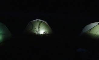
Remote solitude: Most tent sites near Paskenta remain uncrowded even during peak summer weekends. At Howard Meadows Campground, sites are "dispersed" with "a trickling creek with frogs in the evening," creating a sense of isolation.
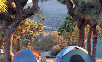
Natural surroundings: The forest canopy provides shade at most established sites, though some areas show evidence of past fires or maintenance issues. One camper noted Sugarfoot Campground as a "beautiful campground" though commented that it was "not well kept" with "downed trees from last year."
Free firewood: Certain campgrounds occasionally offer firewood at no cost, particularly after forest management operations. A visitor to Surveyor Campground mentioned "the Forrest service has provided free stacks of wood" due to closures at a nearby lake.
What you should know
Vehicle requirements: Many access roads demand high-clearance vehicles, with some requiring four-wheel drive capability. A reviewer at Howard Meadows Campground warned that while "a capable 4x4 can handle it easily," falling trees can block primary routes, forcing use of "another way out" that "definitely requires 4lo."
Water availability: Only Whitlock Campground provides drinking water; all other sites require visitors to bring their own supply. Forest Service recommendations suggest one gallon per person per day minimum during summer months.
Fire restrictions: Regulations change throughout the season based on conditions, with complete bans common from July through October. Always check current fire status with the Mendocino National Forest office before departure.
Tips for camping with families
Wildlife viewing opportunities: Dawn and dusk offer the best chances to see deer, various bird species, and amphibians near water sources. Children can participate in the Junior Ranger program available through the Mendocino National Forest visitor centers.
Weather preparedness: Even summer nights can drop below 50°F at higher elevations in the Mendocino range. Sugarfoot Campground campers noted limited "shade trees left since they are all cut down," making sun protection essential during daytime hours.
Emergency planning: Cell service is nonexistent at most campgrounds near Paskenta. The nearest medical facilities are typically 45-60 minutes away in larger communities, requiring families to pack comprehensive first aid supplies.
Tips from RVers
Road access limitations: Most tent camping areas near Paskenta restrict RV access due to narrow, unpaved roads with tight turns. Surveyor Campground can accommodate smaller RVs but visitors advise to "bring lots of water and drive a well running car. You don't want to get stuck out here!"
Limited amenities: None of the best tent camping near Paskenta, California offers hookups or dump stations. Self-contained units must arrive with full water tanks and empty waste tanks, prepared for primitive camping conditions.
Alternative routes: Navigation apps often provide inaccurate directions to remote Forest Service campgrounds. One RVer recommended specific directions to find Surveyor Campground: "Take Forrest Route N17 off of Spouts Spring Rd" since it's "not found on a map!"


 Traveler