
Santa Cruz Island Scorpion Canyon Campground — Channel Islands National Park
Channel Islands, Santa Cruz, Scorpion, May, 2019
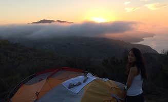
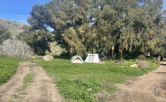
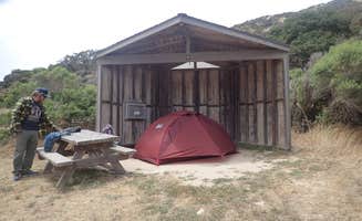
My husband and I are using our senior park pass to it’s fullest advantage. On our most recent trip, we decided to try Channel Islands and we were thrilled. First thing to know is that this trip requires some planning and flexibility. You must book your boat ride and camp site in advance and then check the day before to make sure weather permits the boat ride. Island packers provides the boat ride for both campers and day trips. We camped two nights. We departed at around 9 am and arrived at around 10:30. We had to check in by 8 in the parking lot at Ventura bay. You must not have water in your back pack, the propane must be out in a separate bin, and you are allowed only 60 lbs of “stuff” each. We took our Mountain House meals along with our jet boil, a few fruits, and a couple of sandwiches; our tent, sleeping bags, a Wenzel air mattress and were set. You take your stuff to the boat to load. On the day of our travel winds were gusting so severely that they cancelled the day trips, and it was rough! Lots of people got sick on the ride over. Upon arriving on the island, you form a bucket brigade to unload all the luggage/stuff, then a park ranger gives a brief overview of rules, mainly pack out all trash, no trash can be left on the island and to use the “Fox boxes” for all food stuff as the island foxes and ravens WILL take your stuff. You then take a short hike with all your stuff to your campsite - it’s about 1/4 mile or more, depending on your site. Each campground has multiple spigots on potable water, so no need to bring water with you. There are plenty of very clean vault toilets that are always filled with supplies including hand sanitizer. The hikes are spectacular and the trails are well maintained. Note, the hikes are challenging, when they say strenuous, they mean it! The park rangers are very helpful and accessible. The last day of our trip, we packed up our site and moved our stuff to a staging area so the next group could set up their tent. We watched the kayakers and snorkeling groups. The weather was very calm. The boat ride back was amazing, we saw schools of dolphins, the captain estimated over 2000 dolphins. He stopped so we could get lots of pictures. Note, there is no store on the island, we did have spotty cell coverage with AT&T.