Set at 10,000 feet elevation in the Sierra Nevada, Horseshoe Meadow Campground serves as a gateway for backpackers heading into the high country. The Forest Service maintains 21 walk-in sites scattered among Jeffrey pines around a large, flat meadow. Campers park along the perimeter and carry gear to individual sites equipped with picnic tables, fire rings, and bear boxes.
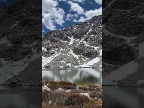
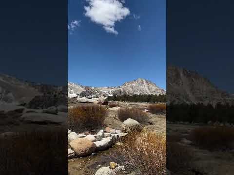
Each site provides space under the pines with vault toilets and water spigots distributed throughout the campground. "Trails to multiple peaks and passes all from this alpine valley," notes Michael A., highlighting the area's appeal for serious hikers. Streams run through the meadow where marmots emerge from rocky areas. Wildlife sightings include coyotes, foxes, deer, and occasionally bighorn sheep at higher elevations.
The $6 fee reflects the campground's basic amenities and walk-in format. Day hikers can reach Chicken Spring Lake for alpine swimming when temperatures climb. Most visitors use this spot as either a staging area for multi-day backcountry trips or a high-altitude escape from valley heat. The campground attracts primarily tent campers, as the walk-in design doesn't accommodate RVs.
For different camping experiences, nearby Inyo National Forest Cottonwood Lakes Trailhead Campground offers similar access to mountain trails.
Description
Horseshoe Meadow is a vast 10,000 foot high meadow, surrounded by lodgepole pine forest. Getting there is an adventure in itself; the road to Horseshoe Meadow climbs over 6,000 feet, as it winds its way up from Lone Pine. Three campgrounds are located in the Horseshoe Meadow Area. Trails from Horseshoe Meadow provide access to the Golden Trout Wilderness and Sequoia-Kings Canyon National Park. The road to Horseshoe Meadow is closed from approximately November to May due to snow.
RV Road Trip Guides


Map & DirectionsHorseshoe Meadow Campground is located in California near Alabama Hills
Directions
Located at the end of Horseshoe Meadow Road, 24 miles southwest of the town of Lone Pine, California. From center of Lone Pine, turn west at the stoplight and follow Whitney Portal Road for 3 miles. Then turn south onto Horseshoe Meadow Road. Follow Horseshoe Meadow Road to its end.
Coordinates
36.44857686 N
118.16871367 W
Connectivity
 T-MobileNo Coverage
- VerizonNo Coverage
- AT&TNo Coverage
Connectivity
- T-MobileNo Coverage
- VerizonNo Coverage
- AT&TNo Coverage
Access
- Drive-InPark next to your site
- Walk-InPark in a lot, walk to your site.
- Hike-InBackcountry sites.
Site Types
- Tent Sites
- Standard (Tent/RV)
- Equestrian
Features
For Campers
- ADA Access
- Trash
- Picnic Table
- Firewood Available
- Drinking Water
- Toilets
- Alcohol
- Pets
- Fires
For Vehicles
- Sanitary Dump
Drive Time
- 3 hrs 13 min from Bakersfield, CA
- 4 hrs 15 min from Visalia, CA
- 4 hrs 23 min from Hanford, CA
- 4 hrs 45 min from Fresno, CA