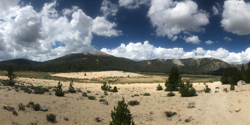
Perched at 10,040 feet elevation in the Eastern Sierra, Cottonwood Pass Walk in Campground serves as a staging area for high-altitude adventures. The walk-in format requires campers to carry gear from the parking area to individual sites spread across open terrain dotted with conifers. Each site includes a fire pit, picnic table, and bear box—essential given the frequent bear activity reviewers consistently mention.
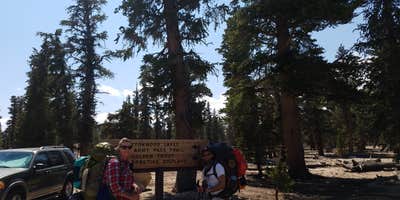
The campground functions primarily as a launching point for Sierra Nevada backpacking trips, with multiple trailheads providing direct access to the John Muir Trail system and popular peaks like Mount Whitney and Mount Langley. Jennifer D. notes the location is "steps away from multiple trails" and emphasizes the importance of using bear boxes due to "a lot of bear activity." The elevation helps backpackers acclimate before tackling higher peaks, a benefit multiple reviewers highlight.
Basic amenities include vault toilets, drinking water, and trash service. The open terrain provides little natural windbreak, and campers should prepare for mountain weather conditions. Sites accommodate various group sizes, though the walk-in access limits gear options. Several reviewers mention using the campground as a secure vehicle staging area during extended backcountry trips.
This campground works best for experienced campers comfortable with high-elevation conditions and those planning Sierra Nevada wilderness adventures.
Description
Located in the Horseshoe Meadow Recreation Area this trailhead campground has 18 walk-in sites suitable for backpackers and hikers to use the night before they are going to hike into Golden Trout Wilderness via the Cottonwood Pass trail. Please self-register at Horseshoe Meadows Campground when you arrive. Sites include food storage boxes, tent pads, and tables, fire grates, piped water, and toilet facilities. One night stay limit. Horseshoe Meadow Area Campgrounds Guide (pdf)
RV Road Trip Guides


Map & DirectionsCottonwood Pass Walk in Campground is located in California near Alabama Hills
Directions
Located at the end of Horseshoe Meadow Road, 24 miles southwest of the town of Lone Pine, California. From center of Lone Pine, turn west at the stoplight and follow Whitney Portal Road for 3 miles. Then turn south onto Horseshoe Meadow Road.
Coordinates
36.44791758 N
118.16904582 W
Connectivity
 T-MobileNo Coverage
- VerizonNo Coverage
- AT&TNo Coverage
Connectivity
- T-MobileNo Coverage
- VerizonNo Coverage
- AT&TNo Coverage
Access
- Walk-InPark in a lot, walk to your site.
Site Types
- Tent Sites
- Standard (Tent/RV)
Features
For Campers
- Trash
- Picnic Table
- Drinking Water
- Toilets
Drive Time
- 3 hrs 13 min from Bakersfield, CA
- 4 hrs 15 min from Visalia, CA
- 4 hrs 23 min from Hanford, CA
- 4 hrs 45 min from Fresno, CA


