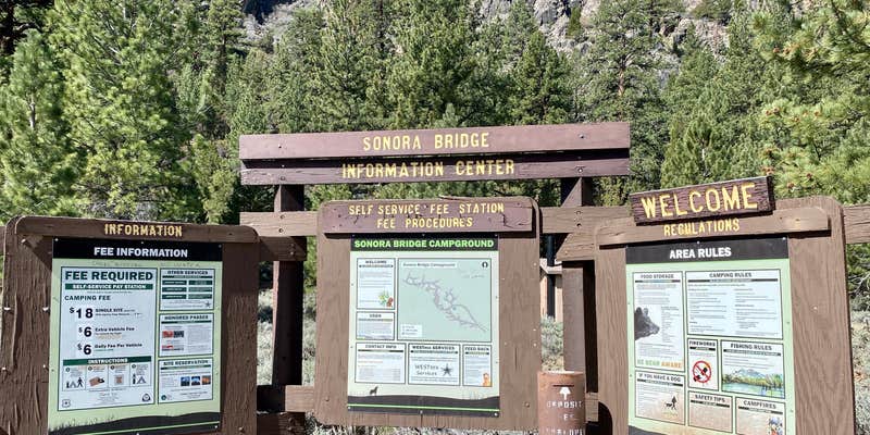
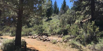
Where Highway 108 crosses the Walker River at 6,800 feet elevation, Sonora Bridge campground provides 23 first-come, first-serve sites beneath Jeffrey pines. The campground sits just east of Sonora Pass in the Eastern Sierra, with the Walker River flowing directly alongside the camping area.
Sites accommodate both tents and RVs, though water hookups are currently unavailable due to well contamination issues that have persisted for several years. The Forest Service shut off water after testing revealed elevated levels of cancer-causing chemicals, and subsequent drilling efforts have not resolved the problem. Campers must bring their own water for the duration of their stay.
The Walker River provides the main attraction here, with multiple reviewers highlighting exceptional fishing opportunities. Erin M. found the fishing "PHENOMENAL" and "absolutely outstanding." The river runs cool even during summer heat, when afternoon temperatures can climb significantly and shade becomes limited. Cell service is generally unavailable throughout the campground area.
Bridgeport lies 8 miles away for supplies and services. For additional camping options in the region, explore campgrounds around Toiyabe National Forest. The campground typically sees light use except during peak summer weekends, making it a reliable overnight stop for travelers crossing Sonora Pass.
Description
Overview
Sonora Bridge campground offers opportunity to get away from crowds amidst shade of Jeffrey Pines. Campground is close to fishing on West Walker River. The river is stocked with trout. Nearby picnic area, near Tule Lake, has accessible facilities.
Facilities
This tent and RV friendly campground offers primitive single family campsites with picnic tables and campfire rings. Vault toilets and garbage service are provided. Firewood is available for purchase from the host. The campground does not have potable water.
Natural Features
Sonora Bridge campground is at an elevation of 6300 feet.
RV Road Trip Guides


Map & DirectionsSonora Bridge is located in California near Coleville
Directions
1. From Highway 395 south in Bridgeport, drive approximately 17 miles to Highway 108, Sonora Junction. 2. Turn left on Highway 108 and go approximately one mile. The campground is on left hand side of road.
Coordinates
38.3674 N
119.4818 W
Connectivity
 T-MobileNo Coverage
 VerizonLTESome CoverageVerified by 2 usersLast on 6/13/26
 AT&T5GGood CoverageVerified by 2 usersLast on 6/6/26
Connectivity
- T-MobileNo Coverage
- VerizonLTESome CoverageVerified by 2 usersLast on 6/13/26
- AT&T5GGood CoverageVerified by 2 usersLast on 6/6/26
Access
Site Types
- Tent Sites
- RV Sites
Features
For Campers
- Pets
For Vehicles
- Water Hookups
Drive Time
- 1 hr 14 min from Carson City, NV
- 1 hr 42 min from Reno, NV
- 3 hrs 47 min from Modesto, CA
- 4 hrs 21 min from Merced, CA


