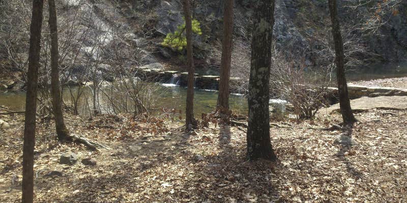
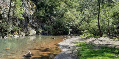
Overnight camping is no longer permitted at Iron Springs, though the site remains open as a day-use area within Ouachita National Forest. The forested location sits alongside a creek where visitors can swim, hike, or picnic using the available tables and restrooms. Recent visitors note graffiti in the facilities but appreciate the creek access and natural setting.
Campers planning overnight stays in the region can explore places to camp around Ouachita National Forest or check nearby Forest Service RD 153 Ouachita National Forest for established camping options. The site works well as a rest stop or day trip destination for those traveling through the area.
Description
Wooded roadside setting on stream near historic springs.
RV Road Trip Guides


Map & DirectionsIron Springs is located in Arkansas near Jessieville
Directions
On Arkansas Scenic 7 Byway, 4-1/2 miles north of Jessieville, AR.
Coordinates
34.76100007 N
93.07300081 W
Connectivity
 T-MobileNo CoverageVerified by 2 usersLast on 7/24/26
 VerizonLTESome Coverage
- AT&TLTESome CoverageVerified by 1 userLast on 7/24/26
Connectivity
- T-MobileNo CoverageVerified by 2 usersLast on 7/24/26
- VerizonLTESome Coverage
- AT&TLTESome CoverageVerified by 1 userLast on 7/24/26
Access
Site Types
- Tent Sites
Features
For Campers
- Trash
- Picnic Table
- Toilets
- Pets
- Fires
Drive Time
- 32 min from Hot Springs, AR
- 1 hr 7 min from Little Rock, AR
- 2 hrs 5 min from Texarkana, TX
- 2 hrs 6 min from Fort Smith, AR


