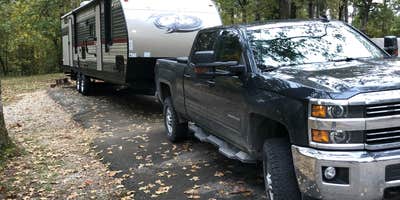
Part of Arkansas's state park system, Crowley's Ridge State Park Campground sits on a geological formation that rises above the surrounding Mississippi River Delta. The campground divides into distinct areas, with primitive sites featuring latrine facilities and a developed section offering water and electric hookups for RVs up to 110 feet.
Sites vary considerably in size and terrain. "Our site was huge, enough room for several tents," notes Shelly S., though campers report the tent areas sit close together with limited privacy between neighbors. The paved RV sites accommodate different rig lengths, but reviewers emphasize checking site dimensions carefully as some spots work only for smaller units. Site 9 draws mixed reactions due to its steep access, while Site 1 gets frequent recommendations for its pull-through design and spacious layout.
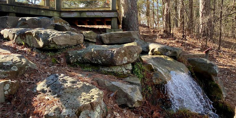
The park centers around two lakes that serve different purposes. The swimming lake features a spring-fed area, historic CCC-built facilities, and a water slide, while the second lake across the road provides fishing opportunities and boat access. Trail systems connect directly from the campground, including routes to a suspension bridge and wooden walkways around the spring area. "You can also walk to the lake from here," explains Shana D., noting the convenient trail access from camping areas.
The shower house receives consistent praise for cleanliness, though cellular coverage varies by carrier. Mosquitoes present a significant challenge during warmer months, with multiple reviewers emphasizing the need for repellent and campfire smoke for relief. The park stays open year-round, with winter visits offering quieter conditions.
For additional camping options in the region, Lake Frierson State Park Campground provides an alternative 6 miles southwest.
RV Road Trip Guides


Map & DirectionsCrowley's Ridge State Park Campground is located in Arkansas near Walcott
Directions
Take U.S. Hwy 412 off U.S. 67 at Walnut Ridge and travel 16 miles east, then go south on Hwy. 141 just 2 miles; from Paragould, follow Hwy. 412 west for 10 miles, then go 2 miles south on Hwy. 168; from Jonesboro, travel 15 miles north on Hwy 141 to Walcott or off of U.S. Hwy 63, take Southwest Drive exit to Hwy 141.
Address
2092 Highway 168 North
Paragould, AR 72450
Coordinates
36.04448484 N
90.666218 W
Connectivity
 T-MobileLTESome Coverage
- VerizonLTESome CoverageVerified by 9 usersLast on 6/29/26
 AT&T5GGood CoverageVerified by 4 usersLast on 6/29/26
Connectivity
- T-MobileLTESome Coverage
- VerizonLTESome CoverageVerified by 9 usersLast on 6/29/26
- AT&T5GGood CoverageVerified by 4 usersLast on 6/29/26
Access
- Drive-InPark next to your site
- Walk-InPark in a lot, walk to your site.
Site Types
- Tent Sites
- RV Sites
- Standard (Tent/RV)
- Group
- Cabins
Features
For Campers
- Market
- ADA Access
- Trash
- Picnic Table
- Firewood Available
- Phone Service
- Reservable
- WiFi
- Showers
- Drinking Water
- Electric Hookups
- Toilets
- Alcohol
- Pets
- Fires
For Vehicles
- Sanitary Dump
- Water Hookups
- Pull-Through Sites
- 30 Amp Hookups
- Big Rig Friendly
Drive Time
- 30 min from Jonesboro, AR
- 1 hr 30 min from Memphis, TN
- 2 hrs 4 min from Jackson, TN
- 2 hrs 5 min from Cape Girardeau, MO


