
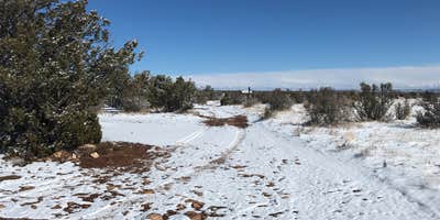
Within Coconino National Forest, Jack's Canyon Camping and Climbing Area operates as a dispersed camping destination managed by the US Forest Service. The campground sits near the rim of Jack's Canyon, accessible via a bumpy dirt road that remains passable for standard vehicles. Multiple dispersed sites accommodate everything from tents to medium-sized RVs, with larger spaces located further from the trailhead.
The camping area provides a pit toilet on-site, though campers must bring their own toilet paper. No water is available, making it essential to pack adequate supplies for the duration of your stay. Cell service reaches the area, with T-Mobile users reporting consistent coverage. The 10-minute hike down to the climbing area makes this a popular base for rock climbers exploring the canyon walls.
Site sizes vary considerably across the dispersed camping area. Smaller spots near the trailhead work well for tent camping, while RV users will find more suitable space in areas further back. Brad P. notes the facility is "very close to the rim of the canyon" with a "clean" pit toilet. The campground maintains a no-pets policy, and alcohol is permitted on-site.
Campers seeking additional options in the region can explore camping near Coconino National Forest for different forest service sites and amenities.
Description
Situated in a beautiful canyon where water has carved the rock, Jack___s Canyon offers vertical to wildly overhanging routes on compact stone. The majority of the climbing is characterized by steep highly pocketed limestone/sandstone mix cliffs. Route length varies from short ___bouldery___ twenty foot routes to long ___pumpy___ routes around seventy feet. On vertical walls, the rock can be bubbly with edges and blocks. If you want to find fun and safe sport climbing on the Coconino National Forest, this is your place. Sport climbing, focused on movement and safety offers the opportunity for large dynamic moves on well protected routes. Fixed anchoring systems here keep climbers safe while minimizing impact to the rock compared to traditional anchoring systems such as pitons and trees. Jacks Canyon boasts 300 routes of what some consider being some of the best sport climbing in the country. Jacks Canyon is a great collaboration between the National Forest and the rapidly growing user group of rock climbers.The roll-over photos here are from the top of the rim overlooking climbing areas and at the bottom at the creek.__Camping: The camping is free and unimproved at the canyon rim, where a 10 minute trail gets you to the routes. Please camp at obvious sites.Weather: The Weather is great year round with spring and fall offering the best conditions. In the summer you___ll be chasing the shade with temperatures rising to the 90___s F. During the winter, temperatures can get down to freezing and can be snowy, but the sun warms the rock. Chase the sun and you___ll be climbing in tee-shirt and shorts. Watch out for late spring and summer monsoon floods.Attractions: Climbing, Hiking, Wildlife viewingFacilities: Toilet (vault type), NO water or trash services (Pack-it-In, Pack-it-Out)
RV Road Trip Guides


Map & DirectionsJack's Canyon Camping and Climbing Area is located in Arizona near Happy Jack
Directions
Location: 30 miles south of Winslow. Elevation approximately 6,100 feet.GPS (Map): 34__45'20.2"N 111__03'41.3"WUSGS Map(s): Dane Canyon, Blue Ridge ReservoirAccess:From Winslow: Take SR 87 south from I-40 approximately 30 miles to mile marker 314. Continue 0.3 mile to dirt road on right. Close gate behind you and follow directions below.From Phoenix: Take SR 87 north towards Payson. From Payson, continue on another 60 miles (approximately) towards Winslow to mile marker 313. Continue on 0.7 miles and turn left on dirt road. Close gate behind you and follow directions below.Gate DirectionsDrive 0.3 mile and turn left at the obvious fork__Drive 0.2 mile and turn right__Continue 0.7 mile to trailhead and campground (total 1.2 miles from gate). You'll see gravel parking and the camping spots will be to your left (same side as toilet)__Click map thumbnail for larger view.__
Coordinates
34.755643 N
111.061516 W
Connectivity
 T-MobileNo Coverage
 VerizonLTESome CoverageVerified by 2 users
 AT&T5GExcellent Coverage
Connectivity
- T-MobileNo Coverage
- VerizonLTESome CoverageVerified by 2 users
- AT&T5GExcellent Coverage
Access
- Drive-InPark next to your site
- Walk-InPark in a lot, walk to your site.
Site Types
- Tent Sites
- RV Sites
- Standard (Tent/RV)
- Dispersed
- Group
Features
For Campers
- Phone Service
- Toilets
- Alcohol
Drive Time
- 1 hr 13 min from Flagstaff, AZ
- 1 hr 34 min from Prescott Valley, AZ
- 2 hrs 9 min from Phoenix, AZ
- 3 hrs 50 min from Tucson, AZ


