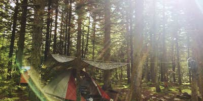
Thick conifer forests muffle sound at West Virginia's highest peak, where campers find primitive sites scattered around the summit parking area and along nearby trails. Located within the Monongahela National Forest, this dispersed camping area sits at 4,863 feet elevation near the concrete observation tower that marks the state's highest point.
Campers can pitch tents in established spots among the spruce trees northeast of the parking lot, a few hundred yards down the Seneca Backcountry trail, or directly south of the tower. The elevation creates notably cooler temperatures year-round, and summit winds can be sharp even in summer. Dave V. notes "obviously, on a clear night, star gazing is incredible as there no ambient light." The area maintains pit latrines and waste receptacles near the parking area, plus a picnic shelter with tables for meal preparation.
Access requires navigating steep, winding roads that can challenge vehicles - one route from Route 33 near Harman turns to gravel and becomes particularly rough, while the preferred approach from Route 33/28 between Seneca Rocks and Circleville stays paved but remains steep. Campers must bring all water, as none is available on the summit. The nearby Spruce Knob Lake Campground offers a more developed alternative less than a mile away. This high-elevation camping works best for experienced campers comfortable with primitive conditions and cooler mountain weather.
Description
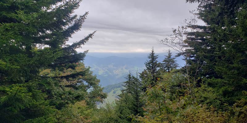
At 4,863 feet above sea level, Spruce Knob is West Virginia's highest peak. From this rugged alpine peak, you can view grassy openings and pastures or look down on forested ridges as far as the eye can see. The vegetation here has adapted to a harsh environment. One-sided red spruce deformed by constant exposure to strong westerly winds cling to the high rocky ridges. Blueberry and huckleberry plants hug the ground. Spruce Knob Tower - A stone and steel observation tower sits atop the Knob, providing visitors with a vantage point from which to enjoy a 360 degree view. The half-mile Whispering Spruce Trail circles the knob and provides panoramic views. Interpretive signs along the gentle, graveled trail describe the high country vegetation, geology and animal life. Vault toilets, picnic tables, grills and vehicle parking complete the facilities available at the tower.
RV Road Trip Guides


Map & DirectionsSpruce Knob and Spruce Knob Observation Tower is located in West Virginia near Circleville
Directions
From the north: Take Whitmer Road (CO-29) south from US-33 (one mile west of Harman) to Whitmer for 8.3 miles. From Whitmer continue south on Whitmer Road for 10.3 miles and turn left on Forest Road 1 for 2.5 miles to the campground and lake. From the south: Turn left onto Forest Road 112 for approximately 11 miles to the lake. From the east: Take Briery Gap Road (CO-33/4 at Gateway General Store) 2 miles south of Riverton off US-33 for 2.5 miles to Forest Road 112 and follow the signs to Spruce Knob. Click here for map.
Coordinates
38.70716729 N
79.58935527 W
Connectivity
 T-MobileNo Coverage
- VerizonNo Coverage
- AT&TNo Coverage
Connectivity
- T-MobileNo Coverage
- VerizonNo Coverage
- AT&TNo Coverage
Access
- Drive-InPark next to your site
- Walk-InPark in a lot, walk to your site.
- Hike-InBackcountry sites.
- Boat-InSites accessible by watercraft.
Site Types
- Tent Sites
- RV Sites
- Standard (Tent/RV)
- Group
- Tent Cabin
Features
For Campers
- ADA Access
- Trash
- Picnic Table
- Firewood Available
- Reservable
- Drinking Water
- Toilets
- Alcohol
- Pets
- Fires
Drive Time
- 1 hr 46 min from Harrisonburg, VA
- 2 hrs 19 min from Morgantown, WV
- 2 hrs 36 min from Charlottesville, VA