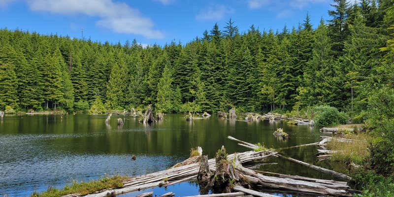
Snag Lake Campground, near Naselle, Washington, is a charming spot for those looking to escape into nature. With a mix of drive-in and walk-in sites, it offers a rustic experience surrounded by beautiful scenery and a serene lake.
The campground is known for its primitive, private campsites that provide a peaceful atmosphere. Visitors have highlighted the great fishing opportunities in the stocked lake, making it a favorite for anglers. As one camper noted, “The lake is great for small floats and rafts,” though swimming might not be the best idea due to water clarity.
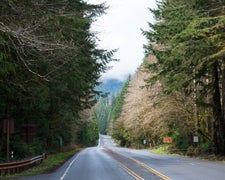
Accessing the campground can be a bit of an adventure, with some reviewers mentioning the rough road leading up to it. However, once you arrive, you’ll find a cozy spot to set up camp, complete with picnic tables and fire rings nestled among the trees. There’s no trash service, so be sure to pack out what you bring in to keep the area pristine.
For those eager to explore, the surrounding area offers paths for walking and enjoying the natural beauty. Just a short drive away, you can find more outdoor activities and local attractions. Whether you’re fishing, hiking, or simply soaking in the tranquility, Snag Lake Campground is a solid choice for a weekend getaway.
Description
Located north of Naselle, Snag Lake is a primitive campground situated on the way up to Radar Ridge. The campground has two RV sites and seven walk-in tent sites, fishing docks, and a restroom.
RV Road Trip Guides

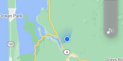
Map & DirectionsSnag Lake Campground is located in Washington near Naselle
Directions
Start at milepost 3 on SR-4. Go north on C-Line Road; take the left fork at Naselle Youth Camp entrance for 2.9 miles. Turn left on C-2600 Road (gravel, one lane) for .6 miles. Turn right on C-2620; the camp is at the end of the road.
Coordinates
46.41937377 N
123.81528555 W
Connectivity
 T-Mobile5GExcellent CoverageVerified by 6 usersLast on 7/21/26
 VerizonLTESome CoverageVerified by 2 usersLast on 7/21/26
- AT&T5GExcellent CoverageVerified by 2 usersLast on 7/21/26
Connectivity
- T-Mobile5GExcellent CoverageVerified by 6 usersLast on 7/21/26
- VerizonLTESome CoverageVerified by 2 usersLast on 7/21/26
- AT&T5GExcellent CoverageVerified by 2 usersLast on 7/21/26
Access
- Drive-InPark next to your site
- Walk-InPark in a lot, walk to your site.
- Boat-InSites accessible by watercraft.
Site Types
- Tent Sites
- RV Sites
- Standard (Tent/RV)
- Group
- Equestrian
Features
For Campers
- ADA Access
- Picnic Table
- Phone Service
- Toilets
- Alcohol
- Pets
- Fires
Drive Time
- 1 hr 4 min from Longview, WA
- 1 hr 40 min from Olympia, WA
- 1 hr 50 min from Portland, OR
- 2 hrs 26 min from Bremerton, WA


