Palmer Mountain operates as a Bureau of Land Management campground that prohibits pets, making it distinct from many other public camping areas. The established campground sits within forested and open terrain near a lake, providing both shaded and exposed camping options. Access requires navigating BLM roads typical of the region's backcountry areas.
The campground's location places it roughly 10 miles from camping areas around Oroville, with several other established campgrounds within a few miles including Spectacle Lake and Palmer Lake Campground to the north. The no-pets policy creates a quieter environment for campers who prefer camping without dogs present.
Description
Palmer Mountain Management Area comprises more than 6,500 acres of public land and is managed by the BLM. It is a great place for hiking, backpacking, dispersed camping, horseback riding, hunting, mounting biking, and fishing at tiny Washburn Lake. The autumn is especially picturesque when the many stands of aspen trees create a brilliant yellow and orange background. Visitors are sure to find a favorite spot to enjoy the quiet, scenic views of the Okanogan hillsides, aspen tree groves, grasslands, and the serene waters of Washburn Lake. Know Before You Go: Open Season Palmer Mountain Recreation Site is open YEAR ROUND, but the main access road is closed by snow in winter. 3 Primitive Campsites with fire rings; first come first serve. No Restrooms available. No Drinking Water available. Pack Out All Trash. Please keep pets on a leash and dispose all pet waster in trash receptacles. Cell Phone Coverage may be limited. Point of Interest: Palmer Mountain is alive with color during spring and early summer, when many varieties of wildflowers bloom. At the higher elevations, wildflower season extends well into June and July when highland meadows seem carpeted with colorful blooms. Palmer Mountain-Split Rock Brochure
Fee Info
No Fees.
Warning 1 Alert is In Effect
There is 1 alert for this campground. Camp safely!
Warning 1 Alert is In Effect
There is 1 alert for this campground. Camp safely!
Air Quality at this campground may currently be unhealthy. Please check with the campground before making a reservation.
RV Road Trip Guides

Map & DirectionsPalmer Mountain is located in Washington near Oroville
Directions
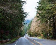
From Tonasket, Washington: Travel State Highway 97 to the Loomis Oroville Highway and continue west towards Loomis. After approximately 12 miles, turn right on the Washburn Lake Road. Follow the gravel road to the parking area above Washburn Lake and to other public lands administered by BLM.
Coordinates
48.84476216 N
119.594726 W
Connectivity
 T-Mobile5GExcellent Coverage
 VerizonNo Coverage
 AT&T5GGood Coverage
Connectivity
- T-Mobile5GExcellent Coverage
- VerizonNo Coverage
- AT&T5GGood Coverage
Access
Site Types
- Tent Sites
Features
Drive Time
- 2 hrs 47 min from Wenatchee, WA
- 3 hrs 42 min from Spokane, WA
- 5 hrs 39 min from Mount Vernon, WA
- 6 hrs 3 min from Bellingham, WA

