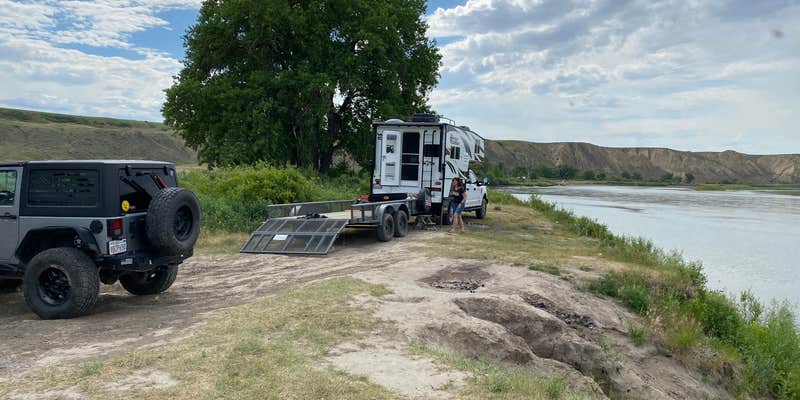
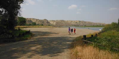
A gravel road off the Loma Missouri bridge leads down to Wood Bottom Recreation Area, a BLM-managed site sitting along the Upper Missouri River at river mile 20.3. The campground itself is basic: fire rings at the edge of a parking area and a single outhouse. Dispersed spots closer to the river are a better option for anglers and paddlers. Cell coverage runs about one bar of Verizon, workable with a signal booster. Trailers should note that the road past the campground becomes heavily rutted and turning around is difficult. Those exploring campgrounds around BLM Land — Upper Missouri River Breaks National Monument Field Office will find nearby primitive boat camps, including Black Bluff Rapids Primitive Boat Camp less than a mile northeast. Wood Bottom works best as a base for river access rather than a destination in its own right.
RV Road Trip Guides

Map & DirectionsWood Bottom Recreation Area is located in Montana near Fort Benton
Directions
If approaching from the south(Great Falls/Fort Benton) take U.S. Hwy 87 North, turn right on Loma Bridge Road (improved gravel) just prior to crossing the Marias River, proceed approximately 1 mile to Missouri River, turn right on the improved gravel road and follow signs to Wood Bottom Boat Launch (approximately 1.2 miles). If approaching from the north (Havre/Big Sandy) take U.S. Hwy 87 South, proceed through the town of Loma, and take first left after crossing the Marias River--this will be Loma Bridge Road (improved gravel). Proceed 1 mile to Missouri River, turn right on improved gravel road, and follow signs to Wood Bottom Boat Launch (approximately 1.2 miles).
Coordinates
47.90690087 N
110.48849955 W
Connectivity
 T-Mobile5GExcellent Coverage
 VerizonLTESome CoverageVerified by 1 userLast on 7/13/26
 AT&TNo CoverageVerified by 3 usersLast on 7/13/26
Connectivity
- T-Mobile5GExcellent Coverage
- VerizonLTESome CoverageVerified by 1 userLast on 7/13/26
- AT&TNo CoverageVerified by 3 usersLast on 7/13/26
Access
- Drive-InPark next to your site
- Boat-InSites accessible by watercraft.
Site Types
- Tent Sites
- RV Sites
- Standard (Tent/RV)
Features
For Campers
- Toilets
- Alcohol
- Pets
- Fires
For Vehicles
- Pull-Through Sites
Drive Time
- 54 min from Great Falls, MT
- 2 hrs 8 min from Helena, MT
- 3 hrs 29 min from Bozeman, MT
- 3 hrs 35 min from Billings, MT


