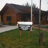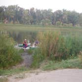
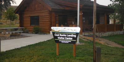
Managed by the Bureau of Land Management along the Upper Missouri River Breaks, Coal Banks Landing sits at river mile 41.5 and functions as a primary put-in and take-out point for floaters running the wild and scenic Missouri River past the White Cliffs. The campground is open year-round and accessible by vehicle, foot, or boat. It draws a steady mix of paddlers staging multi-day canoe trips and campers looking for a riverside stop in open, largely treeless terrain.
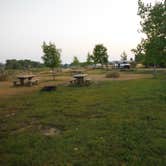
The site includes 13 picnic tables, 9 fire rings, and two vault toilets. Drinking water and trash service are available on-site, and a visitor center provides WiFi for those finishing up logistics before heading out. No pets are permitted. The campground sits down by the river rather than up on the plateau, which gives it some shelter from wind, though the open layout offers little shade. Bugs can be significant in late summer. Cell service is available, and reviewers note the camp staff are knowledgeable about river conditions.
Crowd levels vary. Weekends in summer can see the launch area busier with groups starting float trips, but the camping area itself can still be quiet. Dexter I. describes the staff as having "vast knowledge of the river," which is useful for first-time floaters. Nearby options along this stretch of the Missouri include Virgelle Merc Antiques & Accommodations to the southwest and Lone Tree Campground further east. Coal Banks Landing works best for anglers, paddlers, and anyone whose trip begins or ends on the water.
Description
Coal Banks Landing Campground, situated along the Upper Missouri River, is open from April 1 to December 1, annually. This is a popular site for launching watercraft, as well as camping, picnicking and fishing. The potable water system at the campground becomes operational after the last freeze in the spring, typically by May 15th. Campsites are on a first-come, first-serve basis NO RESERVATIONS. There are 20 sites, five (5) of which can accommodate trailers or recreational vehicles (RVs) up to 40 feet in length. There are no hookups available. Each site has a designated fire ring and picnic table. The campground is equipped with vault toilets and trash dumpsters. The boat launch use is dependent on water levels, typically 5,000-7,000 cfs is required to launch motorized watercraft.
Fee Info
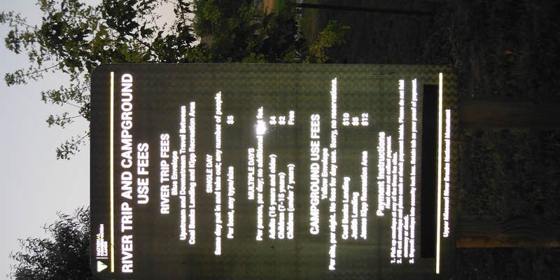
$10.00 Per Night
RV Road Trip Guides


Map & DirectionsCoal Banks Landing is located in Montana near Big Sandy
 Public Campground
Directions
Local Directions: When approaching from the south (Great Falls/Fort Benton), take U.S. Hwy 87 north to mile marker 66.7. Turn right on Gardiner Road (improved gravel) and proceed approximately 7 miles to the Virgelle Ferry Road ( Gardiner Road will pass under an old train bridge and end at a \"T\" intersection). Turn left on Virgelle Ferry Road, travel approximately 1 mile and the campground will be on the right. When approaching from the north (Havre/Big Sandy) take U.S. Hwy 87 south to mile marker 72.4. Turn left on the Virgelle Ferry Road (improved gravel), proceed approximately 6 miles, and the campground will be on the left.
Address
Upper Missouri River Breaks National Monument
920 Northeast Main
Lewistown, MT 59457
Coordinates
48.03222 N
110.23682 W
Connectivity
 T-MobileNo Coverage
- VerizonNo Coverage
- AT&TNo Coverage
Connectivity
- T-MobileNo Coverage
- VerizonNo Coverage
- AT&TNo Coverage
Access
- Drive-InPark next to your site
- Walk-InPark in a lot, walk to your site.
- Boat-InSites accessible by watercraft.
Site Types
- Tent Sites
- RV Sites
- Standard (Tent/RV)
- Group
Features
For Campers
- Trash
- Phone Service
- WiFi
- Drinking Water
- Toilets
- Alcohol
Drive Time
- 1 hr 21 min from Great Falls, MT
- 2 hrs 35 min from Helena, MT
- 3 hrs 56 min from Bozeman, MT
- 4 hrs 2 min from Billings, MT