Within Malheur National Forest, Magone Lake Campground provides drive-in access to a forested setting beside its namesake lake. The US Forest Service manages this established campground with sites accommodating RVs up to 50 feet, though campers should expect rough access roads leading to the area.
The lake supports fishing for trout and offers a walking trail around its perimeter. Campers report catching fish daily during their stays, with osprey hunting overhead in the evenings and resident beavers active around the water. The campground includes drinking water, restrooms, and trash service, operating from late May through early November at $25-60 per night. For those preferring different terrain, Grant County RV Park sits south in John Day with full hookups.
Description
Overview
Magone Lake Campground is situated along its namesake lake in the northern reaches of Malheur National Forest in the Blue Mountains of eastern Oregon. Visitors enjoy fishing, canoeing, swimming and hiking.
Recreation
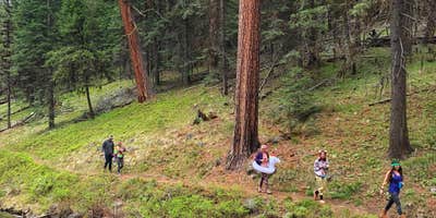
The Magone Lake area offers swimming, fishing, hiking and mountain biking opportunities. The lake contains eastern brook and rainbow trout. A boat ramp is available on-site. Visitors also enjoy viewing wildflowers and interesting geology throughout the region.
Facilities
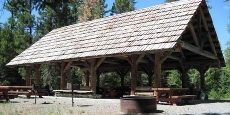
The campground offers both a picnic shelter and overnight campsite for groups to reserve. These sites can accommodate up to 75 people each. Individual family sites are available on a first-come, first-served basis. Picnic tables and campfire rings with grills are provided, as are vault toilets and drinking water.
Natural Features
The campground is set in a forest of Engelmann spruce and ponderosa pine. Magone Lake covers about 50 acres and features both deep holes of up to 100 feet and shoals on the north side. Geologists believe Magone Lake was created by a landslide in the early 1800s. It is located in the southern reaches of the Malheur National Forest.
Contact Info
For facility specific information, please call (541) 575-3131.
Reservation Info
All individual sites are first come first serve.
RV Road Trip Guides


Location
Public CampgroundMagone Lake Campground is located in Oregon
Directions
From John Day, Oregon, take U.S. Highway 26 east for approximately 9 miles. At the junction of County Road 18, travel north approximately 10 miles. At Forest Road 3620, turn left and drive approximately 1 mile to Forest Road 3618. The campground is 1 mile from the turnoff. The reservable group site is on the right, the shelter is in the day use area on the left. From Prairie City, Oregon, take U.S. Highway 26 approximately 3 miles west. At the junction of County Road 18, travel north approximately 10 miles. Turn right on Forest Road 3620 and travel approximately 1 mile to Forest Road 3618. The campground is about 1 mile from the turnoff. The reservable group site is on the right, the shelter is in the day use area on the left.
Coordinates
44.549397 N
118.912825 W
Connectivity
 T-MobileNo Coverage
- VerizonNo Coverage
- AT&TNo Coverage
Connectivity
- T-MobileNo Coverage
- VerizonNo Coverage
- AT&TNo Coverage
Access
- Drive-InPark next to your site
Site Types
- Tent Sites
- RV Sites
- Standard (Tent/RV)
- Group
Features
For Campers
- Trash
- Reservable
- Drinking Water
- Toilets
- Alcohol
- Pets
For Vehicles
- Big Rig Friendly
Contact
General Info
Reservations
Drive Time
- 3 hrs 4 min from Bend, OR
- 3 hrs 11 min from Walla Walla, WA
- 3 hrs 17 min from Kennewick, WA
- 3 hrs 41 min from Boise, ID


