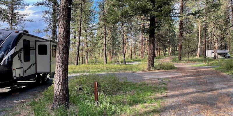
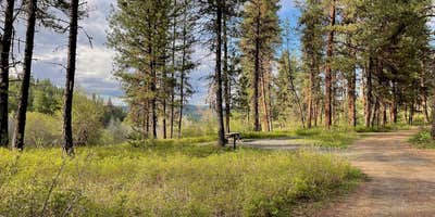
Lower Camp Creek Forest Camp sits within the Malheur National Forest, offering seven sites including several pull-throughs that accommodate RVs up to 37 feet. The campground maintains good spacing between sites and provides standard amenities including fire rings, picnic tables, and well-stocked pit toilets.
Camp Creek runs adjacent to the sites, with water levels typically high during spring from snowmelt runoff. The forested setting provides natural shade, while the drive-in access makes the campground accessible year-round. Campers can find additional campgrounds near Prairie City for extended stays in the region.
Description
A pleasantly small campground tucked among ponderosa pines along a forest creek. This campground is popular with hunters. Just a short drive away from the beautiful Middle Fork of the John Day River. Less than a mile away is Arch Rock Trail #258, an ashflow tuff with a scenic arch and several small rockshelters eroded into the outcrop, allowing visitors a place to see fascinating geological features. A bit further at 13 miles away is Magone Lake Campground, a great place to swim, fish or hike.
RV Road Trip Guides


Map & DirectionsLower Camp Creek Forest Camp is located in Oregon near Prairie City
Directions
From the town of Prairie City, OR, travel west 3 miles on US Highway 26 to the junction with County Road 18. Turn right, follow County Road 18 approximately 9 miles to the junction with Forest Road 36, turn right and follow Forest Road 36 approximately 11 miles. The camp ground will be on the left.
Coordinates
44.67300022 N
118.79900028 W
Connectivity
 T-MobileNo Coverage
- VerizonNo Coverage
- AT&TNo Coverage
Connectivity
- T-MobileNo Coverage
- VerizonNo Coverage
- AT&TNo Coverage
Access
- Drive-InPark next to your site
Site Types
- Tent Sites
- RV Sites
Features
For Campers
- ADA Access
- Picnic Table
- Toilets
- Alcohol
- Pets
- Fires
Drive Time
- 3 hrs 12 min from Walla Walla, WA
- 3 hrs 16 min from Boise, ID
- 3 hrs 18 min from Kennewick, WA
- 3 hrs 34 min from Bend, OR


