Accessible by paved road ending at a round gravel parking area, Rough Canyon Campground sits on the edge of Amistad Reservoir within the national recreation area. The National Park Service manages this year-round facility with basic amenities including toilets and trash service, though pets are not permitted. Sites accommodate big rigs and surround the central gravel lot in open terrain.
Campers report deer moving through the area at night and note the campground's proximity to both water access and a small community above the sites. For additional options, see camping near Amistad National Recreation Area. The location works well for those wanting lake access without remote conditions.
Description
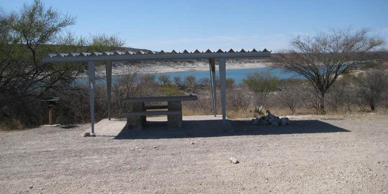
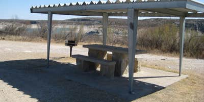
Rough Canyon Campground is generally open year-round and is in close proximity to a boat ramp. There may be a camp host on duty in the winter, and a Ranger Station is staffed intermittently. This campground offers 4 primitive sites, each with a covered picnic table and a BBQ grill. The sites are suitable for tents or RVs. No drinking water or hookups are available. Comfort station and running water available nearby at the Ranger Station.
Reservation Info
Group campsites are available by reservation only. Reservations can be made up to 180 days in advance and no less than three days in advance. Reservations can be made at the Visitor Center or by phone at 830-775-7491 with a valid credit card.
An RV dump station with potable water is located along the road to the Diablo East boat ramp.
RV Road Trip Guides


Map & DirectionsRough Canyon Campground is located in Texas near Comstock
Directions
From Amistad National Recreation Area's Visitor Center- Head east (turn left out of parking lot) and drive 4.7 miles. Turn left onto Highway 377 North and travel 12.1 miles (follow signs to Sonora). Turn left onto Recreation Road 2 (also called \"R 2\") and travel 7.4 miles. Campground is located at the end of Recreation Road 2 just before the boat ramp area. GPS Coordinates 29.573629, -100.977417 or Lat-Long: 29 34' 24.9564\" N 100 58' 38.8560\" W
Coordinates
29.573599 N
100.97746 W
Connectivity
 T-MobileLTESome CoverageVerified by 2 usersLast on 4/15/26
- VerizonLTESome Coverage
 AT&T5GExcellent Coverage
Connectivity
- T-MobileLTESome CoverageVerified by 2 usersLast on 4/15/26
- VerizonLTESome Coverage
- AT&T5GExcellent Coverage
Access
- Drive-InPark next to your site
- Boat-InSites accessible by watercraft.
Site Types
- Tent Sites
- RV Sites
- Standard (Tent/RV)
- Dispersed
- Group
Features
For Campers
- Trash
- Toilets
- Alcohol
For Vehicles
- Big Rig Friendly
Drive Time
- 1 hr 20 min from Eagle Pass, TX
- 2 hrs 12 min from San Angelo, TX
- 2 hrs 48 min from San Antonio, TX
- 3 hrs 28 min from Laredo, TX


