Biking enthusiasts will find easy access to trails throughout the Strawberry Range from this Forest Service campground along Big Creek. The $8 sites feature water and sewer hookups with easy back-in access for RVs, plus standard amenities including picnic tables, fire pits, and clean pit toilets.
Big Creek runs high with snowmelt through late spring, creating habitat for grouse that perform their distinctive wing-flapping mating displays from nearby fallen logs. The campground tends to stay quiet during mid-May visits, making it a functional base for extended stays and exploration of surrounding trails. Campers can access additional pet-friendly campsites near Malheur National Forest for longer itineraries in the area.
Description
Overview
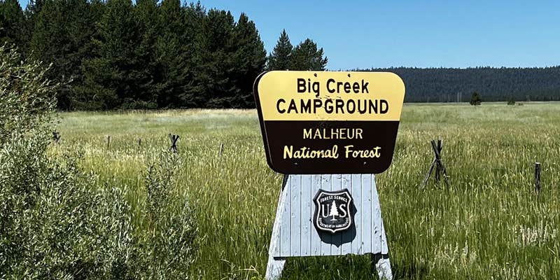
Big Creek Campground sits at the edge of beautiful__Logan Valley along Big Creek and is a great starting point for multiple recreation opportunities, including mountain biking, hiking, stream fishing, hunting and bird watching and exploring the Strawberry Mountain Wilderness. In the spring and early summer the area is exceptional for wildflower viewing.
Recreation
Big Creek Campground offers a central base for all your recreation activities. From casting a line in Big Creek to biking nearby terrain and hiking Strawberry Mountain wilderness, adventure is all around.
Facilities
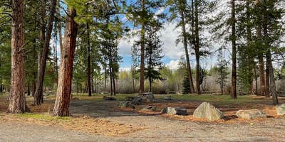
Each campsite has a picnic table, fire ring, and parking for camp trailers. Accessible vault toilets are conveniently located in the middle of the campground. Potable water is available during the summer months.
Natural Features
Big Creek Campground is located in Logan Valley with views of the Strawberry Mountains. Big Creek borders the campground.
Contact Info
For local information, please call (541) 820-3800 or call (541) 575-3000 for general information.
Nearby Attractions
Prairie City Ranger DistrictStrawberry Mountain WildernessLogan ValleyMurray CampgroundLake Creek Youth CampMalheur RiverMalheur River Ford Trailhead
Warning 1 Alert is In Effect
There is 1 alert for this campground. Camp safely!
Warning 1 Alert is In Effect
There is 1 alert for this campground. Camp safely!
All campsites are first come, first serve. No reservations required.
RV Road Trip Guides


Map & DirectionsBig Creek Campground is located in Oregon near Seneca
Directions
From the town of Prairie City, OR., turn onto South Main Street. Follow South Main Street to the junction with Bridge Street. Turn left onto Bridge Street and follow out of town past the local cemetary. The road then becomes County Road 62. Follow County Road 62 approximately 19 miles to the junction with Forest Road 16. Turn West onto Forest Road 16, follow for approximately 6 miles the campground will be on the right.
Coordinates
44.187109 N
118.616079 W
Access
Site Types
- Tent Sites
- RV Sites
Features
For Campers
- Pets
- Fires
For Vehicles
- Sewer Hookups
- Water Hookups
Drive Time
- 3 hrs 9 min from Bend, OR
- 3 hrs 16 min from Boise, ID
- 3 hrs 55 min from Walla Walla, WA
- 4 hrs 6 min from Kennewick, WA


