Best Dispersed Camping near Haines, OR
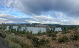
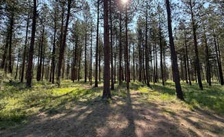
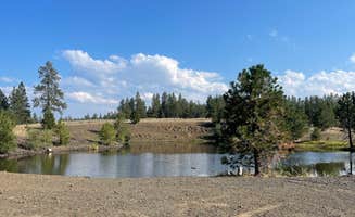
Looking for dispersed camping near Haines? Find the best information on dispersed campgrounds near Haines, including photos, reviews, and tips. Find the perfect dispersed campsite for your next adventure.
The Southern Elkhorn Mountain/Powder River Basin recreation area is located south of the Anthony Lakes Highway (Forest Road 73) to the Monument Rock Wilderness area. It includes__all of the developed recreation sites and trails in the Blue and Elkhorn Mountains__generally west of Baker City and Unity, Oregon.Popular recreation areas include__Anthony Lakes, Phillips Lake, North Fork John Day Wilderness (Baldy Unit),__the Elkhorn Scenic Byway,__the North Fork John Day River, the North Powder Wild and Scenic River, Dooley Mountain, Monument Rock Wilderness, the North and South Forks of Burnt River, the campgrounds along Highway 26, and Camp Creek. It also includes parts of the old__Baker and Unity Ranger Districts that have been__incorporated into the Whitman Ranger District.Local communities that have__a variety of services (i.e. fuel, lodging, stores and/or restaurants) are Baker City, Sumpter, Granite, Unity, Greenhorn and Haines. These communities are within one hour of the__recreation area.
Dispersed camping is a popular camping method for many visitors to the Forest. Choosing to camp along a stream or adjacent to a meadow where there are no picnic tables, toilets or firerings allows campers to enjoy a more primitive experience.
It is recommend that dispersed campers keep to traditional campsites off of established 'two-track' vehicles routes which have been used in the past. Most of these routes are less than 300 feet from a designated open road.
There are some areas on the Forest that are closed to dispersed camping. These include administrative site, special use permit area, or sensitive areas for archeology or wildlife.
Please remove all temporary structures before you leave such as meat poles, toilets, furniture, and ditches around your tents. To find out more about minimum impact camping please visit our outdoor ethics section. Some general rules of use and restrictions also apply to visitor using dispersed camping sites. These include regulations like forest-wide camping stay limits; use of camp fires, firearms, and fireworks; and controlling pets.
Aneroid Lake is one of my favorite locations in the Eagle Cap Wilderness. The dispersed camping for backpackers is on the North side of the lake, whereas the South side is private property (Camp Halton). The lake is stocked every few years with rainbow trout, and has a good supply of brook trout.
The water is very cold but worth the dip if it's a hot summer day.
There are a few spots and spurs off NF-6510 that would make for good boondocking. Might be hard to get level, but other than that it’s pretty nice. The spot on the map has a stone fire ring. There are a few spots before and after that would be suitable to setup camp as well.
I got to the spot marked on the map in my extended Transit, but I’m sure road conditions may change with the seasons, storms; etc. Depending on your comfort, you may only want to head this way with high-clearance vehicle.
Sites are far apart but some lack privacy. I saw Lots of elk and turkeys(?) and a rattlesnake. Outside of the lack of privacy there are some people who it appears that they live there(I a have no issues with that) my issue is the drive up and down the road multiple multiple time a day at high rates of speed leaving dust flying. When I was out walking I walked past one of their campsites on accident I didn’t get close and they started firing a gun in the air. I slept in my car that night and left the next morning. Also trash is an issue as well as people using the bathroom right on the ground and leaving used baby wipes everywhere. So watch out for human waste if you use a tent.
Many options for private pull-offs once you drive past established NF campgrounds—likely tough to do without high clearance and/or 4WD when wet. Only “traffic” was the occasional ATV/OHV. Tons of great hiking around.
We just needed a quick tent soot on a monday night on the way to moab. better than expected. bit muddy. some shells. but lots of space. drove in to about 45.35967, -118.30846
Stayed one night on my way to Seattle. I drove up the road some and found it pretty passable in my van, although most of the sites were too muddy and I was worried about getting stuck. Camped in the first spots behind the Spring Creek Info sign and had good phone service (verizon) and a uneventful night. But area had a ton of broken glass, nails and shotgun shells and a decent amount of litter. Don't know how rowdy it gets in the warmer months but it might be wise to skip this place or camp further up the road at the campground then, especially if you're a solo female.
There are 100s of spots to camp
Sweet little spot for smaller vehicles. We walked along the path to check it out before attempting it in our 26ft class c and I’m glad we did. The path was too narrow for us, and the road rose up a bit too high along the middle. A smaller vehicle shouldn’t have a problem. There’s a nice little clearing at the end of the path right along the little creek. Very peaceful and green when we came here in July.
At the main road there IS a spot large enough for our RV (that’s where we parked when we got out to walk to the creek spot) but we decided not to stay the night there. It wasn’t flat at all and a little too noisy and close to the main road. But it would definitely do in a pinch- very easy to get to- just off the main road to the right. There’s a fire pit marking the spot.
Zero cell reception in this entire area for verizon and ATT. No amenities here, this is a FS dispersed camping spot so please keep the area clean and pack out your waste.
Easy and vacant find for a last minute change to our route. Primitive dispersed campsites with rock fire rings right off the highway. Down side is it's a little too noisy for my taste. Would have driven further down into the woods if I had more time to set up as we got here late. All in all its an easy find just off the highway.
Do not try and tow a trailer up this road!!! I made that mistake and barely made it out. Didn’t make it up to the reservoir
Directions: About 13 miles from Medical Springs on a gravel road (half hour or so). Take Big Creek Rd to Collins Lane. That turns into USFS 67, then 72. The gravel road is good, but access to the camping is pretty narrow and rougher. Probably not a good place for a big nice camp trailer.
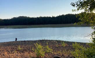
Camping is dispersed, mostly on the west side of the reservoir. The east side has a few spots but the road is really rough toward the dam. Fish are stocked. Boats with oars, paddles or electric motors are allowed. There are no improvements. Check fire restrictions. Campfires are prohibited almost every year for most of July, August and September. Cattle graze here. The water level gets pretty low by August.
Boondocking is easy with a camper van or tent setup in this national forest area, but it’s hard to make a generalization that covers this vast collection of campgrounds and areas. It earns a good review at the end of the day for being conveniently located and hassle free; you can always find a decent spot up around the bend and it’s the right mix of privacy and tranquility while being reasonable close to civilization if calamity strikes.
The water is no-joke cold. Fantastic nine-mile hike into the forest. Stayed two nights. Elevation is ~8,000 feet. Got altitude sickness on day two.
No fires allowed. No amenities. Back-country hikers only. No cell service. Perfect getaway.
This is not an official campground. There is a lot of space for campers, though, and it is not heavily trafficked. The trek to Echo Lake is about 8 miles (one-way) from the start of the Hurricane Creek Trail. When you arrive at Echo Lake, beauty awaits you! This location is a remote and peaceful retreat. The lake is so clear and serene. The views of the mountainside are breathtaking. This is a great site for groups and there is enough space to spread out. The stars are vivid and you can see the movement of the stars and moon along the mountains. The trek to the lake is SO WORTH IT! This is probably one of the most beautiful places that I have ever been to. It gave me the wilderness escape that I needed. It is a hidden gem! Whenever you visit, leave your stressors behind you and enjoy the preserved beauty. The lake is very cold, but I definitely enjoyed the shock after the hike in!
The hike into Echo Lake is an intense incline! We tracked about 3,500 feet of elevation gain in about 5 hours during our hike in. The way back only took us about 3.5 hours and is mostly downhill. I would not recommend this hike for a beginner hiker/backpacker. I carried 60 lbs on my back up and down this trek and it was A LOT for me as a relatively new backpacker (with endurance conditioning). It is a hike that one should work towards, for sure! This trek is would be great crosstraining for an endurance athlete (like me!). At times, the incline felt like a 10-15% grade, but I do not know this for sure. It is pretty steep and challenging if you are carrying a lot of weight. I recommend going as minimalist as possible to avoid extra weight, if possible. I brought my bull mastiff dog along with me and she had a blast! I would recommend conditioning your dog for a trek like this. It can be pretty gnarly and steep at times! My dog wouldn't have made it if she had not done treks like this before. There are creeks along the route to the lake and I would bring extra water to hydrate your dog in between water sources. As always, leave no trace and keep this spot pristine and clean :)
This backpacking trip is a very accessible hike.
The road to get to the trailhead is paved and the hike to Ice lake is 9 miles in (18 miles total)
You can add some miles (and a lot of elevation) if you add a day hike to the Matterhorn. Second tallest to Sacajawea. When I say it takes 3 hours to get up and 30 minutes to get down.. I’m not joking. Unless you’re an ultra runner who can handle high intensity at elevation, this will take some time. Well worth it for the views and ice lake will be waiting for you at the bottom.
Photos are from August 2018 and July 2019... notice the snow in July. Couldn’t do the added day hike that time.
Frequently Asked Questions
Which is the most popular dispersed campsite near Haines, OR?
According to TheDyrt.com, the most popular dispersed campground near Haines, OR is Social Security Point Trailhead with a 5-star rating from 1 review.
What is the best site to find dispersed camping near Haines, OR?
TheDyrt.com has all 15 dispersed camping locations near Haines, OR, with real photos and reviews from campers.