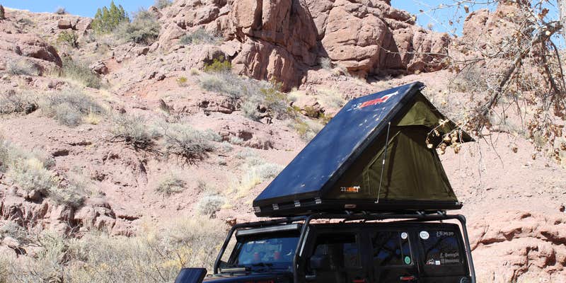
Where the Socorro valley meets the desert foothills, San Lorenzo Canyon sits on BLM land accessible via a challenging dirt road that requires careful navigation. Multiple campers warn against following Google Maps, which leads to a closed gate instead of the correct entrance under Interstate 25. The route involves a 14.5-foot clearance underpass and sandy conditions that can trap larger rigs without four-wheel drive.
The canyon itself opens into a wide wash surrounded by rock walls, with camping spots scattered along the drainage. Sites offer considerable distance between neighbors, though wind can be intense when the more sheltered canyon wall areas fill up first. Sandy ground makes backing up difficult for trailers, so campers with towed rigs should choose pull-through spots carefully.
Dennis P. notes the geological features, describing how the road follows "a dry wash past a giant 'bread loaf' that is a geological unconformity" before entering "an abrupt canyon with straight walls and side slots." Flash flood potential exists in this narrow drainage system. The area provides no water or restroom facilities, requiring campers to pack everything in and out. Nearby San Lorenzo Canyon Dispersed offers additional camping just to the east for those seeking more options in the same canyon system.
Description
This is primitive camping.
San Lorenzo Canyon is jointly managed by the U.S. Fish and Wildlife Service and the Bureau of Land Management as a primitive recreation area. This scenic east-west canyon offers ample outdoor opportunities for hiking and primitive camping. Not only a destination for hikers, the Canyon offers outstanding opportunities for photographers. Millions of years of Earth’s history unfold in San Lorenzo Canyon, a picturesque area of sandstone cliffs, arches, and hoodoos. The cottonwoods indicate there may have been a reliable water source at one time in the area. The area has remnants of old ranches and homesteads; springs and tiny creeks are hidden in the canyon bottoms and washes. High clearance and/or 4-wheel drive vehicles are recommended. There are no restrooms or drinking water.
RV Road Trip Guides


Map & DirectionsSan Lorenzo Canyon is located in New Mexico near Polvadera
Directions
The site is northwest of Socorro and about 5 miles northwest of Lemitar, NM. The area can be reached by taking the western frontage road north from Lemitar (along I-25) and driving about 5 miles. At that point, you follow a maintained dirt road west which will take you to the main canyon.
Coordinates
34.24354785 N
106.99394328 W
Connectivity
 T-MobileNo Coverage
- VerizonNo CoverageVerified by 1 userLast on 3/6/26
- AT&TNo Coverage
Connectivity
- T-MobileNo Coverage
- VerizonNo CoverageVerified by 1 userLast on 3/6/26
- AT&TNo Coverage
Access
- Drive-InPark next to your site
- Walk-InPark in a lot, walk to your site.
Site Types
- Tent Sites
- RV Sites
- Standard (Tent/RV)
Features
For Campers
- Alcohol
- Pets
- Fires
For Vehicles
- Pull-Through Sites
FREE established camping
Enjoy camping on government land. Limited or no services at this camping area.
PERMIT might be REQUIRED
We curate permit requirements across the US for our PRO members. Try PRO to see if San Lorenzo Canyon needs a permit.
Drive Time
- 1 hr 9 min from Albuquerque, NM
- 1 hr 53 min from Santa Fe, NM
- 2 hrs 30 min from Las Cruces, NM
- 3 hrs 5 min from El Paso, TX


