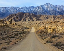
Bureau of Land Management operates Mathews Canyon Dam as an established campground near Caliente, Nevada. The facility prohibits pets, making it unsuitable for campers traveling with dogs or other animals. Located 4.9 miles east of Pine Canyon Dam, this BLM site sits within the high desert landscape of Lincoln County. Campers can find additional places to camp around Caliente for extended stays in the region. Check current conditions before arrival, as desert weather can change rapidly.
Description
This site is an Army Corps of Engineers flood control dam for the railroad. The site contains two shade structures, picnic tables, grills, fire pits, garbage cans, and vault toilets.
RV Road Trip Guides

Map & DirectionsMathews Canyon Dam is located in Nevada near Caliente
Directions
From Caliente: 1) Travel 6 miles north on US 93. 2) Turn right and travel 13 miles southeast down Beaver Dam Road. 3) Stay right at the fork and travel 4 miles south down Barclay Road. 4) Turn left and travel 2 miles south east on Bunker Pass Road. 5) Turn left and stay on Mathews Dam Road for .5 miles to site.
Coordinates
37.49630035 N
114.2262 W
Connectivity
 T-MobileNo Coverage
- VerizonNo Coverage
- AT&TNo Coverage
Connectivity
- T-MobileNo Coverage
- VerizonNo Coverage
- AT&TNo Coverage
Access
Site Types
- Tent Sites
Features
Drive Time
- 2 hrs 25 min from St. George, UT
- 3 hrs 5 min from Las Vegas, NV
- 5 hrs 18 min from Lake Havasu City, AZ
- 6 hrs 28 min from Flagstaff, AZ

