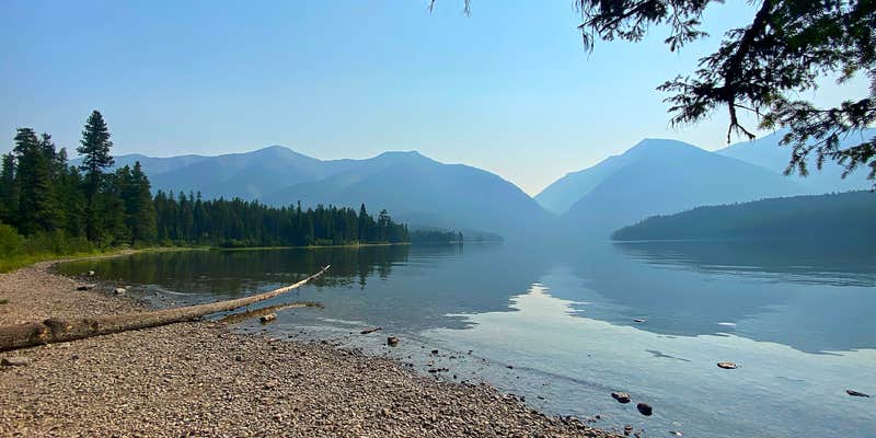
Paddlers and swimmers will find Holland Lake well-suited to their activities, though motorized boaters should know the launch ramp is not designed for larger vessels, which limits powerboat traffic on the water. The campground sits within Flathead National Forest and provides drinking water, toilets, picnic tables, and trash service, with reservations available. Campers planning to bring a trailered boat should consider nearby Holland Lake Campground or a site on Seeley or Placid Lake instead. Book ahead for summer weekends.
Description
This area has a large parking area and a primitive boat ramp located near the Holland Lake Campground. Please be advised this ramp is very shallow and will not accomodate large boats. This site is also near the group camping site, picnic and swimming area, and Holland Lake Nature Trail. Restrooms are available.
RV Road Trip Guides

Map & DirectionsHolland Lake Boating Site is located in Montana near Condon
Directions
From Highway 83 turn east onto Holland Lake Road #44 near mile marker 35. Follow this road about 2.5 miles. Just past the intersection leading to Owl Packer Camp, turn right for the boat ramp. If you go past signs for the day use area or Bay Loop you've gone too far.
Coordinates
47.44544277 N
113.61655282 W
Connectivity
 T-MobileNo CoverageVerified by 7 usersLast on 7/25/26
- VerizonNo Coverage
- AT&TNo Coverage
Connectivity
- T-MobileNo CoverageVerified by 7 usersLast on 7/25/26
- VerizonNo Coverage
- AT&TNo Coverage
Access
- Drive-InPark next to your site
Site Types
- Tent Sites
- Standard (Tent/RV)
- Group
Features
For Campers
- Trash
- Picnic Table
- Reservable
- Drinking Water
- Toilets
- Alcohol
- Pets
- Fires
For Vehicles
- Sanitary Dump
- Pull-Through Sites
Drive Time
- 1 hr 23 min from Missoula, MT
- 2 hrs 9 min from Helena, MT
- 2 hrs 40 min from Great Falls, MT
- 3 hrs 49 min from Coeur d'Alene, ID

