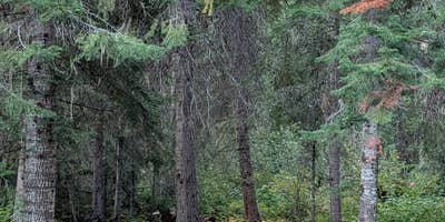
Sites spread out along a gravel access road provide privacy between camping spots in this Forest Service campground. The Magruder Corridor itself requires high clearance vehicles, particularly when approaching from the western route, though the eastern access proves less challenging for most rigs.
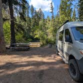
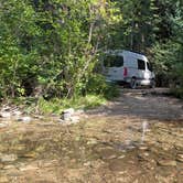
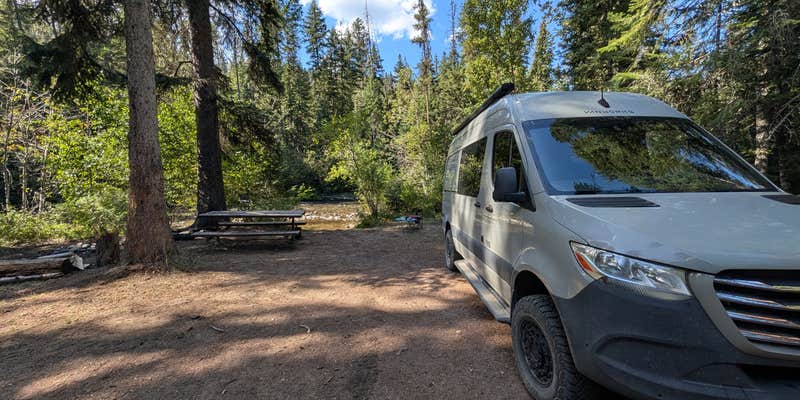
Flat sites accommodate big rigs, and the campground maintains a quiet atmosphere despite ATV and side-by-side traffic on the nearby road corridor. Hunters and horse packers frequent the area during peak seasons. Basic amenities include vault toilets, picnic tables, and fire rings, with pets welcome throughout the campground. Deep Creek Campground offers another option for campsites near Bitterroot National Forest.
Description
Magruder Crossing Campground features 6 campsites on the Selway River, and a vault toilet. Site will accept RV's or trailers to 30'. Stock can be kept in this campground. This was the crossing on a route established for commerce between Lewiston and Virginia City, MT during the gold rush. To the north of the campground, an earlier route, Southern Nez Perce Trail, crosses the road.
RV Road Trip Guides

Map & DirectionsMagruder Crossing Campground is located in Montana near Bitterroot National Forest
Directions
From Darby, MT travel 4.3 miles south on Highway 93. Turn southwest (right) onto West Fork Rd/County Road 473. Go approximately 14 miles and turn west (right) onto Nez Perce Rd FS 468. Follow for 37 miles.
Coordinates
45.7352727 N
114.75859236 W
Connectivity
 T-MobileNo Coverage
- VerizonNo Coverage
- AT&TNo Coverage
Connectivity
- T-MobileNo Coverage
- VerizonNo Coverage
- AT&TNo Coverage
Access
- Drive-InPark next to your site
Site Types
- Tent Sites
- RV Sites
- Standard (Tent/RV)
Features
For Campers
- Picnic Table
- Toilets
- Pets
- Fires
For Vehicles
- Pull-Through Sites
Drive Time
- 4 hrs 1 min from Missoula, MT
- 5 hrs 34 min from Helena, MT
- 7 hrs 36 min from Lewiston, ID
- 8 hrs 56 min from Boise, ID