Public Campground
Magruder Rangers House
Magruder Rangers House is located in the Bitterroot National Forest, featuring forested terrain with a mix of trees and open spaces. The area experiences temperature highs around 80°F in summer and lows near 10°F in winter. Nearby attractions include the Selway-Bitterroot Wilderness and the Nez Perce-Clearwater National Forests, offering opportunities for hiking and exploring nature.
Description
Overview
Magruder Rangers House is one of seven buildings still used by Forest Service trail crews and wilderness rangers, but it is open to the public through parts of the year. It provides visitors with access to two designated wilderness areas, plenty of opportunities for sightseeing and exploration and a comfortably equipped place to stay.
Recreation
Hunting, fishing and hiking are popular activities enjoyed by visitors to the area. The adjacent Scenic and Wild Selway River and a variety of nearby mountain streams are well known for trout fishing. Anglers might see bullhead, rainbow, steelhead and cutthroat trout, as well as mountain whitefish. There are a variety of trails that traverse the area, including the 11-mile Swet Creek Trail. It follows a creek bed and connects to other trails in the area. It is open to hiking and horseback riding. Bicycles and motorized travel are not allowed within wilderness boundaries but is allowed on roads.
Facilities
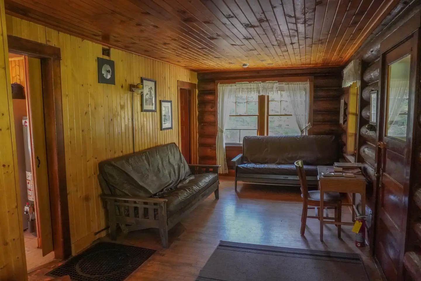
The Magruder Ranger House is a historical cabin and along with six other buildings which were at one time part of the Deep Creek Ranger Station and later the Magruder Ranger Station. The two-story, five-room log cabin has two bedrooms, a living area, a kitchen and an indoor bathroom. It has beds with mattresses, as well as futons, to sleep up to 10 people. A wood stove for heat is available in the basement of the cabin and firewood is provided. The kitchen is equipped with a table and chairs, propane refrigerator, stove and propane lights. Cooking and eating utensils are available, as well as various cleaning equipment. During the summer, hot and cold running water is available for the kitchen and bathroom, which has a flush toilet and a shower. The water system is turned off for fall and winter. Water is turned on from June through September 30. An outdoor vault toilet is provided. Guests will need to bring their own bedding, towels, food, matches, garbage bags and toilet paper, among other necessities. It is required that guests replenish the cut kindling supply and clean the cabin prior to leaving. The cabin is accessible by four-wheel drive and high-clearance vehicles. Guests are responsible for their own travel arrangements and safety. Please be aware the access is through a forested area where trees may fall across roads and trails anytime and there is no cell phone coverage. Livestock are not permitted at the Magruder Cabin compound.
Natural Features
The house is located on the Selway River, between the 1.2-million-acre Selway-Bitterroot Wilderness and the 2.3-million-acre Frank Church-River of No Return Wilderness areas, at an elevation of about 4,000 feet. It was once the residence of the district ranger and his family. Most of the area is covered by coniferous forests, with open meadows near the river. Because of its size, the wilderness provides a secluded habitat for a wide variety of wildlife. Populations of mountain lions and grey wolves live in the area, as well as coyote, fox, bighorn sheep, mountain goats, elk, moose, deer and black bears (learn about outdoor safety).
Nearby Attractions
The adjacent Magruder Road provides drivers with a unique experience in the back country of Idaho. The road was built by the Civilian Conservation Corps in the 1930s and remains much the same now as it did then. It continues to the Nez Perce Pass and is generally open in early June.
Contact Info
For facility specific information, please call (406) 821-3269.
Fee Info
The cabin rental fee is $100 per night, for up to four consecutive nights. No Golden Age/Access discounts apply at this site. The cabin can be reserved up to 180 days in advance.
Location
Magruder Rangers House is located in Montana
Directions
From Darby, Montana, travel south on Highway 93 for 4 miles to West Fork Road/Highway 473. Continue on this road for approximately 14 miles to the Nez Perce Road/Magruder Corridor Road #468 and go another 34 miles on the one-lane gravel, and partially paved road. Just before Deep Creek meets up with the Selway River, turn south at a stone bridge that crosses the creek and continue .5 mile to the rental cabin. High- clearance vehicles are advised on the road from the Montana from June through September. Snow may fall in the high country and along Nez Perce Pass in the fall and roads are not plowed. Maps may be purchased by stoping at the West Fork Ranger District. \_\_From Elk City, Idaho to Magruder along road #468 to Magruder is generally not passable by vehicles until mid to late July, but call the West Fork Ranger District at (406)821-3269 to inquire if the road is open and ask about the current road conditions.
Address
WEST FORK RANGER DISTRICT
6735 WEST FORK ROAD
Darby, MT 59829
Coordinates
45.7022222 N
114.7166667 W
Connectivity
- T-MobileNo Coverage
- VerizonNo Coverage
- AT&TNo Coverage
Connectivity
- T-MobileNo Coverage
- VerizonNo Coverage
- AT&TNo Coverage
Access
- Drive-InPark next to your site
Site Types
- Cabins
Features
For Campers
- Reservable
- Drinking Water
- Pets
- Fires
For Vehicles
- Water Hookups
Drive Time
- 3 hrs 51 min from Missoula, MT
- 5 hrs 24 min from Helena, MT
- 7 hrs 27 min from Lewiston, ID
- 8 hrs 24 min from Boise, ID


