Within Bitterroot National Forest, Fales Flat Campground provides drive-in access for RVs up to 50 feet along with standard tent sites. The US Forest Service operates this established campground from late April through October, charging $30 per night with advance reservations available. Located near both creek and river access in open terrain, the campground includes picnic tables and allows campfires. Fishing opportunities draw anglers to the nearby water sources. The no-pets policy sets this campground apart from many forest service locations. Campers seeking tent sites around Bitterroot National Forest will find this spot works well for those comfortable with the pet restriction.
Description
Overview
Fales Flat Campground is a group facility on Nez Perce Fork of the Bitterroot River. It is also well equipped for equestrian campers. The campground provides access to a variety of hiking and horseback riding trails in the area, as well as a variety of historic sites that denote the presence of the Nez Perce many years ago.
Recreation
Fly fishing and wading in the Nez Perce Fork, which runs alongside the campground, are also popular activities. A variety of trails and unimproved roads are great for hiking and horseback riding. Three trails originate near the campground. Watchtower Trail is just down the Nez Perce a mile, Sheephead Creek Trail which is across the road from Fales Flat campground accesses the Selway-Bitterroot Wilderness and can be hiked as a loop, or up to or down from the top of Nez Perce Pass. A third trail, Barecone Trail starts just below Fales Flat Campground and is a steep, 2-mile trail which leads to Bare Cone Lookout.
Facilities
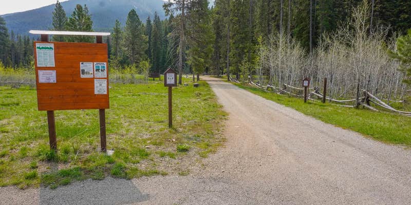
The campground offers one large group site for tent and RV camping. It can accommodate 15 to 100 people. Hookups are not available. Parking surfaces are gravel. The site is equipped with multiple tables and a large campfire circle. Vault toilets are provided. Drinking water and trash collection bins are not available. A few individual and equestrian sites are available at the campground on a first-come, first-served basis. Those sites have access to a horse staging area and hitching racks.
Natural Features
The campground is located in a large meadow at the base of Nez Perce Pass along the Nez Perce Fork of the Bitterroot River. The area is believed to have been used by the Nez Perce Nimi'ipuu tribe during its travels to the buffalo country in eastern Montana.
Nearby Attractions
The campground is at the base of Nez Perce Pass which is a corridor into the heart of the Selway-Bitterroot Wilderness and Frank Church-River of No Return Wilderness Areas. The Montana/Idaho stateline sits atop Nez Perce Pass where there is interpretive information and trailhead access north and south.
RV Road Trip Guides

Map & DirectionsFales Flat Campground is located in Montana near Conner
Directions
From Darby, travel south on Highway 93 for about four miles. Turn onto Highway 473 and continue southwest for 14 miles. Turn west onto Forest Road 468 and continue about 12 miles to the campground.
Address
WEST FORK RANGER STATION
6735 WEST FORK RD
Darby, MT 59829
Coordinates
45.7461111 N
114.4433333 W
Connectivity
 T-MobileNo Coverage
- VerizonNo Coverage
- AT&TNo Coverage
Connectivity
- T-MobileNo Coverage
- VerizonNo Coverage
- AT&TNo Coverage
Access
- Drive-InPark next to your site
Site Types
- Tent Sites
- RV Sites
- Standard (Tent/RV)
- Group
Features
For Campers
- Picnic Table
- Reservable
- Fires
Drive Time
- 2 hrs 33 min from Missoula, MT
- 4 hrs 6 min from Helena, MT
- 4 hrs 19 min from Bozeman, MT
- 6 hrs 9 min from Lewiston, ID

